
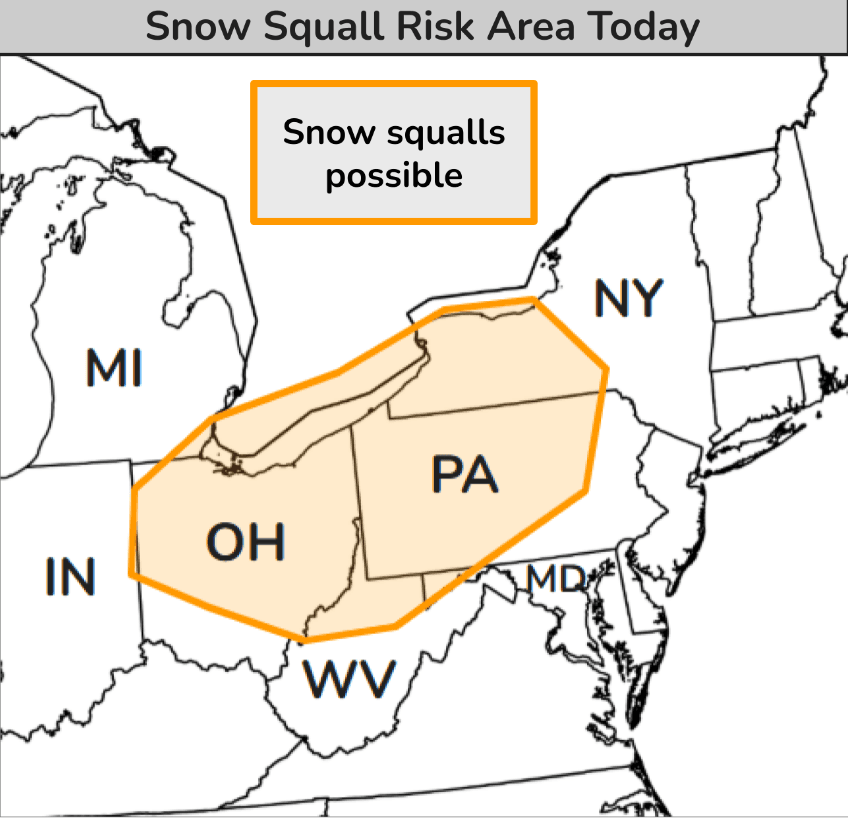
Snow squalls create hazardous travel conditions across Ohio and Pennsylvania
Snow squalls continued through the Saturday afternoon, January 17, 2026, across parts of Ohio and Pennsylvania as an Arctic cold front advanced eastward from the Midwest into the Interior Northeast. The National Weather Service warned of sudden whiteout conditions, gusty winds, and rapidly deteriorating visibility, creating dangerous travel for motorists.

Image credit: New York State Thruway Authority
An amplified upper-level trough moving across the Eastern United States on Saturday weakened gradually while a strong Arctic front pushed eastward through the Midwest. Snow showers and squalls developed along and behind the boundary, with the highest risk area extending from eastern Ohio into central Pennsylvania.
The Weather Prediction Center forecasts snow squalls capable of producing rapid visibility reductions and gusty winds, which can create dangerous travel conditions across the region.
Temperatures across the Northern and Central Plains, as well as the Upper Midwest, remained well below average, with daytime highs in the teens to subzero temperatures.The combination of Arctic air and strong winds maintained dangerous wind chill values across much of the region.
A secondary shortwave trough is expected to move southward into the North-Central U.S. overnight, followed by a developing surface low that will generate another round of strong winds and blowing snow over the Northern and Central High Plains through Sunday. Cold and windy conditions will spread into the Midwest and Great Lakes by early Monday morning, according to the National Weather Service.
The Arctic wave is being driven by a disruption in the polar vortex triggered by a stratospheric warming event during early January.
Eastern US is experiencing heavy snow with cold temperatures. Also a couple of snow squall warnings in Ohio at the moment. Be careful if traveling as visibilities can be reduced and roads may be slick. #NYwx #OHwx #PAwx #snow pic.twitter.com/n7Stiy1mLw
— WeatherAI (@WeatherAI_) January 17, 2026
This disruption is interacting with the jet stream, which has taken on a wave-like shape with a northward bulge along the Pacific Coast, covering the western United States, and a southward dip centered around the Great Lakes, covering the eastern half of the country.
This configuration sucks in the Arctic air from Canada into the U.S. and will bring extremely cold temperatures across the eastern half of the U.S.

I am an Assistant Editor and Severe Weather & Science Journalist at The Watchers, specializing in real-time severe weather coverage, geophysical event reporting, and research-driven scientific analysis. You can reach me at rishav(at)watchers(.)news.
Commenting rules and guidelines
We value the thoughts and opinions of our readers and welcome healthy discussions on our website. In order to maintain a respectful and positive community, we ask that all commenters follow these rules.