
Back-to-back atmospheric rivers forecast to impact the U.S. West Coast through December 20
Two atmospheric rivers are forecast to bring prolonged heavy rain and mountain snow to the Pacific Northwest and northern California through December 20, 2025. The Weather Prediction Center (WPC) forecasts 100–150 mm (4–6 inches) of precipitation across western Washington and 100–200 mm (4–8 inches) across western Oregon, with locally higher totals in the Cascades and coastal ranges.
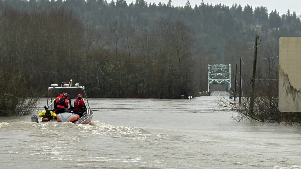
Flooding in King County, Washington on December 12, 2025. Credit: Eastside Fire & Rescue
According to the Center for Western Weather and Water Extremes (CW3E), two back-to-back atmospheric rivers (ARs) are forecast to move over the Pacific Northwest and northern California through Saturday, December 20.
The first system made landfall on December 15, with a second, more intense plume expected to arrive by the evening of December 17. Together, the two systems may result in more than 48 hours of continuous AR conditions over Oregon and northern California.
The WPC forecasts indicate total precipitation of 100–150 mm (4–6 inches) over the Olympic Peninsula and the Washington Cascades from the first AR during the 72-hour period ending 04:00 LT on December 18. The second system is expected to deliver 100–200 mm (4–8 inches) in the Oregon Coast Ranges and Cascades within 48 hours, ending 04:00 LT on December 20.
Ensemble model guidance from the Global Ensemble Forecast System (GEFS) and the European Centre for Medium-Range Weather Forecasts (ECMWF) shows high probability of 90% for sustained AR conditions along the Pacific Northwest and California coasts between December 15 and 20. Both models also indicate potential for additional AR activity around December 24–26.
Snowfall projections from the National Weather Service (NWS) suggest 60–120 cm (24–48 inches) of snow accumulation above 1 500 m (5 000 feet) in the Olympic Mountains and Washington Cascades during the first event. A second phase of heavy snowfall is expected later in the week as the next AR moves through the region.
Freezing levels will fluctuate sharply, dropping to 1 200 m (4 000 feet) before rising to 2 000 m (6 500 feet) and then falling again to 900 m (3 000 feet) as colder air returns behind the front.
The Northwest River Forecast Center (NWRFC) forecasts widespread river rises, with several locations expected to exceed flood stage. The Skagit River near Concrete, Washington, is forecast to crest above major flood stage on December 17, while the Luckiamute River near Suver, Oregon, is expected to exceed moderate flood stage on December 20.
The WPC has issued Slight Risk Excessive Rainfall Outlooks for December 16 and December 19 across western Washington and Oregon, representing at least a 15% probability of flash flooding. Marginal risk areas extend south into Northern California.
Overall, precipitation totals over the northern Oregon Cascades are forecast to exceed 190% of the region’s normal December rainfall, representing 30–45% of typical water year precipitation in just one week. The Climate Prediction Center (CPC) also highlights a continuing risk of heavy precipitation and mountain snow across the U.S. West Coast through late December.
References:
1 Two Atmospheric Rivers to Bring Heavy Precipitation to the Pacific Northwest This Week – CW3E – December 15, 2025

I am an Assistant Editor and Severe Weather & Science Journalist at The Watchers, specializing in real-time severe weather coverage, geophysical event reporting, and research-driven scientific analysis. You can reach me at rishav(at)watchers(.)news.
Commenting rules and guidelines
We value the thoughts and opinions of our readers and welcome healthy discussions on our website. In order to maintain a respectful and positive community, we ask that all commenters follow these rules.