
Heavy lake-effect snow creates whiteout conditions, disrupts travel south of Chicago
Powerful bands of lake-effect snow brought traffic on parts of Interstate 57 (I-57) south of Chicago, Illinois, to a standstill amid whiteout conditions on the morning of November 10, 2025. The National Weather Service (NWS) warned drivers to use extreme caution as snowfall rates exceeded 7 cm/h (3 in/h) in localized bands, producing near-zero visibility and hazardous travel across portions of northeastern Illinois.
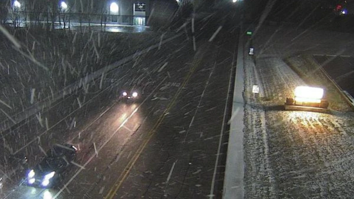
Image credit: NWS Chicago
Heavy lake-effect snow developed over the western Great Lakes region overnight into Monday morning, November 10, as cold air moved across the relatively warm surface of Lake Michigan. The resulting snow bands extended inland, aligning over portions of northeastern Illinois and producing intense snowfall along corridors including Interstate 57 south of Chicago.
According to the National Weather Service (NWS) in Chicago, narrow snow bands produced snowfall rates of more than 7 cm/h (3 in/h), leading to dangerous to impossible travel conditions. The agency cautioned that travel was not advised within active lake-effect bands, which periodically refocused near Interstate 55 and 57 before shifting eastward later in the morning.
CBS Chicago reported that poor to no visibility was observed along I-57 south of the city during the early morning hours, with vehicles forced to slow or stop amid whiteout conditions. Local broadcasts showed vehicles stranded in accumulating snow while plows attempted to clear lanes.
The Illinois Department of Transportation (IDOT) reported widespread snow-covered and slippery roadways across Cook, Will, and Kankakee counties. However, no official closure notice for I-57 was issued as of midday, and no major injury incidents had been confirmed.
Accumulations exceeded 25 cm (10 inches) in parts of Lake County and northwest Indiana, while areas closer to downtown Chicago saw several centimetres. The NWS bulletin “Lake-Effect Snow Gradually Ends Today” noted that snow showers would taper through the afternoon as winds shifted, bringing improved visibility and conditions later in the day.
The storm also caused broader regional disruption, including the cancellation of more than 450 flights at Chicago O’Hare and Midway airports and multiple school closures across the metropolitan area.
Lake-effect snow occurs when cold, dry air passes over the warmer lake surface, picking up moisture and heat. The air mass becomes saturated and unstable, forming narrow, intense snow bands that can deposit large amounts of snow over limited areas. Events like this are typical in early-season cold outbreaks around the Great Lakes.
As of late Monday, forecasters expected the lake-effect activity to shift southeast into Indiana and western Michigan as winds turned northerly, ending significant accumulation in the Chicago area.
I'm a dedicated researcher, journalist, and editor at The Watchers. With over 20 years of experience in the media industry, I specialize in hard science news, focusing on extreme weather, seismic and volcanic activity, space weather, and astronomy, including near-Earth objects and planetary defense strategies. You can reach me at teo /at/ watchers.news.
Commenting rules and guidelines
We value the thoughts and opinions of our readers and welcome healthy discussions on our website. In order to maintain a respectful and positive community, we ask that all commenters follow these rules.