
Series of atmospheric rivers to bring heavy rain to Washington, Oregon, and northern California through early October
A series of atmospheric rivers (AR) is forecast to hit the U.S. West Coast from late September through early October, beginning with a strong AR that made landfall over British Columbia on September 26, 2025. Forecasts show moderate AR conditions in Washington, Oregon, and northern California on September 28, followed by a stronger system making landfall on September 30 and potentially continuing into October 7.
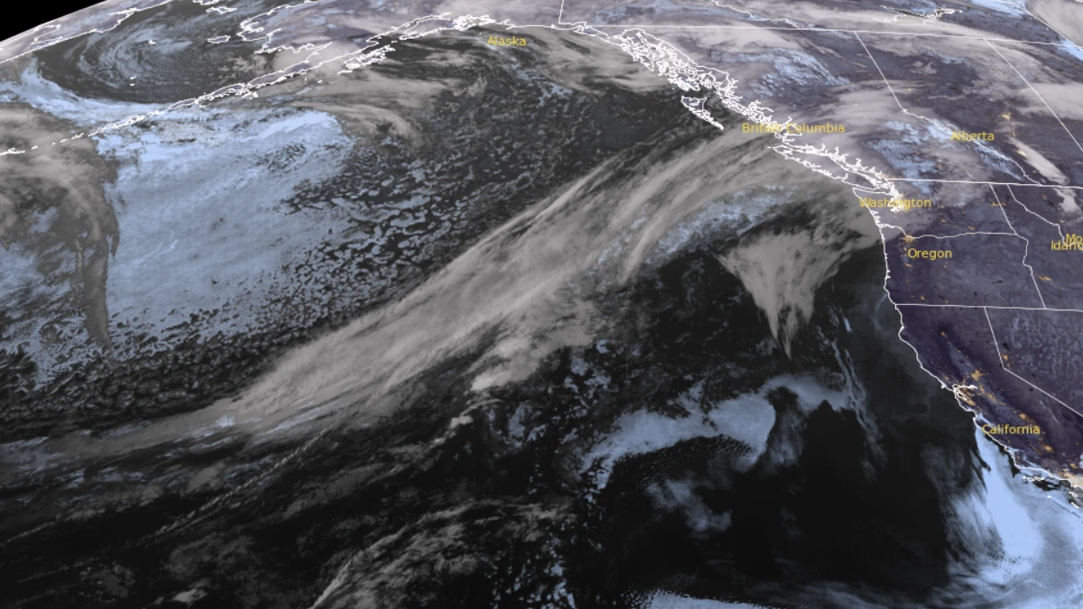
Satellite image of AR making landfall over British Columbia at 08:20 UTC on September 27, 2025. Credit: NOAA/GOES-19, RAMMB/CIRA, The Watchers
The atmospheric river, making landfall over British Columbia, Canada, on September 26, is forecast to initially weaken before re-intensifying near the U.S. West Coast on September 28.
This will bring a brief period of moderate AR conditions (IVT ≥500 kg m-1 s-1) to coastal Washington, Oregon, and northern California.
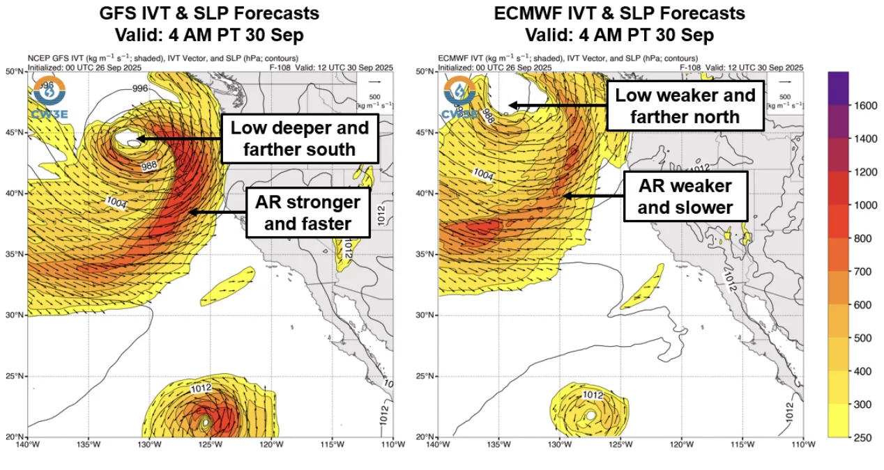
After the initial AR moves onshore, a second AR associated with a strong low-pressure system will make landfall between Washington and northern California on September 30.

Different forecast models show variance in the intensity and landfall timing of the AR. Compared to the ECMWF model, the GFS model forecasts the second AR to be stronger and to make landfall earlier.
The GFS also forecasts the low-pressure system to be deeper, track farther south, and stall off the Washington coast through early October 2. Meanwhile, the ECMWF forecasts the low to dissipate earlier and give way to a third landfalling AR by late October 1.
According to the Center for Western Weather and Water Extremes (CW3E) AR landfall forecast tools, there is a high probability (over 90%) for AR conditions between Washington and northern California with the first AR. Meanwhile, there is a moderate to high probability (50–90%) of AR conditions over the same areas in association with the second AR.
Both GEFS and EPS also show elevated probabilities (>50%) of AR conditions continuing over southern Washington and Oregon through October 7, in association with a third potential AR landfall.

The Weather Prediction Center (WPC) forecasts 50–125 mm (2–5 inches) of total precipitation in the Northern California Coast Ranges, the Northern Sierra Nevada, the Oregon Coast Ranges, and the Cascades during the next 7 days, with higher amounts of 125–250 mm (5–10 inches) forecast over the Olympic Peninsula.
The WPC has issued a marginal risk (level 1 of 4) excessive rainfall outlook (ERO) for much of northern California and far southwestern Oregon for the 24-hour periods ending 05:00 LT on September 30 and 05:00 LT on October 1.

Model differences in the forecast of the second AR and low-pressure system are contributing to differences in forecast precipitation over interior northern California. The GFS model forecasts heavier precipitation of around 46 mm (1.8 inches) in the Upper Yuba watershed, compared to the ECMWF’s 15 mm (0.6 inches) of mean areal precipitation over the next 7 days.
References:
1 Quick Look at Atmospheric Rivers Forecast to Impact the US West Coast – CW3E – September 26, 2025

I am an Assistant Editor and Severe Weather & Science Journalist at The Watchers, specializing in real-time severe weather coverage, geophysical event reporting, and research-driven scientific analysis. You can reach me at rishav(at)watchers(.)news.
Commenting rules and guidelines
We value the thoughts and opinions of our readers and welcome healthy discussions on our website. In order to maintain a respectful and positive community, we ask that all commenters follow these rules.