
Over 140 structures destroyed as wildfires scorch more than 8 094 ha (20 000 acres) in Minnesota
Wildfires in Minnesota have destroyed at least 140 buildings and scorched over 8 094 ha (20 000 acres) of land since May 11, 2025, prompting evacuations, road closures, and air quality alerts.
Munger Shaw fire as of May 14, 2025. Credit: Northland Fire Department
Wildfires have scorched more than 8 094 ha (20 000 acres) of land and destroyed at least 140 structures in Minnesota since May 11, when the first major fire was reported.
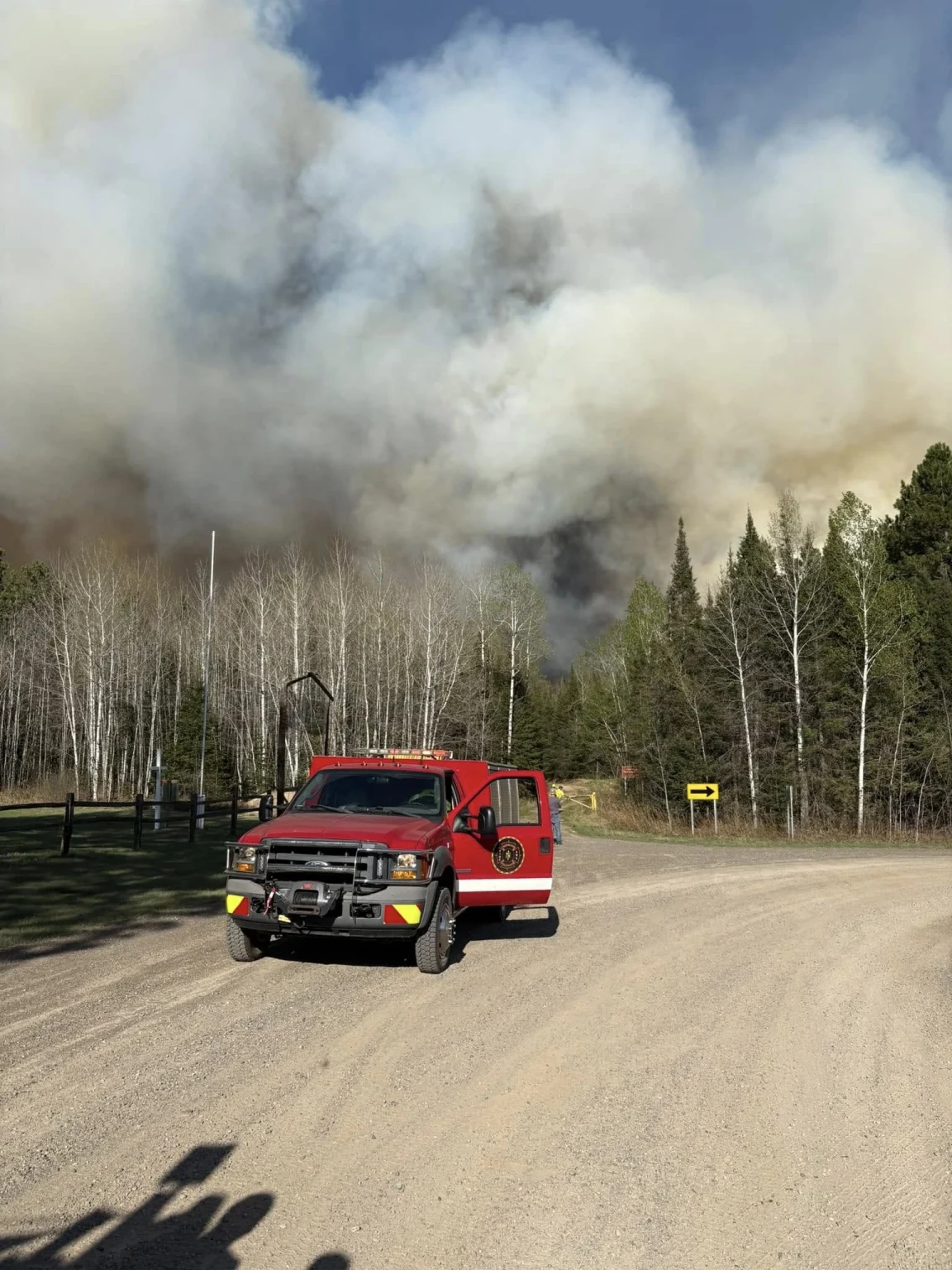
The Camp House Fire, located about 3.2 km (2 miles) northeast of Brimson in St. Louis County, was first reported on May 11. It has since grown to an estimated 4 768 ha (11 778 acres), with containment remaining at 0 %, according to the Minnesota Department of Natural Resources (DNR).
Authorities report the fire is burning in mixed forest vegetation, including large areas of spruce budworm-killed timber, which is contributing to intense fire behavior and complicating suppression efforts due to the challenging terrain.
 Camp house fire near St. Louis Country, Minnesota. Credit: St. Louis County Rescue Squad
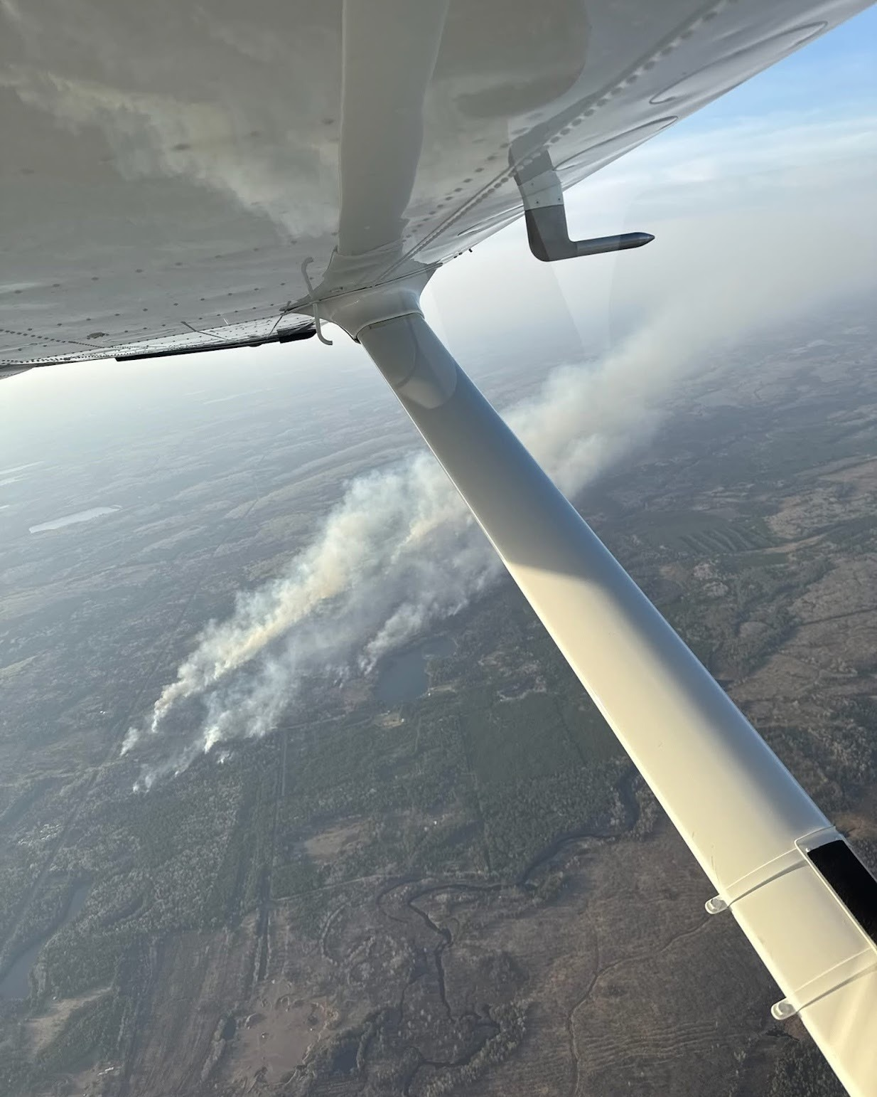
- Aerial view of the Camp House Fire in Minnesota on May 12, 2025. Credit: GLLM
- Road closed due to Camp House Fire on May 12, 2025. Credit: GLLM
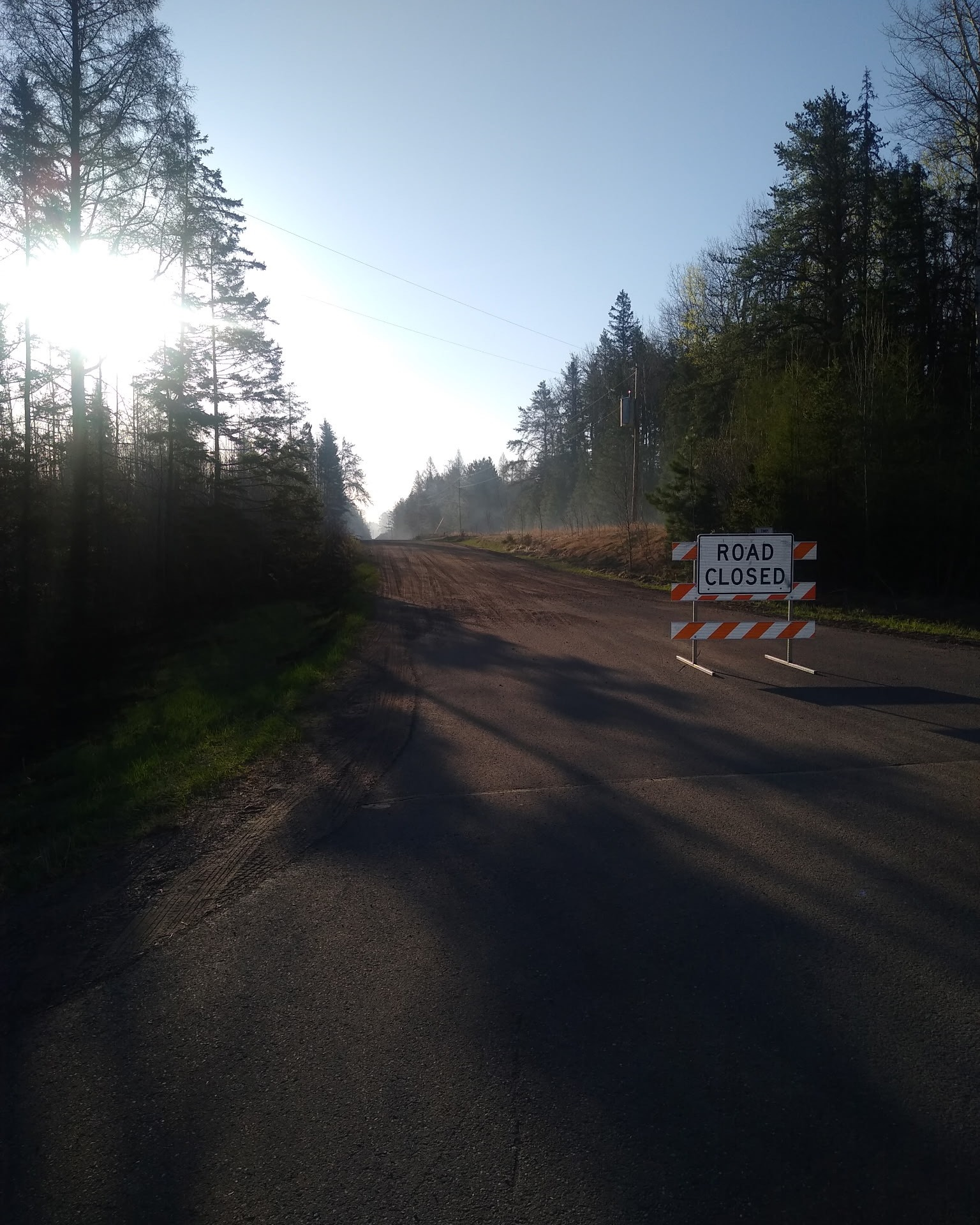

Mandatory evacuations have been issued by the St. Louis County Sheriff’s Office. Road closures are in effect at multiple points, including the intersections of Highway 16 and County Highway 44, Highway 16 and Brimson-Toimi Road (6205 Road), and County Highways 44 and 355.
More than 200 personnel are assigned to the incident, including Minnesota DNR teams, Superior National Forest resources, local fire departments, and mutual aid responders. Aircraft are supporting suppression efforts in the remote and mountainous terrain.
The Jenkins Creek Fire has burned more than 2 751 ha (6 800 acres) and remains active. Cadotte Lake Campground has been evacuated and closed. Multiple road closures are in place, and a shelter has been opened at the Fredenberg Community Center by St. Louis County Public Health and the Red Cross.
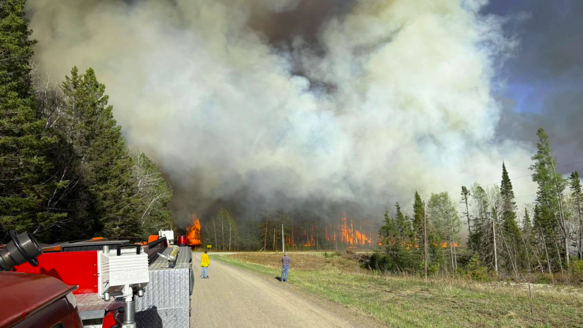
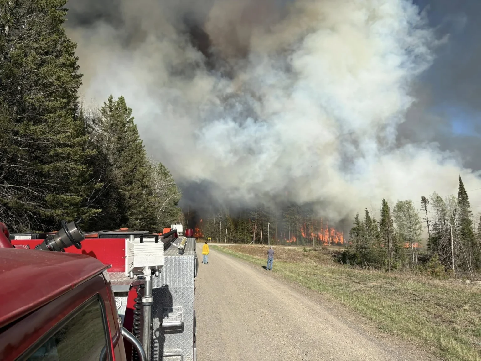
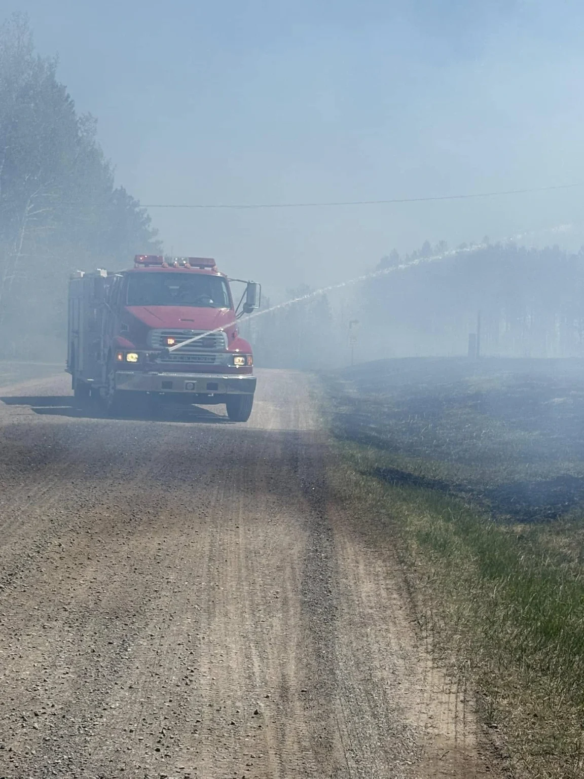
The Munger Shaw Fire has burned approximately 647 ha (1 600 acres) and is slowly spreading north. Several road closures are in effect, and some evacuations are under review to determine if they should remain in place.
- Munger Shaw Fire in Minnesota on May 14, 2025. Credit: Northland Fire Department
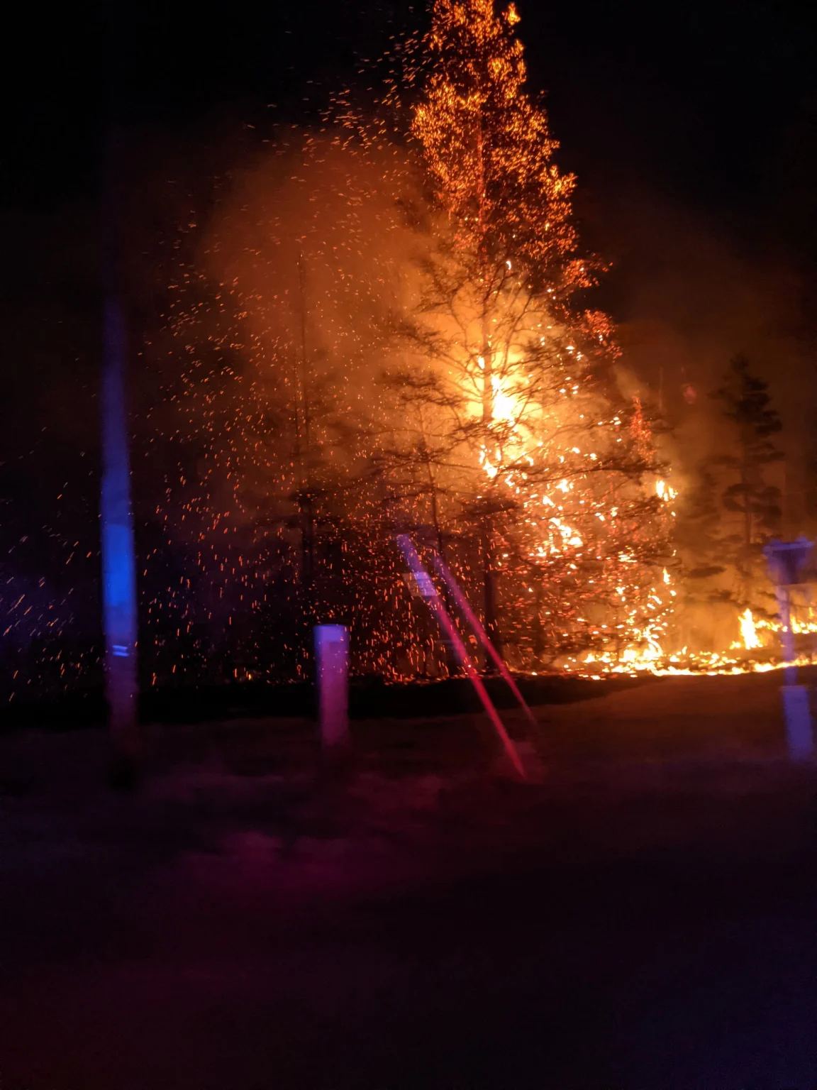
- Fire truck engaging the Munger Shaw Fire on May 14, 2025. Credit: Northland Fire Department
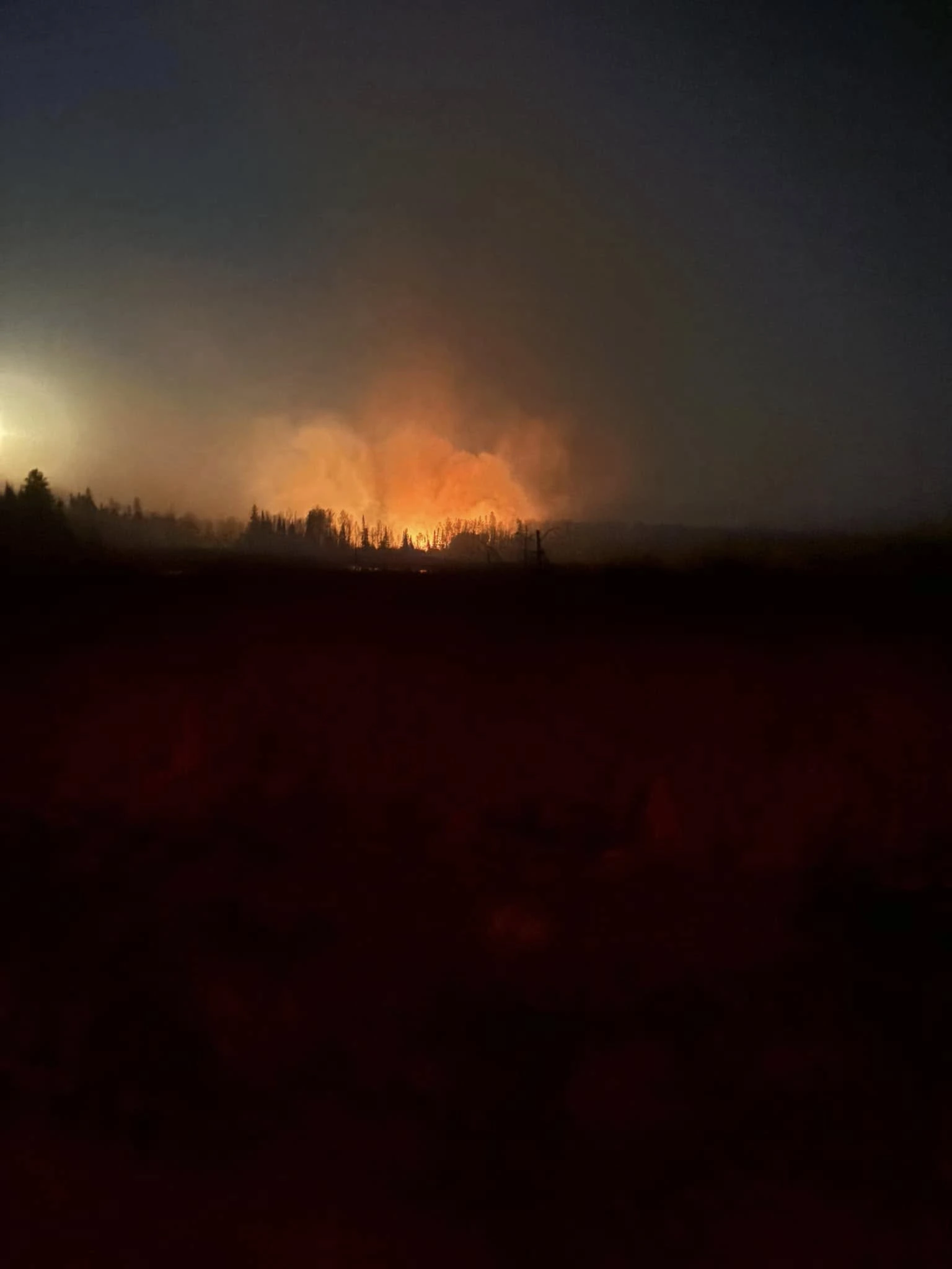
- Munger Shaw fire during early hours of May 14, 2025. Credit: Northland Fire Department
- Munger Shaw fire as of May 14, 2025. Credit: Northland Fire Department


The National Weather Service (NWS) reports that high temperatures and low dewpoints are expected to continue on Wednesday, May 14, creating conditions favorable for the spread of current and potential new fires.
Southerly winds are forecast to shift to the southeast, spreading smoke from the fires across northern St. Louis County and into Lake County. An Air Quality Alert is in effect for those areas today.
Improved firefighting conditions are forecast for May 15, with possible showers, thunderstorms, and cooler temperatures. Additional rainfall is expected on May 16.

I am an Assistant Editor and Severe Weather & Science Journalist at The Watchers, specializing in real-time severe weather coverage, geophysical event reporting, and research-driven scientific analysis. You can reach me at rishav(at)watchers(.)news.
Commenting rules and guidelines
We value the thoughts and opinions of our readers and welcome healthy discussions on our website. In order to maintain a respectful and positive community, we ask that all commenters follow these rules.