
Heavy rain and flash flood threats for New England and Florida Panhandle through May 11
Heavy rains and flash floods are forecast to impact the Northeast and Southeast United States from Friday through Saturday, May 9 and 10, 2025, with rainfall totals between 25 and 100 mm (1 to 4 inches) expected in areas including New England and the Florida Panhandle.

Image credit: OK Highway Patrol/DPS
Two slow-moving storm systems are driving the weekend’s weather hazards — one moving through the Northeast and another impacting the Southeast. Both are producing widespread rainfall, with localized flash flood risks and severe weather threats in different regions.
Heavy rains and thunderstorms are forecast to move into the Northeast on Friday, May 9, with the heaviest rainfall expected from the Catskills eastward across New England.
The storm system will strengthen as it tracks into the Gulf of Maine by Saturday, May 10, bringing widespread rainfall to northern New England. The Weather Prediction Center (WPC) forecasts 25 to 50 mm (1 to 2 inches) of rain across the region, with localized amounts exceeding 50 mm (2 inches).
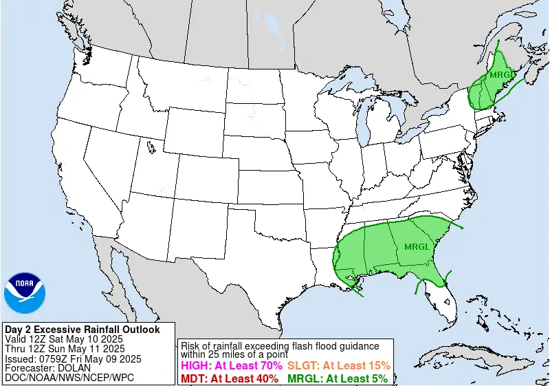
Saturated soils may lead to isolated flash flooding and minor river flooding through Saturday. The WPC has issued a Marginal Risk (level 1 of 4) for flash flooding, primarily in urban areas and locations with poor drainage. Rainfall is forecast to taper off across New England by Saturday evening as the system exits into the Gulf of Maine.
In the southern United States, heavy rains and thunderstorms are expected to stretch from the Lower Mississippi Valley to the Southeast coast on Friday.
The upper-level low will shift eastward by Saturday, placing Alabama, the Florida Panhandle, and southern Georgia at the greatest risk for heavy rainfall. Between 25 and 100 mm (1 to 4 inches) of rain is forecast across the region through Saturday, with the Florida Panhandle likely to receive the highest amounts.
Flash flooding and localized river or stream flooding are possible across the region, with additional rainfall expected on Sunday and continuing into early next week.
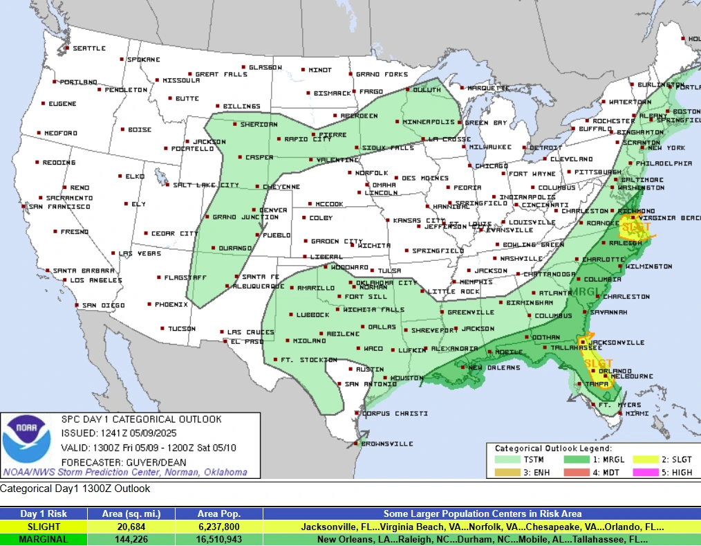
The WPC has issued a Marginal Risk for excessive rainfall, while the Storm Prediction Center (SPC) has placed parts of Florida’s Space Coast and North Carolina’s Outer Banks under a Slight Risk (level 2 of 5) for severe weather, including damaging winds, large hail, and isolated tornadoes.
On Saturday, a Marginal Risk (level 1 of 5) also extends across much of northern and central Florida, where severe storms remain possible.
In contrast to the wet conditions in the East, much of the western and northern United States is experiencing record warmth. Temperatures across parts of California, the Great Basin, and the Northern Plains are forecast to reach 15 to 30°F (8 to 17°C) above average through the weekend.

I am an Assistant Editor and Severe Weather & Science Journalist at The Watchers, specializing in real-time severe weather coverage, geophysical event reporting, and research-driven scientific analysis. You can reach me at rishav(at)watchers(.)news.
Commenting rules and guidelines
We value the thoughts and opinions of our readers and welcome healthy discussions on our website. In order to maintain a respectful and positive community, we ask that all commenters follow these rules.