
Oklahoma flooding leaves two dead, breaks April rainfall record in Oklahoma City
Two drivers drowned in Oklahoma on April 30, 2025, as slow-moving thunderstorms triggered severe flash flooding across southern and eastern regions. The National Weather Service (NWS) issued multiple flood warnings and watches, with heavy rainfall increasing risks through early May.

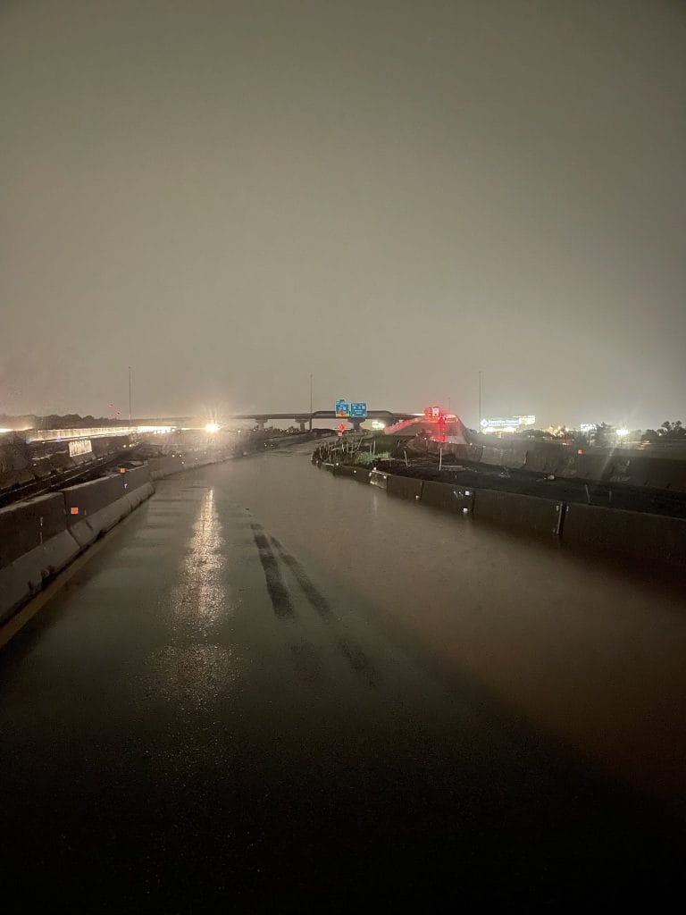
I-35 northbound at I-44 in OKC shut down due to flooding. Image credit: OK Highway Patrol/DPS
Two drivers drowned in Pottawatomie and Lincoln counties on April 30 when their vehicles were swept away by floodwaters. In Pottawatomie County, a sheriff’s deputy attempted a rescue but was caught in the current; he was hospitalized and later released. The Oklahoma Highway Patrol reported the Lincoln County incident near Prague, where floodwaters trapped a vehicle on a highway.
The National Weather Service (NWS) Tulsa issued a Flash Flood Warning for southeastern Muskogee, Sequoyah, eastern Haskell, and northern Le Flore counties until 10:15 local time (LT) on May 2. Subsequently, a Flood Warning was issued to replace the Flash Flood Warning, extending until 23:05 LT on May 2, affecting areas in northeast Oklahoma, including Creek, Okmulgee, and Wagoner counties.
NWS office in Norman issued a Flash Flood Warning for southern Oklahoma counties, including Comanche and Cotton, as well as parts of northern Texas, valid until 09:00 LT on May 2. The warning specifically highlights the dangers of flooding during nighttime hours. Additionally, a Flood Warning was issued for portions of central, east central, southeast, and southern Oklahoma, encompassing counties such as Grady and Hughes.

Between 25 and 65 mm (1 to 2.5 inches) of rain had already fallen. Oklahoma City set a record for April rainfall, reaching 319 mm (12.55 inches), surpassing the 1947 record of 302 mm (11.91 inches). Statewide, Oklahoma approached the 1942 record for monthly average rainfall of 210 mm (8.3 inches), according to Oklahoma State Climatologist Gary McManus.
The State Emergency Operations Center remained activated, coordinating with agencies including the Oklahoma Highway Patrol and the Department of Transportation. A dam breach occurred at County Line and County Road 1322 in Grady County, resulting in flooding of one home and isolating eight to ten additional homes. Grady County officials are constructing a temporary road to restore access to the affected areas.
In Waurika, approximately 85% of the streets were closed due to flooding, impacting around 40 homes and several public buildings. On April 29, Governor Kevin Stitt declared a State of Emergency for Comanche and Cotton counties, enabling the allocation of emergency resources. Five swift water rescue teams were deployed. The Oklahoma Water Resources Board and U.S. Army Corps of Engineers provided technical support at Lake Waxhoma Dam in Barnsdall and supplied 10 000 sandbags for Johnston County.
Three shelters were opened in Comanche County to assist residents affected by flooding: Cameron Baptist Church at 2621 SW C Avenue, First Baptist Church at 501 SW B Avenue, and the Lawton Salvation Army Corps at 1314 SW E Avenue. The American Red Cross provided cleanup kits, meals, and water. Voluntary evacuations were advised for several neighborhoods.
On April 30, the Lexington Fire Department evacuated homes in the 100 block of east and west roads down the hill as floodwaters entered neighborhoods. The Lexington Senior Center was opened as a shelter for displaced residents. In Tulsa, the zoo and Mohawk Park were closed due to flooded roads and rising creek levels.
Several highways, including SH-5A, SH-5B, and SH-53 in Cotton County, were closed due to flooding, along with roads in Alfalfa, Cleveland, and Tulsa Counties. The Oklahoma Department of Transportation urged drivers to avoid flooded roads.
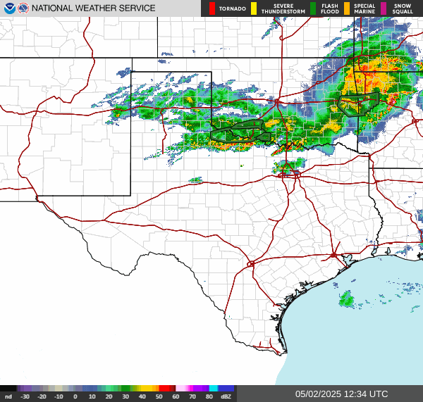
The National Weather Service’s Weather Prediction Center (WPC) issued a Slight Risk (Level 2 of 4) of Excessive Rainfall for portions of the Southern Plains on May 2, valid from 12:00 UTC (07:00 CDT) on May 2 to 12:00 UTC on May 3.
The outlook warned about the potential for heavy downpours capable of producing rainfall rates exceeding 50 mm (2 inches) per hour, particularly in areas with already saturated soils south of Interstate 40.
The risk was associated with thunderstorms developing along and ahead of a southward-moving cold front, drawing moisture from the Gulf of Mexico.

I’m a science journalist and researcher at The Watchers, contributing to the Epicenter edition, where I cover peer-reviewed scientific research and emerging discoveries across Earth and space sciences. With a background in astronomy and a passion for environmental science, I’ve worked in shark and coral conservation in Fiji, conducting reef and shark-behavior research, contributing to mangrove restoration, and earning PADI Open Water and Coral Reef Certifications. I bring a blend of scientific rigor and storytelling to illuminate the discoveries shaping our planet and beyond.
Commenting rules and guidelines
We value the thoughts and opinions of our readers and welcome healthy discussions on our website. In order to maintain a respectful and positive community, we ask that all commenters follow these rules.