
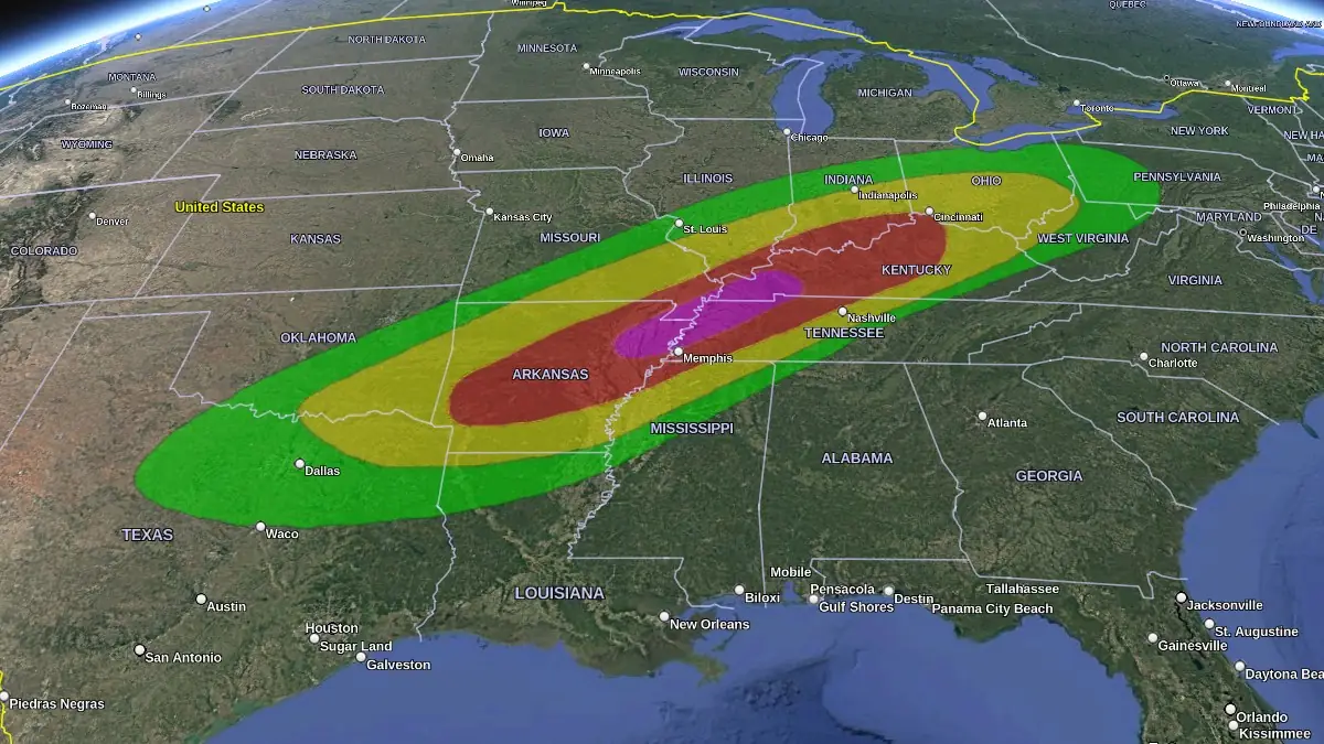
Historic rainfall, significant flooding risk expected in parts of Kentucky, Tennessee, Missouri and Illinois
A powerful spring storm system will bring a barrage of life-threatening weather, including flash flooding and strong tornadoes, to portions of the Lower Ohio Valley and Mid-South on Wednesday, April 2, 2025. The flash flood threat is only the beginning of a multi-day catastrophic and potentially historic event.
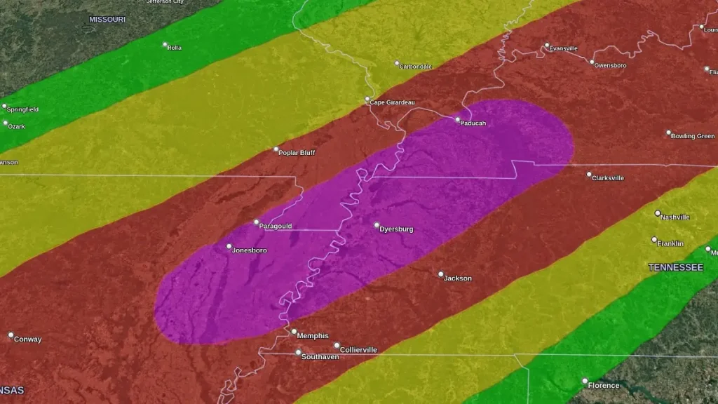
Excessive Rainfall Outlook April 3-4, 2025. Credit: NWS/WPC, Google, The Watchers
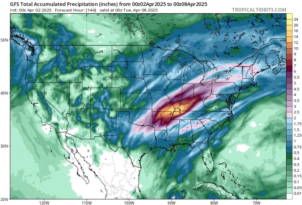
The National Weather Service’s Weather Prediction Center (WPC) has forecasted that from Wednesday through Sunday, parts of the Mid-South, Mid-Mississippi Valley, and western portions of the Ohio Valley are expected to receive between 250–380 mm (10–15 inches) or more of rainfall.
The heavy rainfall is anticipated to begin midweek, with thunderstorms repeatedly moving over the same locations, exacerbating the flood risk.
The affected areas include northeastern Arkansas, southeastern Missouri, western Kentucky, and southern parts of Illinois and Indiana.
“The repeating rounds of heavy rainfall over several days will lead to a dangerous and catastrophic life-threatening flash flood risk, particularly focused on the Lower Ohio Valley, Mid-South, and eastern Ozarks,” WPC forecasters said.
Catastrophic river flooding is possible late this week through the weekend in western Kentucky and northwest Tennessee, and widespread significant river flooding is expected from the Ozarks through the Lower Ohio Valley.
Residents in these regions are advised to stay informed through local news outlets and heed guidance from emergency management officials.
“Now is the time to prepare for potentially long duration and severe disruptions to communities due to the expected extreme rainfall and significant flooding risk,” NWS said.
Preparedness measures should include having an evacuation plan, assembling an emergency kit, and avoiding travel through flooded areas. It’s important to remember that flash floods can develop rapidly, posing significant risks to life and property.
Meanwhile, the Storm Prediction Center (SPC) has introduced a High Risk (level 5/5) of severe weather across portions of the Mid-South where the most favorable overlap of strong upper- and lower-level shear and instability may lead to an outbreak of tornadoes, including multiple intense tornadoes, as well as very large hail and significant damaging winds on Wednesday, April 2.
References:
1 Potentially Historic Rainfall and Significant Flooding Risk Wed-Sun – NWS/WPC – April 2, 2025
I'm a dedicated researcher, journalist, and editor at The Watchers. With over 20 years of experience in the media industry, I specialize in hard science news, focusing on extreme weather, seismic and volcanic activity, space weather, and astronomy, including near-Earth objects and planetary defense strategies. You can reach me at teo /at/ watchers.news.
Commenting rules and guidelines
We value the thoughts and opinions of our readers and welcome healthy discussions on our website. In order to maintain a respectful and positive community, we ask that all commenters follow these rules.