
Extreme cold warnings issued ahead of Arctic blast for much of central U.S.
Extreme cold warnings are in effect from Minnesota to Texas, including South Dakota and Kansas, as Arctic air pushes deep into the U.S., bringing record-breaking temperatures from Tuesday to Friday, February 18–21, 2025. Some areas could see up to 20 cm (8 inches) of snow.

Minimum temperature forecast for Friday, February 21, 2025. Image credit: NWS
Extreme cold warnings are in effect from Minnesota to Texas as an Arctic air mass moves south from Canada, bringing dangerously low temperatures across much of the central United States.
This Arctic outbreak is expected to set numerous daily temperature records across the Plains and surrounding regions from Tuesday to Friday, February 18 to 21. Freezing temperatures could extend as far south as the Gulf Coast.
Wind chills are forecast to range from -34 to -51 °C (-30 to -60 °F) across the northern Plains and could persist for multiple days. The National Weather Service (NWS) warned that such extreme temperatures could cause frostbite within minutes and that sub-zero wind chills may extend southward into Texas, Arkansas, western Tennessee, and Kentucky.
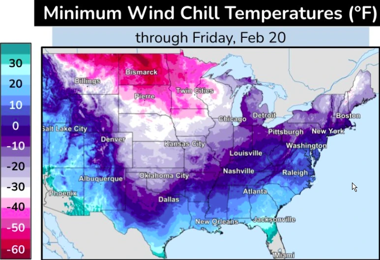
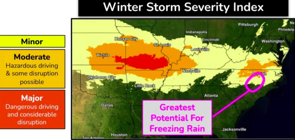
Moderate to heavy snowfall is forecast for Tuesday in central and eastern Kansas, extending into southern Missouri. There is a 60 % chance of snow accumulations reaching up to 20 cm (8 inches), with snowfall rates of 2.5 cm (1 inch) per hour expected in the region.
Travel conditions may be hazardous due to blowing and drifting snow. Significant freezing rain is possible in eastern North Carolina while accumulating snowfall is expected in southeastern Virginia.
References:
1 Short Range Forecast Discussion – NWS/WPC – February 17, 2025

Rishav Kothari is Editor-in-Chief of The Watchers, where he runs the newsroom and covers earthquakes, volcanoes, severe weather and space weather.
