
Atmospheric river brings heavy rain, flood risks, and mountain snow to California
An atmospheric river is forecast to bring heavy precipitation to California today and in the coming days, with significant snowfall expected in the Sierra Nevada and flood risks across multiple regions.
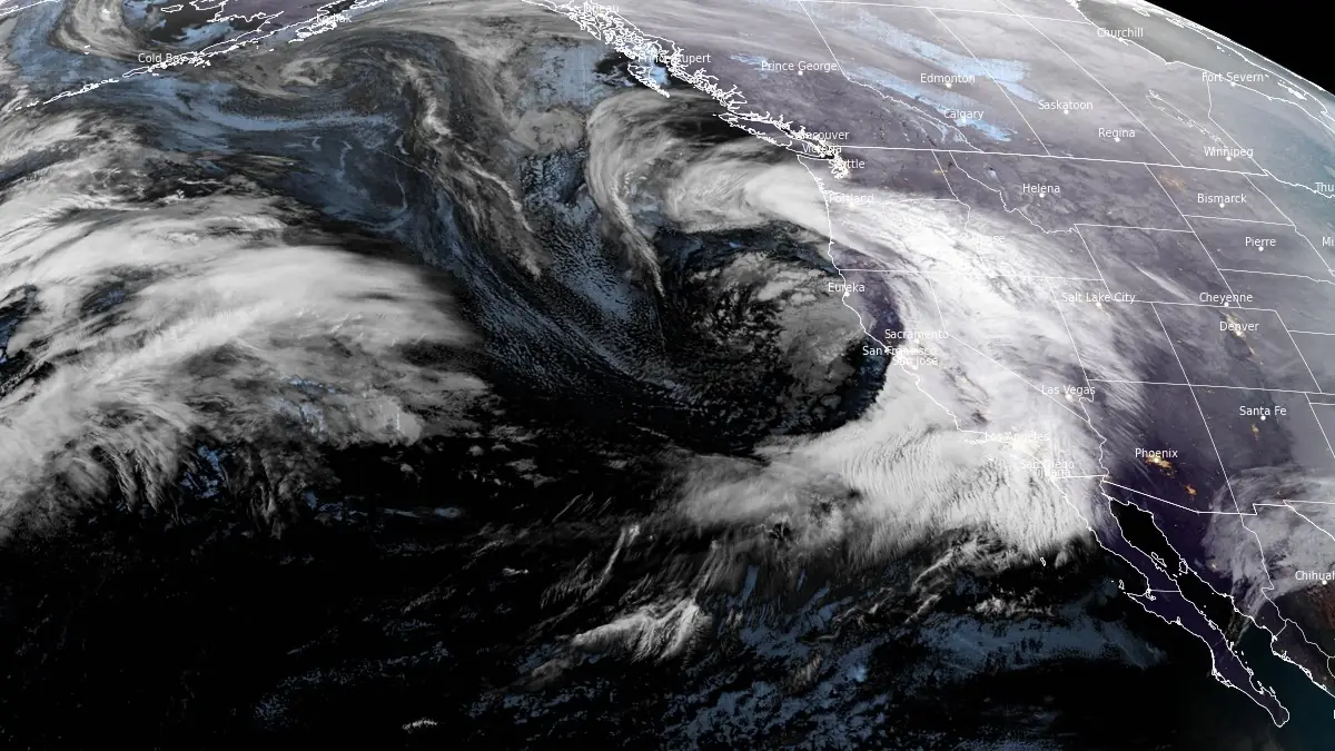
Image credit: NOAA/GOES-West, RAMMB/CIRA, The Watchers. Acquired at 14:40 UTC on February 13, 2025
- Heavy rain arrived in central California this morning and is now spreading inland and south, potentially causing flash and minor river flooding, the National Weather Service (NWS) warns.
- Recent burn areas in Southern California face the highest flash flood risk, including debris flows. Residents should follow the advice of public safety officials.
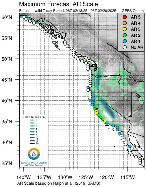
The first pulse of moisture made landfall over Central and Southern California on Wednesday, February 12, according to the Center for Western Weather and Water Extremes (CW3E). The second, more substantial pulse (AR 1 – 2 on the Ralph et al. AR scale) arrived today and will propagate down the coast throughout the day.
Compared to the GFS model, the ECMWF model is forecasting lower precipitation amounts in the Northern California Coast Ranges and Sierra Nevada, and higher amounts in the San Joaquin Valley, Central California Coast Ranges, and Southern California.
The NWS Weather Prediction Center (WPC) is forecasting over 150 mm (6 inches) of precipitation over the California Coast Ranges, Sierra Nevada, and Transverse Ranges over the next 3 days.

Burn areas in Southern California are at an elevated risk of flash flooding and debris flows due to the ongoing heavy rainfall. The lack of vegetation in these areas, caused by recent wildfires, significantly reduces the soil’s ability to absorb water, leading to potential rapid runoffs.
As a result, even moderate rainfall can trigger sudden and fast-moving floods, carrying mud, rocks, and other debris downhill with little warning. The steep terrain in these regions further amplifies the risk, increasing the likelihood of dangerous debris flows in canyons and valleys.
Residents in vulnerable locations are urged to remain vigilant, as debris flows can occur within minutes of heavy rainfall onset. These flows can be particularly hazardous, as they can move at high speeds and carry large boulders, uprooted trees, and other destructive material.
Snowfall accumulations are expected to exceed 1.2 m (48 inches) over much of the Sierra Nevada above 2 km (7 000 feet). Extreme impacts are expected across the Sierra Nevada as a result of the heavy snowfall and strong winds.
The NWS WPC has issued a moderate risk Excessive Rainfall Outlook (level 3 of 4; 40% chance of flooding) over the Transverse Ranges on day 2 (period ending 04:00 PST, February 14).
Stream levels are forecast to rise over much of California, with locations along the Sacramento River potentially experiencing minor flood conditions.
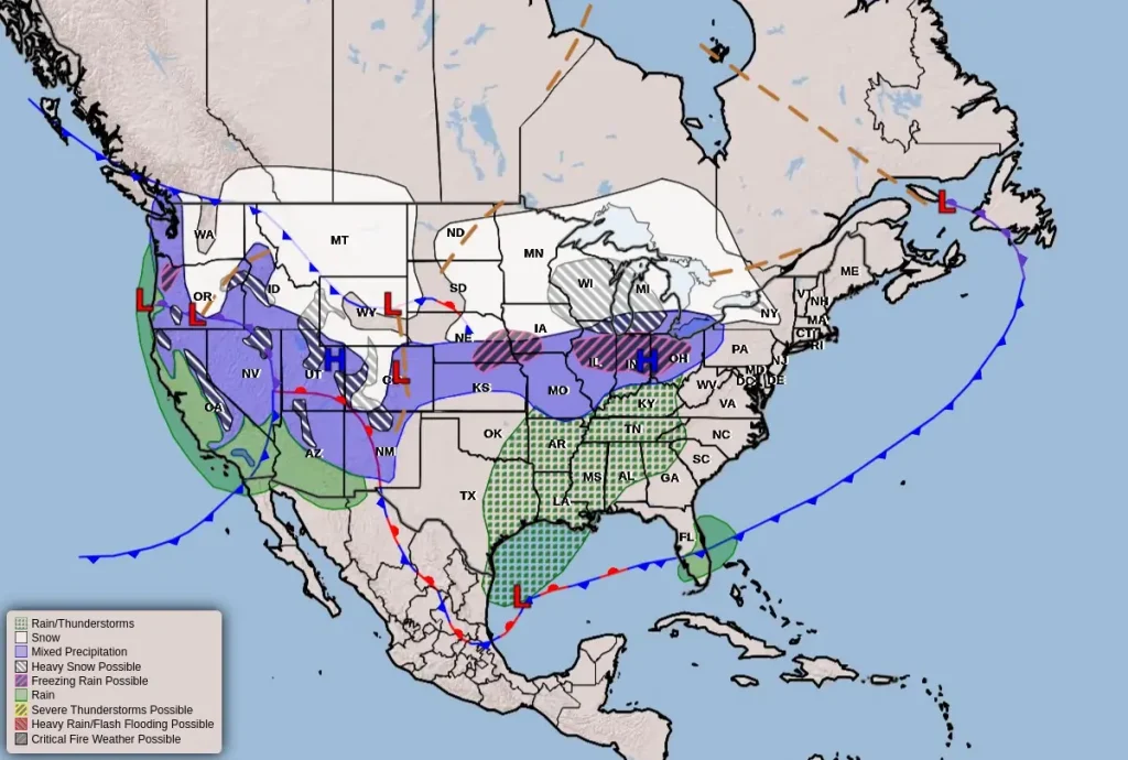
Snow levels will rise through the event, but heavy snow and low visibility are likely to cause dangerous travel at many area passes. Significant snow is also likely in the mountains of Utah and western Colorado. Ice accumulations are likely in northwest Oregon.
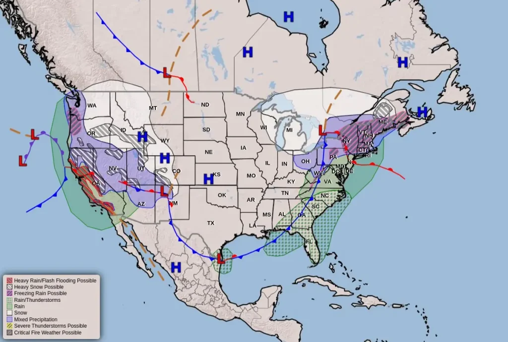
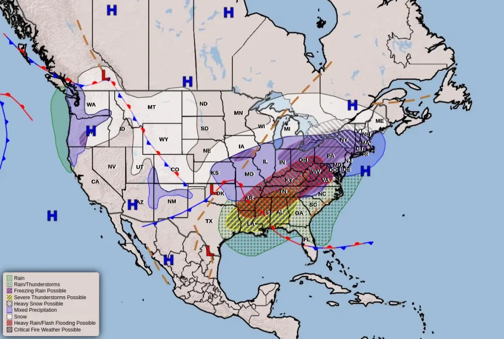
Additional impacts from the winter storm are likely in parts of the central and eastern U.S. from Friday into the weekend, including snow from the Upper Midwest to the Northeast and heavy rain in the Tennessee and Ohio valleys.
References:
1 Atmospheric River Forecast to Bring Heavy Precipitation to US West Coast – CW3E – February 12, 2025
2 Key Messages for coast-to-coast winter storm – NWS/WPC – February 13, 2025
I'm a dedicated researcher, journalist, and editor at The Watchers. With over 20 years of experience in the media industry, I specialize in hard science news, focusing on extreme weather, seismic and volcanic activity, space weather, and astronomy, including near-Earth objects and planetary defense strategies. You can reach me at teo /at/ watchers.news.
Commenting rules and guidelines
We value the thoughts and opinions of our readers and welcome healthy discussions on our website. In order to maintain a respectful and positive community, we ask that all commenters follow these rules.