
Atmospheric river forecast to make landfall over Washington and Oregon this weekend
An atmospheric river is forecast to bring significant precipitation to Washington and Oregon between Friday and Saturday, December 6 and 7, 2024, with the Olympic Peninsula and North Cascades expecting up to 127 mm (5 inches) of rainfall and AR2 conditions likely in southern Washington and northern Oregon. While confidence is high regarding the occurrence of the event, uncertainties remain in its duration, intensity, and precise timing due to variability among GEFS ensemble model predictions.
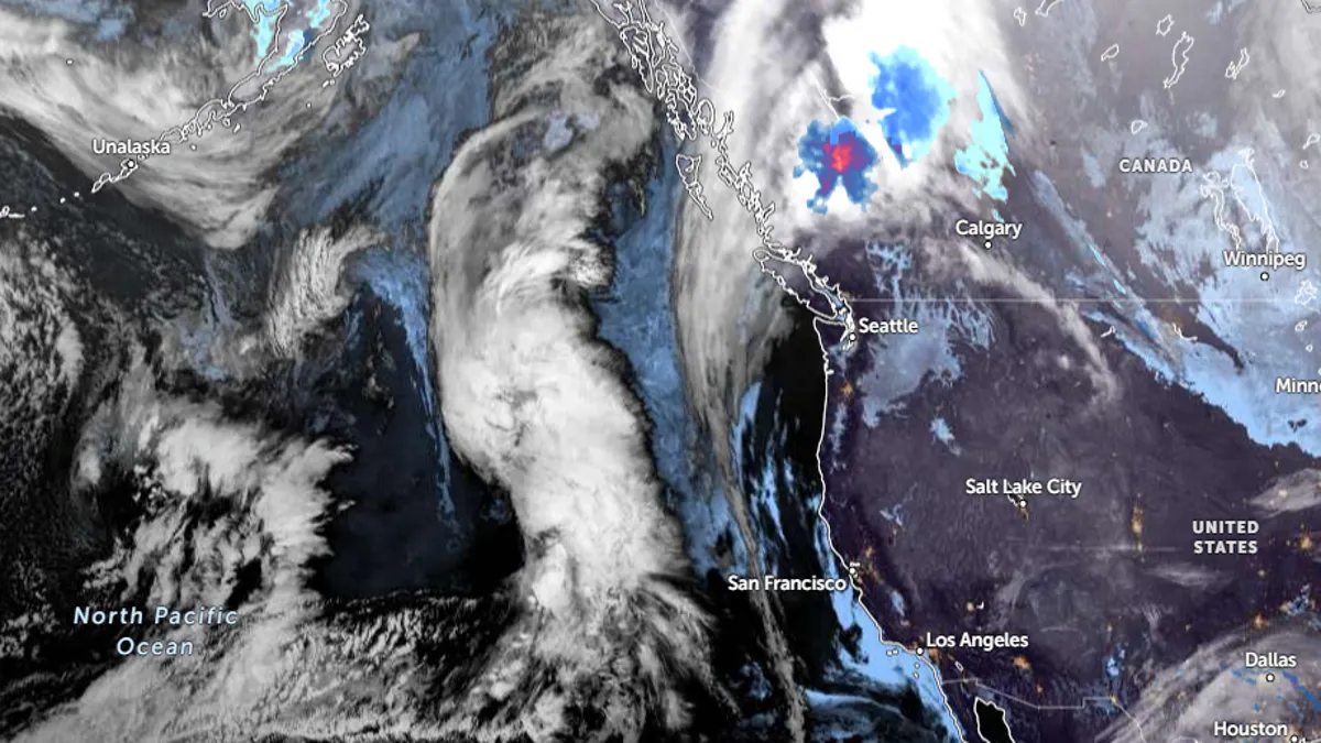
Satellite image of the developing atmospheric river off the U.S. Coast. Image credit: NOAA/Goes-West, Zoom Earth, The Watchers. Acquired at 10:30 UTC on December 4, 2024
- An atmospheric river (AR) is forecast to make landfall near Washington and Oregon between Friday and Saturday, bringing significant precipitation to the Pacific Northwest.
- The Olympic Peninsula and North Cascades are expected to receive 76 – 127 mm (3 – 5 inches) of rainfall, with high freezing levels reducing the likelihood of snow accumulation.
- AR2 conditions are predicted for southern Washington and northern Oregon, while northern Washington will likely experience AR1 conditions.
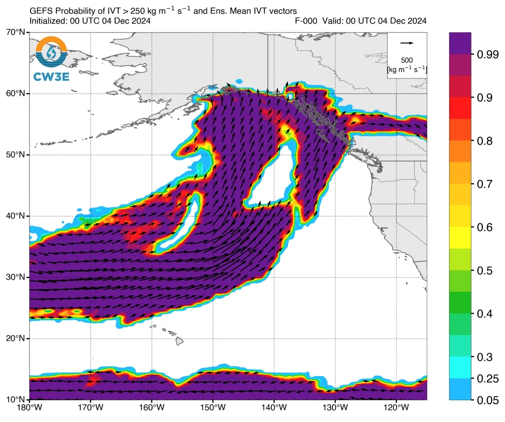
An atmospheric river (AR) moving towards British Columbia and southeastern Alaska, influenced by a ridge off the U.S. West Coast, is forecast to make landfall over Washington and Oregon between Friday and Saturday.
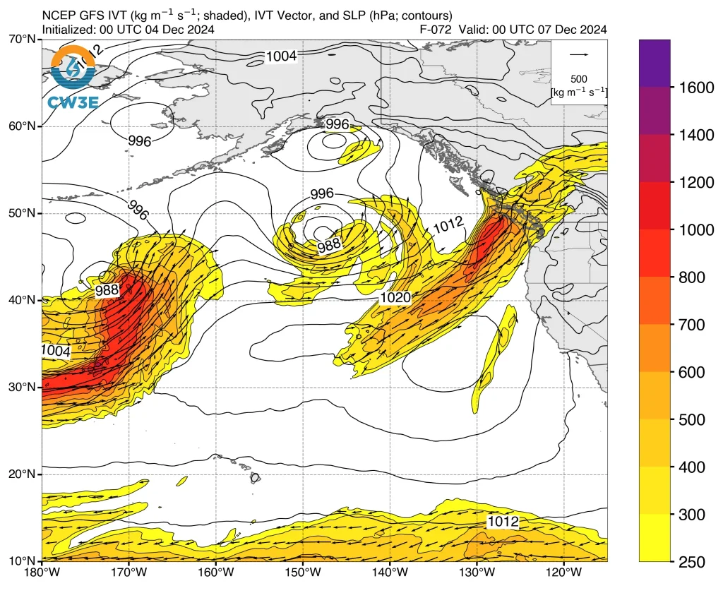
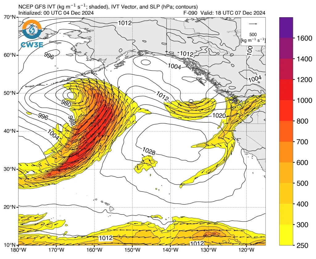
The AR is expected to make landfall near the Olympic Peninsula on Friday as the ridge weakens, with a shortwave trough driving a second AR towards the Pacific Northwest. The AR will then propagate southwards into Oregon on Saturday.
The CW3E AR Landfall Tool, based on the GEFS model, indicates a greater than 90% probability of AR conditions (≥250 kg/m/s of integrated water vapor transport) occurring over coastal Washington and northern Oregon between Friday and Saturday.
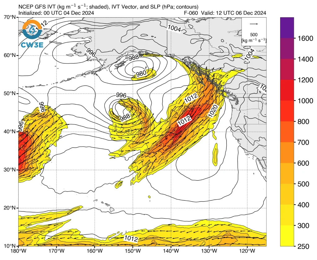
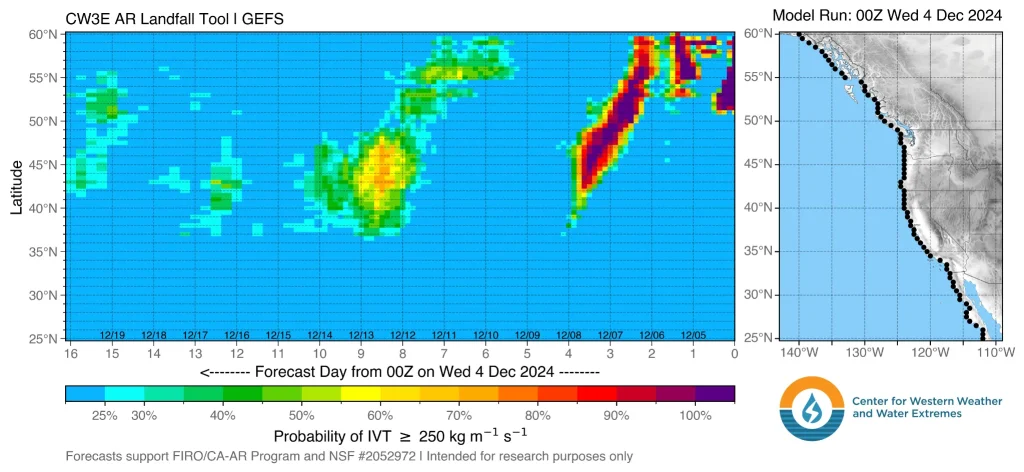
AR2 conditions are forecast for southern Washington and northern Oregon, while AR1 conditions are anticipated for northern Washington.

While confidence is high regarding the occurrence of the AR, uncertainties remain in its duration, intensity, and precise timing due to variability among GEFS ensemble model predictions.
Approximately 55% of ensemble members forecast AR2 or AR3 conditions (stronger intensity) for southwestern Washington.
Approximately 76 – 127 mm (3 – 5 inches) of precipitation is expected over the Olympic Peninsula and North Cascades during the AR event. Freezing levels are projected to remain high enough for most of the precipitation to fall as rain, reducing the likelihood of snow accumulation.
Stream levels are currently anticipated to rise only marginally in some areas. Although the ridge is forecast to weaken slightly, enabling the AR to reach the Pacific Northwest, it is expected to persist off California’s coast, maintaining dry conditions in California into early next week.
References:
1 Quick Look at the Potential Atmospheric River Impacting the Pacific Northwest – CW3E – December 3, 2024

I am an Assistant Editor and Severe Weather & Science Journalist at The Watchers, specializing in real-time severe weather coverage, geophysical event reporting, and research-driven scientific analysis. You can reach me at rishav(at)watchers(.)news.
Commenting rules and guidelines
We value the thoughts and opinions of our readers and welcome healthy discussions on our website. In order to maintain a respectful and positive community, we ask that all commenters follow these rules.