
Extreme winter storm impacts expected in Southern Sierra Nevada
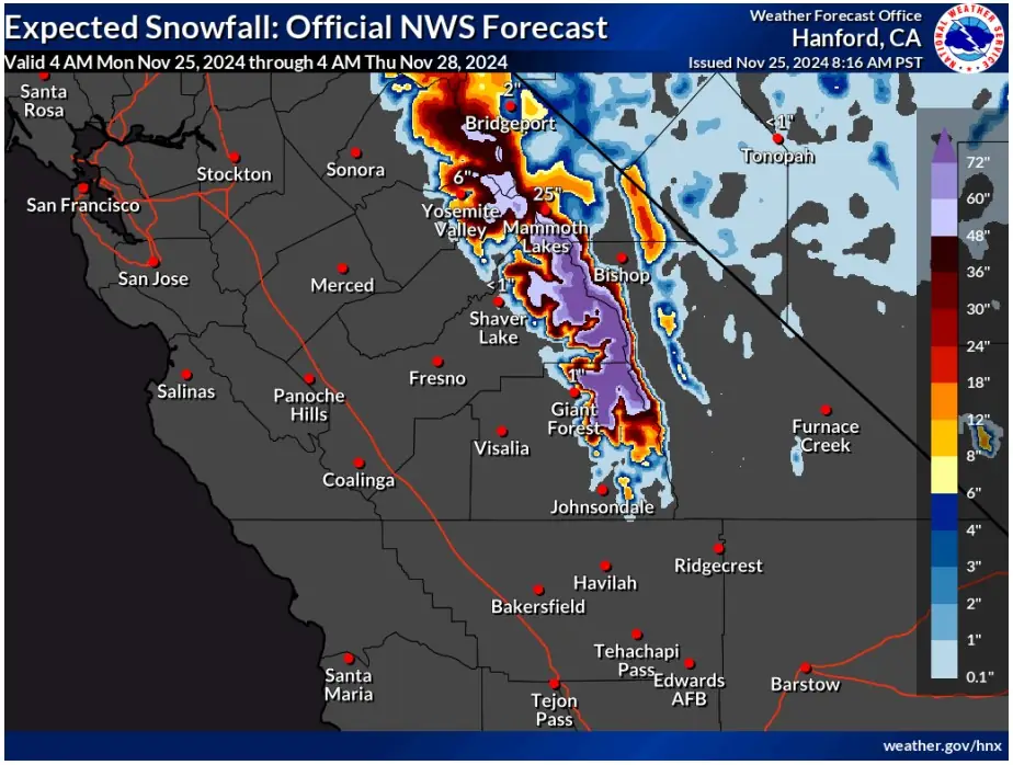
The Center for Western Weather and Water Extremes (CW3E) has warned of an intense winter storm impacting the Southern Sierra Nevada and parts of the Intermountain West from November 25 to 28, 2024. Forecasts indicate over 180 mm (7 inches) of precipitation and snow accumulations exceeding 1.5 m (5 feet) at higher elevations, with flash flood and winter storm warnings in effect.

Image credit: NWS/WPC
- The National Weather Service (NWS) projects that Fresno and Tulare Counties in the Southern Sierra Nevada will receive over 180 mm (7 inches) of precipitation. Higher elevations above 2 130 m (7 000 feet) could experience snow accumulations of 1 – 1.5 m (3 – 5 feet), with localized areas near the Sierra Crest south of Mammoth Lakes potentially exceeding these amounts.
- Central Utah and western Colorado’s higher terrain are also expected to receive significant snowfall, with totals between 0.3 and 0.9 m (1–3 feet).
- While this storm poses significant hazards, including heavy snowfall and possible flash flooding, it is expected to provide beneficial water resources.
An intense winter storm fueled by an atmospheric river is forecast to bring heavy rain and snowfall to the Southern Sierra Nevada and parts of the Intermountain West between November 25 and 28, 2024, according to the Center for Western Weather and Water Extremes (CW3E).
Extreme winter storm impacts are expected in the Southern Sierra Nevada, and major winter storm impacts are expected over the higher terrain in western Colorado. Winter Storm Warnings have been issued for these areas.
According to the National Weather Service (NWS) Weather Prediction Center (WPC) Winter Storm Severity Index, areas where Extreme Impacts are forecast should expect substantial disruption to daily life and extremely dangerous or impossible driving conditions, with travel not advised.
These conditions may lead to extensive infrastructure closures and disruptions, potentially requiring life-saving actions.
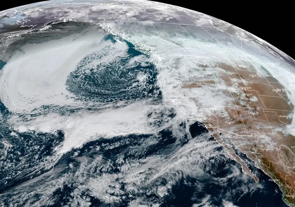
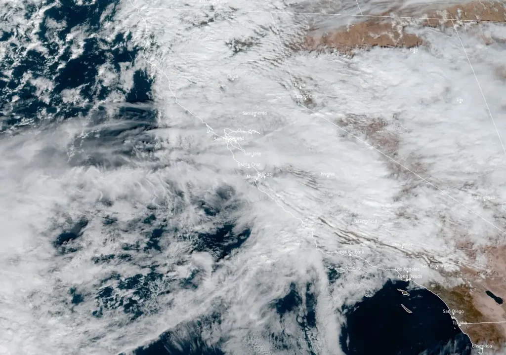

The storm originated as an atmospheric river that made landfall late on November 24, pushing a surge of moisture-laden air into Central California and penetrating into the western United States.
The National Weather Service (NWS) projects that Fresno and Tulare Counties in the Southern Sierra Nevada will receive over 180 mm (7 inches) of precipitation.
Higher elevations above 2 130 m (7 000 feet) could experience snow accumulations of 1 – 1.5 m (3 – 5 feet), with localized areas near the Sierra Crest south of Mammoth Lakes potentially exceeding these amounts.
Central Utah and western Colorado’s higher terrain are also expected to receive significant snowfall, with totals between 0.3 and 0.9 m (1 – 3 feet).

While this precipitation is critical for replenishing the snowpack in these areas, as current snowpack levels in the White-Yampa Basin of northwestern Colorado are only at 80% of the 1991 – 2020 median, the NWS has issued Winter Storm Warnings for affected areas, including a slight risk of rainfall exceeding flash flood thresholds in the Southern Sierra Nevada foothills through early November 26.
Residents and travelers are advised to monitor official forecasts and heed instructions from emergency management officials.
References:
1 Quick Look at the Atmospheric River Impacting California and the Intermountain West This Week – CW3E – November 25, 2024
I'm a dedicated researcher, journalist, and editor at The Watchers. With over 20 years of experience in the media industry, I specialize in hard science news, focusing on extreme weather, seismic and volcanic activity, space weather, and astronomy, including near-Earth objects and planetary defense strategies. You can reach me at teo /at/ watchers.news.
Commenting rules and guidelines
We value the thoughts and opinions of our readers and welcome healthy discussions on our website. In order to maintain a respectful and positive community, we ask that all commenters follow these rules.