
Strong eruptions at Ibu volcano prompt lahar warning, Indonesia
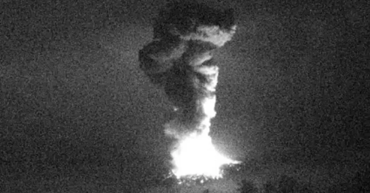
Image credit: PVMBG
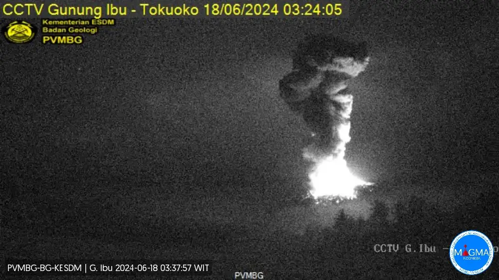
A strong eruption took place at the Indonesian Ibu volcano at 20:21 UTC on June 17, 2024 (03:21 LT, June 18), showering the upper edifice with bright lava bombs. The volcanic ash column reached a height of about 4.3 km (14 400 feet) above sea level.
Early on June 18, a volcanic eruption at the Indonesian Ibu volcano launched bright lava bombs and ejected ash to an altitude of 4.3 km (14 400 feet), primarily towards the northern and northeastern directions.
Incandescent material landed approximately 750 m (2 500 feet) from the cinder cone on the outer caldera flanks. The PVMBG volcano observatory recorded a seismic signal with a maximum amplitude of 28 mm and a duration of 199 seconds.
Similar intensity eruptions continued into June 19.
The Alert Level remains at IV (AWAS) since May 16 — the highest on a four-level scale. Residents are advised to avoid the area within a 4 km (2.5 miles) radius of the crater and 7 km (4.3 miles) from the northern crater wall opening.
The PVMBG is urging residents to be aware of the potential for lahars, or mudflows, which could be triggered by heavy rainfall remobilizing fresh ash deposits, posing a threat to inhabited areas.

Eruptions at the volcano from June 5 to 11, ejected ash as high as 5 km (16 400 feet) above the crater rim and drifted in multiple directions. Similar activity was observed on May 29 and June 3, with white steam-and-gas plumes reaching up to 1 km (3 300 feet) above the crater rim.
Ibu volcano, situated on Halmahera Island in Indonesia, boasts a history of volcanic activity that spans centuries, characterized by frequent eruptions and varying degrees of intensity. According to data compiled by the Smithsonian Institution’s Global Volcanism Program, Ibu is classified as a stratovolcano, a type known for its explosive eruptions driven by the interaction of magma with water and gases within the Earth’s crust.
Historical records show a pattern of eruptive episodes at Ibu volcano dating back to the early 19th century. These eruptions have typically explosive events that generate ash plumes and pyroclastic flows, which pose serious hazards to the surrounding region. The volcano’s activity is closely linked to its location within the Pacific Ring of Fire, where the Indo-Australian Plate subducts beneath the Eurasian Plate, nurturing conditions conducive to volcanic activity.
In recent decades, the Ibu volcano has exhibited increased activity, with notable eruptions documented in 1998, 2000, 2001, 2002, and subsequent years. These eruptions have varied in magnitude and style, ranging from moderate explosions to more substantial eruptions accompanied by lava flow and pyroclastic flows.
References:
1 Ibu volcano update – PVMBG – June 18, 2024
2 Ibu volcano – Geological summary – GVP

I am an Assistant Editor and Severe Weather & Science Journalist at The Watchers, specializing in real-time severe weather coverage, geophysical event reporting, and research-driven scientific analysis. You can reach me at rishav(at)watchers(.)news.
Commenting rules and guidelines
We value the thoughts and opinions of our readers and welcome healthy discussions on our website. In order to maintain a respectful and positive community, we ask that all commenters follow these rules.