
Mount Dempo eruption sends ash up to 7.6 km (25 000 feet) above sea level, Indonesia
Mount Dempo in South Sumatra, Indonesia, erupted at 04:45 UTC on April 15, 2026, sending volcanic ash as high as 7.6 km (25 000 feet) above sea level and prompting Indonesia’s volcano agency to raise the Aviation Color Code to Red. The eruption follows a phreatic blast on April 7 and inflation detected from April 2.
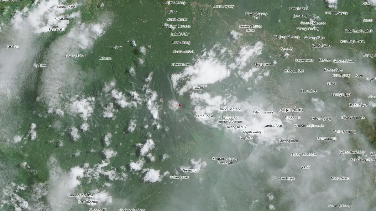
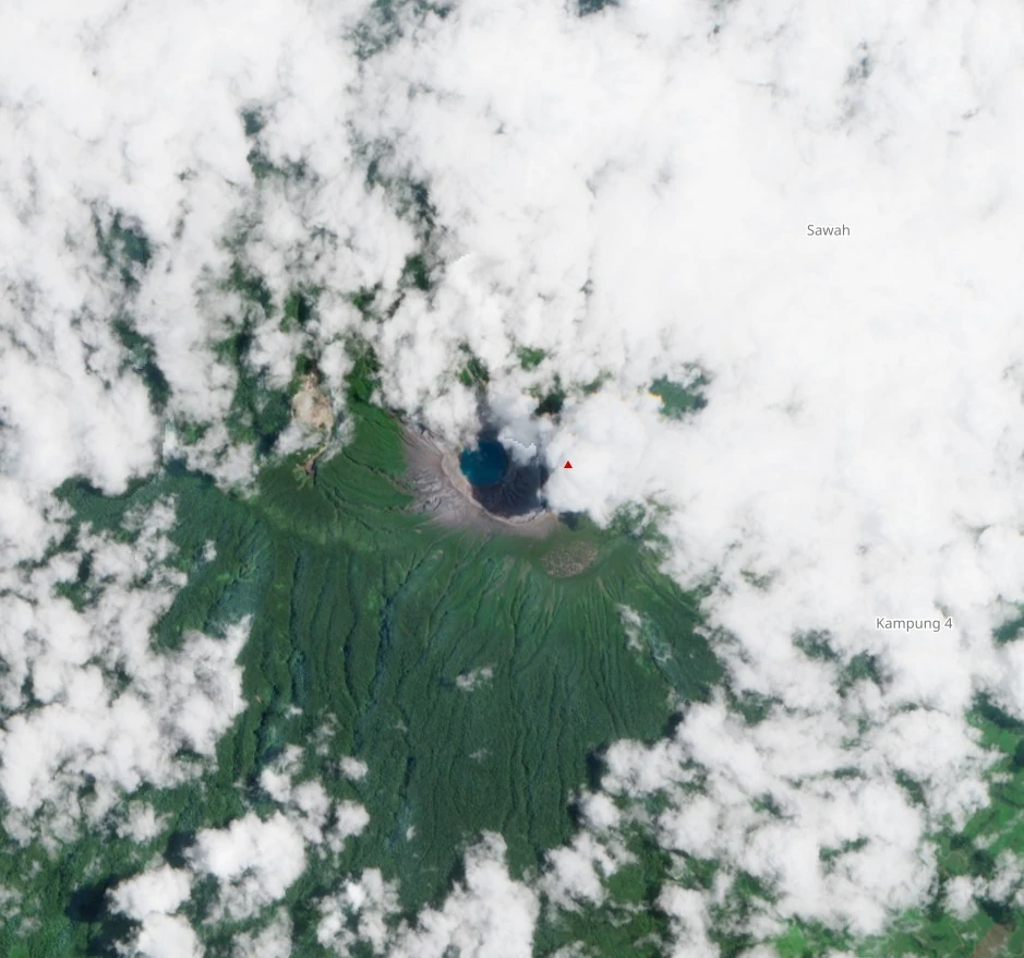
Satellite image of Mount Dempo acquired on April 9, 2026. Credit: CopernicusEU/Sentinel-2, The Watchers
The eruption was recorded at 04:45 UTC (11:45 LT) and produced an ash plume rising to about 6 673 m (21 354 feet) above sea level, or 3 500 m (11 200 feet) above the summit, according to Indonesia’s Center for Volcanology and Geological Hazard Mitigation (CVGHM/PVMBG). Ground observers described the plume as white with medium intensity, drifting toward the northeast.
It was recorded on seismograms with a maximum amplitude of 30 mm and a duration of 829 seconds. Volcanic tremor was also recorded, with a maximum amplitude of 0.5 mm.
An advisory issued by Darwin Volcanic Ash Advisory Center (VAAC) at 05:25 UTC reported volcanic ash to about 7 600 m (25 000 feet), extending northeast of the volcano, based on Himawari-9 satellite data and CVGHM observations. A follow-up advisory at 05:45 UTC refined the ash cloud top about 6 700 m (22 000 feet), with the ash moving northeast at 9 km/h (6 mph).
Darwin VAAC said the ash was not identifiable in the latest satellite imagery because of meteorological cloud and forecast dissipation within 6 to 12 hours.
Today’s eruption follows a phreatic eruption recorded at 01:39 LT on April 7, which lasted nearly three minutes and sent a dense gray ash plume about 2.5 km (1.6 miles) above the summit. Minor ashfall was reported within 4.7 km (2.9 miles) east of the crater.
CVGHM said Global Navigation Satellite System data showed no significant deformation during March 23 to April 6, though tiltmeter data from Tugu Rimau station indicated an inflation trend beginning on April 2.
Mount Dempo remained at Alert Level 2 (Waspada) as of April 14 — elevated but localized volcanic unrest. CVGHM has advised residents and visitors to stay at least 1 km (0.6 miles) away from the crater and up to 2 km (1.2 miles) on the north flank.
Dempo is a stratovolcano rising above the Pasumah Plain in southeastern Sumatra. Historical eruptions since 1817 have generally consisted of small-to-moderate explosions producing local ashfall.
References:
1 Dempo VONA – Dempo Volcano Observatory – Issued at 04:45 UTC on April 15, 2026
2 Dempo VA Advisory – Darwin VAAC – Issued at 05:25 and 05:45 UTC on April 15, 2026
3 Global Volcanism Program, 2026. Report on Dempo (Indonesia) (Sennert, S, ed.). Weekly Volcanic Activity Report, 2 April-8 April 2026. Smithsonian Institution and US Geological Survey.
I'm a dedicated researcher, journalist, and editor at The Watchers. With over 20 years of experience in the media industry, I specialize in hard science news, focusing on extreme weather, seismic and volcanic activity, space weather, and astronomy, including near-Earth objects and planetary defense strategies. You can reach me at teo /at/ watchers.news.
Commenting rules and guidelines
We value the thoughts and opinions of our readers and welcome healthy discussions on our website. In order to maintain a respectful and positive community, we ask that all commenters follow these rules.