
Tropical Cyclone “Fili” forms NW of New Caledonia
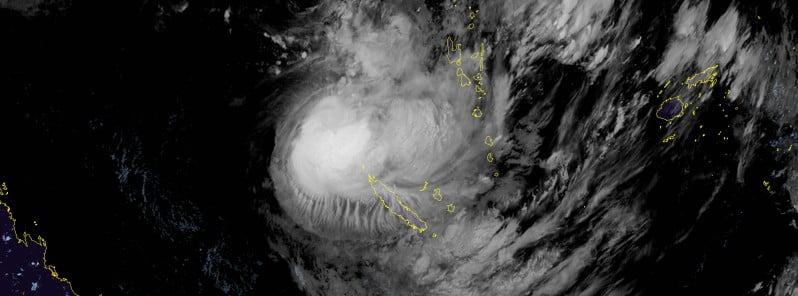
Featured image: Tropical Cyclone "Fili" at 12:40 UTC on April 5, 2022. Credit: JMA/Himawari-8, RAMMB/CIRA, TW
Tropical Cyclone “Fili” formed on Monday, April 4, 2022, NW of New Caledonia as the 5th named storm of the 2021/22 South Pacific cyclone season. Based on the latest forecast track, Fili is expected to pass west of New Caledonia on Wednesday and Thursday. Residents are advised to stay up to date with the latest forecasts and advisories from the local authorities.
As of 09:00 UTC on April 5, Fili was a tropical storm with its center located about 360 km (220 miles) NW of Belep Islands and 670 km (415 miles) NW of Noumea, New Caledonia.
Fili’s maximum sustained winds were 83 km/h (51 mph) at the time, and the system was moving SE at 15 km/h (9 mph).
Animated multispectral satellite imagery (MSI) depicts a medium-sized system that has become elongated southeastward due to northwesterly shear, partly exposing the low level circulation (LLC), JTWC forecasters noted at 09:00 UTC.1
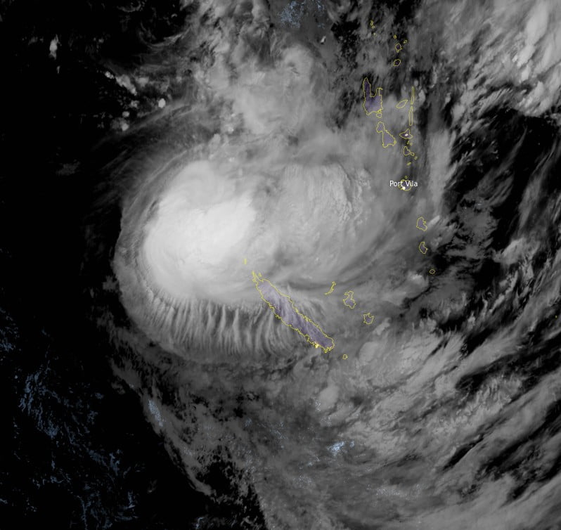
The initial position is placed with high confidence based on the partly exposed LLC in the MSI loop. The initial intensity of 83 km/h (51 mph) is also placed with high confidence based on clustered and equal agency Dvorak estimates, supported by automated Dvorak estimates.
Analysis indicates a favorable environment with moderate to strong vertical wind shear (VWS) offset by strong poleward outflow and warm sea surface temperatures (SST). The cyclone is tracking along the western periphery of the subtropical ridge (STR) to the east.
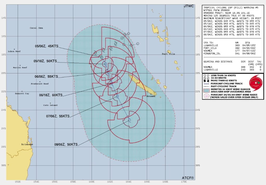
Tropical Cyclone “Fili” will continue on its current track under the steering influence of the STR. The favorable environment will carry up to 21:00 UTC on April 6, peaking at 110 km/h (68 mph).
Afterward, increasing VWS and cooling SST will gradually erode the system down to 90 km/h (55 mph) by 09:00 UTC on April 8.
Concurrently, Tropical Cyclone “Fili” will begin the subtropical transition by 09:00 UTC on April 7 and transform into a subtropical system with an expanding wind field by 09:00 UTC on April 8.
Heavy rainfall has already been reported across Belep and Grande Terre, New Caledonia, leading to the suspension of several transportation services, as a number of roads are impassable. Media report that emergency accommodation centers have opened in Belep.2
A Tropical Cyclone Level 1 alert is in effect for Belep Islands.
Moderate to locally heavy rainfall is forecast over most of New Caledonia, particularly for Belep Islands, on April 5 and 6.
There is much uncertainty regarding Fili’s track and people are advised to stay up to date with the latest forecasts and advisories from the official tropical cyclone warning center at Fiji Meteorological Services.
Tropical cyclone specialists at New Zealand MetService are closely monitoring the situation, and Tropical Cyclone Warning Centre Wellington will take over warning responsibilities on this system once it moves out of the tropics (south of 25S).
References:
1 JOINT TYPHOON WRNCEN PEARL HARBOR HI – PROGNOSTIC REASONING FOR TROPICAL CYCLONE 23P (FILI) – WARNING NR 005
2 New Caledonia – Tropical Storm FILI (GDACS, JTWC, Civil Protection New Caledonia, MeteoFrance New Caledonia, media) (ECHO Daily Flash of 05 April 2022)
I'm a dedicated researcher, journalist, and editor at The Watchers. With over 20 years of experience in the media industry, I specialize in hard science news, focusing on extreme weather, seismic and volcanic activity, space weather, and astronomy, including near-Earth objects and planetary defense strategies. You can reach me at teo /at/ watchers.news.
Commenting rules and guidelines
We value the thoughts and opinions of our readers and welcome healthy discussions on our website. In order to maintain a respectful and positive community, we ask that all commenters follow these rules.