
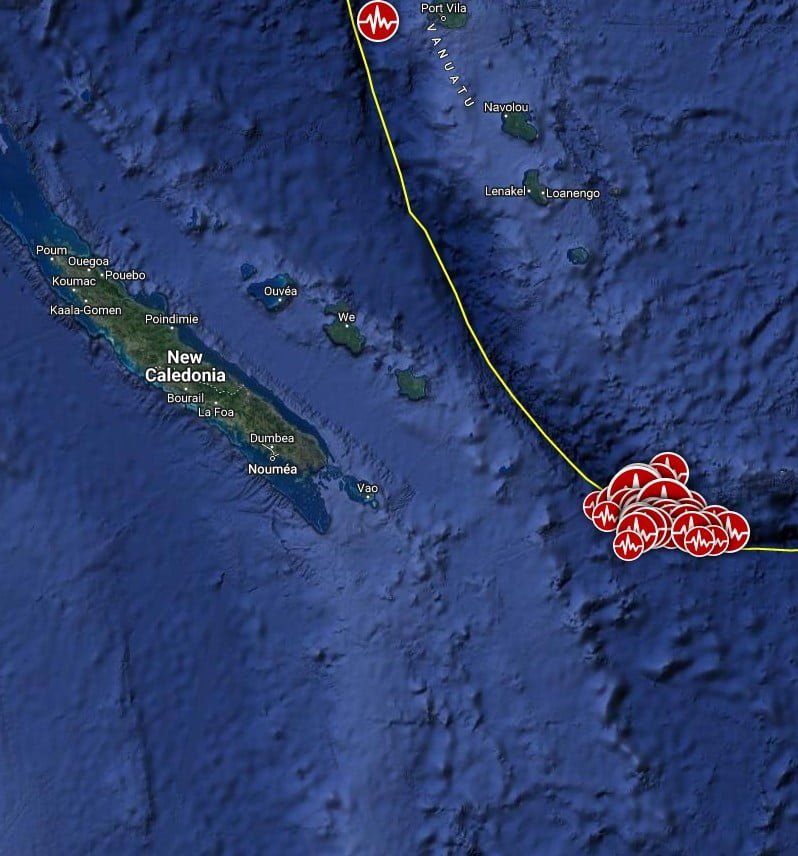
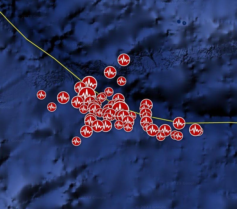
Series of aftershocks, including M7.1 and M6.5 hit southeast of Loyalty Islands following M7.7 and a small tsunami
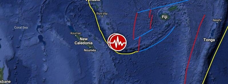
Image credit: TW/SAM, Google
Strong aftershocks continue after a powerful M7.7 earthquake hit southeast of Loyalty Islands at 02:57 UTC on May 19, 2023.
The mainshock was followed by at least 56 moderate to strong aftershocks over the next 30 hours, including M7.1 at 01:51 UTC and M6.5 at 02:09 UTC on May 20.
It occurred as a result of normal faulting near the plate boundary interface between the Australian and Pacific plates. Focal mechanism solutions indicate the earthquake occurred on either a moderately-dipping normal fault striking to the east or on a moderately-dipping oblique normal and strike-slip fault striking to the southwest, according to the USGS.
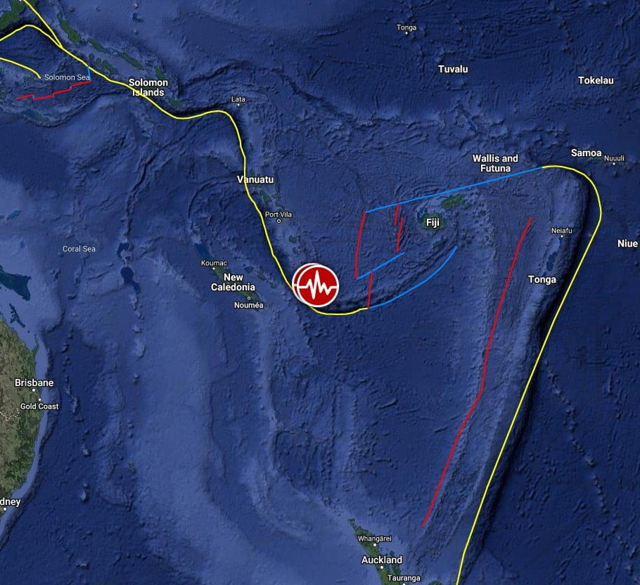
At the location of this earthquake, the Australian plate converges with the Pacific at a rate of approximately 75 mm (2.95 inches) per year. At the South New Hebrides Trench, Australia’s lithosphere sinks beneath the Pacific plate, descending into the mantle and forming the New Hebrides/Vanuatu subduction zone, stretching from New Caledonia in the south to the Santa Cruz Islands in the north.
While commonly plotted as points on maps, earthquakes of this size are more appropriately described as slip over a larger fault area. Normal faulting events of the size of the May 19, 2023, earthquake are typically about 85 x 35 km (length x width). This is 53 x 22 miles.
The Loyalty Islands region is very active seismically, and the region within 250 km (155 miles) of May 19, 2023, earthquake has hosted 13 other M 7+ earthquakes over the preceding 50 years. The largest prior events were an M7.7 on February 10, 2021, and an M 7.7 earthquake on May 16, 1995. Because of their remote locations, earthquakes in this region as less likely to create strong shaking in populated areas.
Today’s M7.1 earthquake produced small tsunami waves, reaching 0.3 m (0.1 feet) at Thio, New Caledonia, 0.14 m (0.5 feet) at Ouinne, New Caledonia, 0.11 m (0.4 feet) at Lifou, New Caledonia, and 0.12 m (0.4 feet) at Mare, New Caledonia. At 03:54 UTC, PTWC reported the tsunami threat from this earthquake has passed.
Tsunami wave observations from coastal and/or deep-ocean sea level gauges reveal the following measurements of the maximum tsunami height following yesterday’s M7.7 (the mainshock), measured with respect to the normal tide level:
Lenakel, Vanuatu recorded a height of 0.61 m (2 feet) at 05:11 UTC with a wave period of 4 minutes; East Cape, New Zealand observed a height of 0.11 m (0.4 feet) at 05:44 UTC with a wave period of 8 minutes; Fishing Rock Raoul located at Raoul Island, New Zealand measured a height of 0.15 m (0.5 feet) at 05:35 UTC with a wave period of 4 minutes; Raoul Is Boat Cove, Raoul Island, New Zealand documented a height of 0.07 m (0.2 feet) at 05:23 UTC with a wave period of 6 minutes; North Cape, New Zealand registered a height of 0.21 m (0.7 feet) at 05:32 UTC with a wave period of 6 minutes; Hienghene, New Caledonia observed a height of 0.03 m (0.1 feet) at 04:54 UTC with a wave period of 20 minutes; Thio, New Caledonia recorded a height of 0.07 m (0.2 feet) at 04:09 UTC with a wave period of 20 minutes; Mare, New Caledonia measured a height of 0.19 m (0.6 feet) at 04:13 UTC with a wave period of 6 minutes; Ouinne, New Caledonia documented a height of 0.20 m (0.7 feet) at 04:06 UTC with a wave period of 8 minutes; and Lifou, New Caledonia registered a height of 0.12 m (0.4 feet) at 04:00 UTC with a wave period of 6 minutes.
Several hours after the quake, the Vanuatu Meteorology & Geo-Hazards Department website announced that Vanuatu retracted its warning to seek higher ground and stated that a destructive tsunami is no longer expected.
Australia’s meteorology bureau initially issued a tsunami threat for Lord Howe Island, located off its east coast, advising the approximately 450 inhabitants to evacuate the water’s edge due to waves and strong currents. However, this warning was later downgraded to a marine warning.
It is important to note that even small tsunamis can be dangerous as they have the potential to easily knock people off their feet and float vehicles. Just to put it into perspective, fast-moving water as shallow as 0.15 m (6 inches) can carry away an adult. Similarly, 0.3 m (12 inches) of fast-moving water can carry away a small car. For larger vehicles like SUVs, vans, and trucks, it only takes 0.45 – 0.6 m (18-24 inches) of fast-moving water to carry them away.
For all earthquakes in this series, the USGS issued a Green alert for shaking-related fatalities and economic losses, stating there is a low likelihood of casualties and damage.
Overall, the population in this region resides in structures that are highly vulnerable to earthquake shaking, though some resistant structures exist. The predominant vulnerable building types are unknown/miscellaneous types and wood construction.
Recent earthquakes in this area have caused secondary hazards such as tsunamis that might have contributed to losses.
The Australia-Pacific margin is a highly dynamic plate boundary known for generating exceptionally strong earthquakes, tsunamis, and volcanic eruptions of global significance.
While the majority of this boundary is characterized by direct convergence between the Australian and Pacific plates, there are also transitional zones where oblique convergence occurs, as well as areas experiencing extension. Notably, the direction of subduction undergoes changes at multiple locations along the plate boundary, making it a distinctive attribute of this particular region.
I'm a dedicated researcher, journalist, and editor at The Watchers. With over 20 years of experience in the media industry, I specialize in hard science news, focusing on extreme weather, seismic and volcanic activity, space weather, and astronomy, including near-Earth objects and planetary defense strategies. You can reach me at teo /at/ watchers.news.
Commenting rules and guidelines
We value the thoughts and opinions of our readers and welcome healthy discussions on our website. In order to maintain a respectful and positive community, we ask that all commenters follow these rules.