
Strong and shallow M6.7 earthquake hits near the coast of West Sumatra, Indonesia
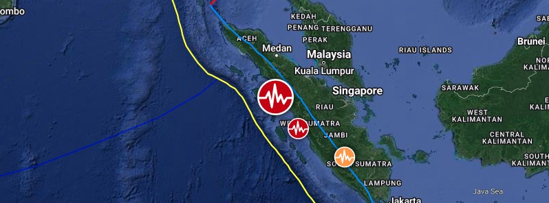
Image credit: TW/SAM, Google
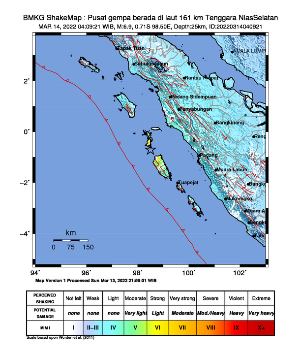
A strong and shallow earthquake registered by the USGS as M6.7 hit near the coast of West Sumatra, Indonesia at 21:09 UTC on March 13, 2022. EMSC is reporting M6.6 at a depth of 20 km (12.4 miles), BMKG M6.9 at a depth of 25 km (15.5 miles). The quake hit just four minutes after M6.4 off the coast of Luzon, Philippines.
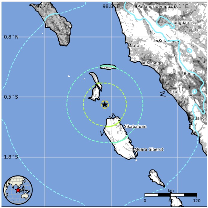
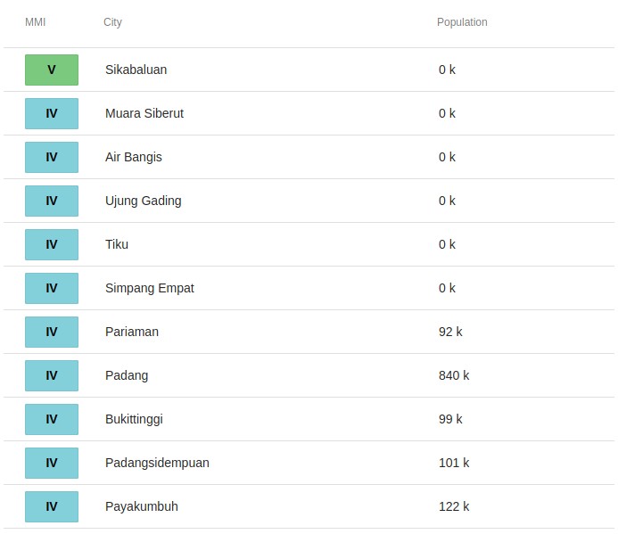
The epicenter was located about 168 km (104 miles) W of Pariaman (population 92 183) and 196 km (122 miles) W of Padang (population 840 352), West Sumatra, Indonesia.
There are about 50 000 people living within 100 km (62 miles).
16 000 people are estimated to have felt strong shaking, 38 000 moderate, and 5 959 000 light.
There is no tsunami threat from this earthquake, BMKG said.
The USGS issued a Green alert for shaking-related fatalities and economic losses. There is a low likelihood of casualties and damage.
Overall, the population in this region resides in structures that are vulnerable to earthquake shaking, though resistant structures exist. The predominant vulnerable building types are unreinforced brick with concrete floor and precast concrete frame with wall construction.
Recent earthquakes in this area have caused secondary hazards such as landslides that might have contributed to losses.
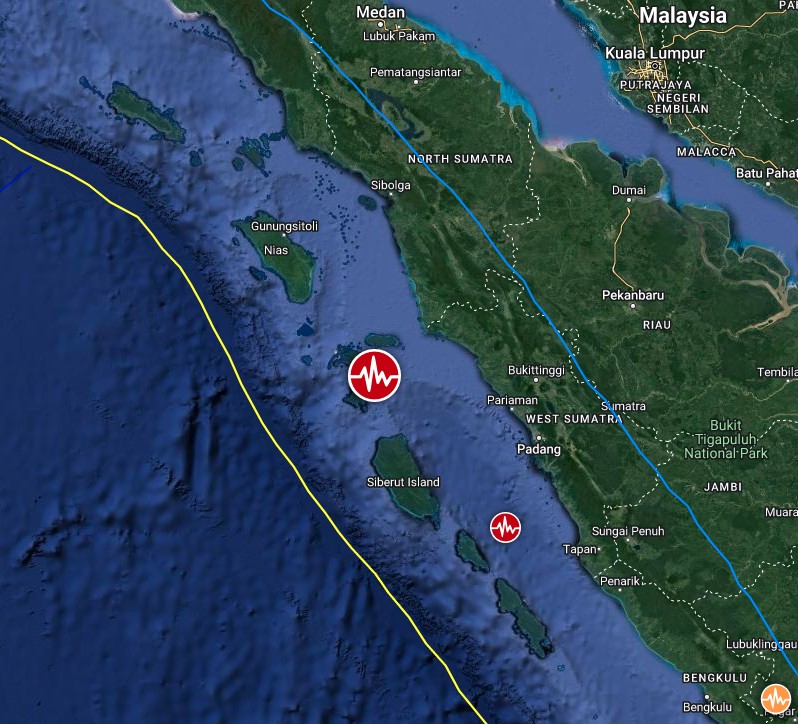
Image credit: TW/SAM, Google
Estimated population exposure to earthquake shaking

Selected cities exposed
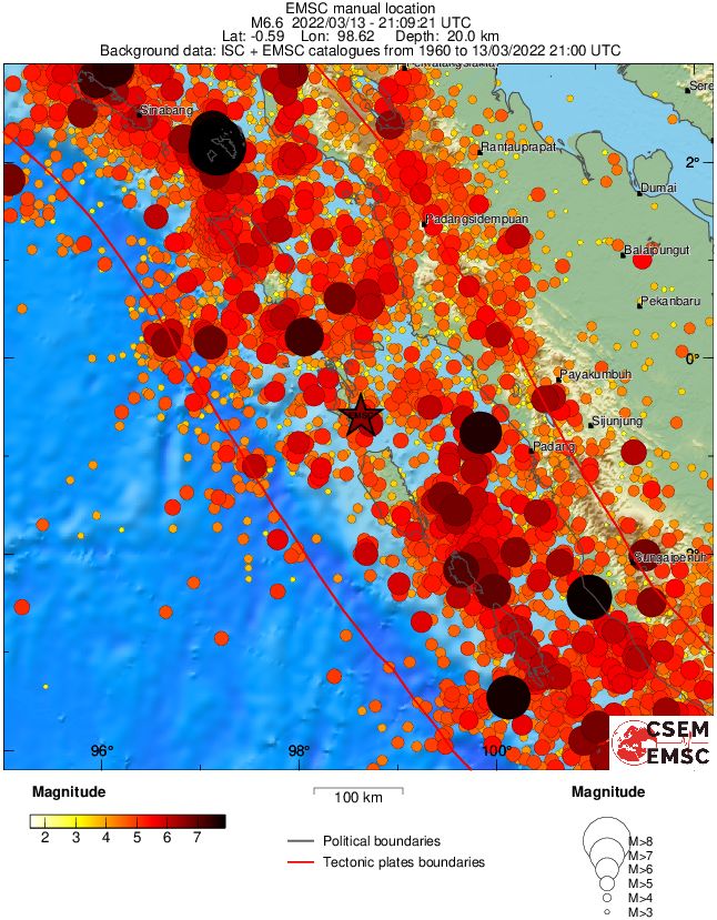
Regional seismicity
I'm a dedicated researcher, journalist, and editor at The Watchers. With over 20 years of experience in the media industry, I specialize in hard science news, focusing on extreme weather, seismic and volcanic activity, space weather, and astronomy, including near-Earth objects and planetary defense strategies. You can reach me at teo /at/ watchers.news.
The Holy Bible is being fulfilled.
These earthquakes are triggered by the big crack that was opened in Earth’s magnetic field which was one of the biggest in years. Solar wind poured through the gap, adding its energy to that of a full-halo CME that headed directly to Earth. Late on March 13th, Coronagraphs onboard the Solar and Heliospheric Observatory (SOHO) recorded the storm cloud leaving the Sun