
Two major storms on the way to Ireland and U.K. this week
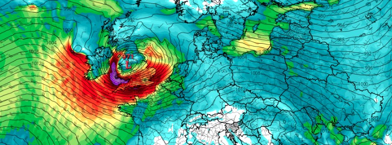
Image credit: TropicalTidbits, GFS
The UK Met Office has named two low pressure systems on February 14, 2022 — Dudley and Eunice. Both are expected to bring spells of very strong and damaging winds to Ireland and the United Kingdom this week.
Storm Dudley will bring strong winds to northern and western parts of Ireland on Wednesday, February 16, then on Friday, February 18 Storm Eunice is forecast to bring more widespread strong and damaging winds across Ireland, along with heavy rain and potentially snow.
Met Éireann has issued nationwide Yellow wind warnings for Wednesday when Dudley is expected to bring wind gusts of around 80 – 110 km/h (50 – 70 mph) at times. An Orange wind warning has also been issued for Donegal, where gusts could reach around 130 km/h (80 mph) along exposed coasts.
A more widespread spell of windy and disruptive weather is expected on Friday as Storm Eunice moves across Ireland, with weather warnings expected to be issued in the coming days.
"It’s been a fairly quiet year so far but that’s all going to change this week as an active jet stream steers several low-pressure systems across Ireland and the UK," Met Éireann meteorologist, Emer Flood said.1
"On Wednesday, Storm Dudley will bring strong winds to mainly northern and western areas, these strong winds in combination with high tides will lead to large coastal waves and some coastal flooding. As Storm Dudley clears eastwards on Thursday morning winds will ease for a time, before picking up again on Friday morning as Storm Eunice approaches," Flood said.
"We’re keeping a close eye on this Storm as there is the potential for more widespread strong winds across Ireland which may lead to some disruption and damage. Along with strong winds, Eunice is expected to bring spells of heavy rain and potentially some snow. We’re advising the public to keep a close eye on the weather forecast as the week progresses as further weather warnings are likely to be issued."
It’s a quiet start to the week but our weather will turn much more unsettled by mid-week as #StormDudley brings strong winds on Wednesday and #StormEunice brings further strong winds along with heavy rain and possibly snow.
Warnings in place https://t.co/nuE5J69XbV pic.twitter.com/S3gAeDTxC8— Met Éireann (@MetEireann) February 14, 2022
An active jet steam will help to develop and then propel #TwoStorms across the UK this week #StormDudley and #StormEunice will bring disruptive winds from Wednesday afternoon and possibly snow on Friday pic.twitter.com/0b8wqZek9c
— Met Office (@metoffice) February 14, 2022
Let's take a closer look at the #rain in the UK
There's been some heavy rain around this lunchtime, especially across northeastern and central parts of the UK
Away from the main area of rain it's a mix of sunny spells and short lived showers pic.twitter.com/Vo6PyRkNIU— Met Office (@metoffice) February 14, 2022
Storm Dudley will cross the northern half of the U.K. Wednesday night into Thursday morning, while Storm Eunice will bring strong winds and potentially some snow for parts of the country Friday.
"An active jet stream is driving low-pressure systems across the country, both of which are likely to cause some disruption and National Severe Weather Warnings have been issued," the U.K. Met Office Chief Meteorologist, Paul Gundersen, said.2
Strong winds will cross western Scotland and Northern Ireland Wednesday evening, pushing eastward to northern England overnight and through Thursday morning.
Wind gusts between 130 and 145 km/h (80 – 90 mph) are possible on exposed coasts and hills of Scotland with 95 – 110 km/h (60 – 70 mph) possible further inland. Winds are expected to ease through Thursday afternoon and evening.
Eunice will track across central areas of the U.K. on Friday.
Further impacts are expected from very strong winds with 95 – 110 km/h (60 – 70 mph) gusts possible inland, perhaps even stronger in some places, though the strongest winds and worst-affected areas are uncertain at present.
This system is also expected to bring some heavy rain and there is a potential for some significant snowfall over hills in the Midlands and further north.
"We’re encouraging drivers to check the latest weather and travel conditions before setting off on journeys and consider if their journey is necessary and can be delayed until conditions improve, National Highways Head of Road Safety, Jeremy Phillips, said.
"If you do intend to travel, then plan your journey and take extra care, allowing more time for your journey," Phillips added.
"In high winds, there’s a particular risk to lorries, caravans and motorbikes so we’d advise drivers of these vehicles to slow down.
"Drivers of other vehicles should be aware of sudden gusts of wind which can affect handling and braking, and give high-sided vehicles, caravans, and motorbikes plenty of space. In the event of persistent high winds we may need to close bridges to traffic for a period, so please be alert for warnings of closures and follow signed diversion routes."
References:
1 Turning very unsettled this week with two storms on the way – Met Eireann
2 The Met Office names two storms – UK Met Office
I'm a dedicated researcher, journalist, and editor at The Watchers. With over 20 years of experience in the media industry, I specialize in hard science news, focusing on extreme weather, seismic and volcanic activity, space weather, and astronomy, including near-Earth objects and planetary defense strategies. You can reach me at teo /at/ watchers.news.
Commenting rules and guidelines
We value the thoughts and opinions of our readers and welcome healthy discussions on our website. In order to maintain a respectful and positive community, we ask that all commenters follow these rules.