
Expansive, prolonged period of winter weather across northwestern U.S.

Image credit: NWS/WPC
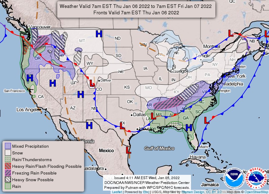
An expansive, prolonged period of winter weather is expected across portions of the northwestern U.S. through Friday, January 7, 2022, and not just over the higher terrain, NWS Weather Prediction Center warns.
An area of low pressure will track southeast along the western coast of Vancouver Island on Thursday and Thursday night, January 6, 2022, and then into northwest Washington by Friday.
The low pressure system is expected to produce several inches of snow across the mountain ranges and passes, along with widespread areas of moderate to heavy snowfall into the lowlands of northeast Washington.
Areas of freezing rain may result in light ice accretions, particularly from the southeast and south-central Washington into north-central Oregon along the Columbia River Gorge.

Heavy rain and rising snow levels will cause rising rivers and may produce flash flooding for the coastal Pacific Northwest, NWS warns.
Heavy snow will continue from the Northwest to the central Rockies, and into the Plains.


Teo Blašković founded The Watchers in 2011 and edited it until 2026, covering seismic and volcanic activity, extreme weather, space weather and near-Earth objects. Articles on this page are his archive.
Published in the last 24 hours
- 2 atmospheric rivers to bring heavy Sierra snow and California flood risk
- El Niño floods kill 2 in Guayaquil as 172.8 mm of rain swamps Milagro, Ecuador's toll rises to 14
- Southern Thailand braces for heavy rain, 15 provinces on flood and landslide alert for November 18-22
- Bay of Bengal system to become Cyclone Akvan, landfall forecast between Nellore and Tuni on November 20, India

Commenting rules and guidelines
We value the thoughts and opinions of our readers and welcome healthy discussions on our website. In order to maintain a respectful and positive community, we ask that all commenters follow these rules.