
Prolonged monsoon rains bring widespread floods to the Philippines
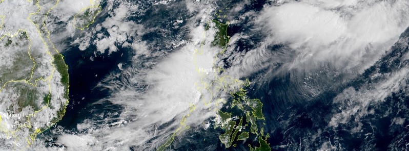
Image credit: JMA/Himawari-8, RAMMB/CIRA, TW. Acquired 00:50 UTC on July 29, 2021
Widespread floods brought by prolonged monsoon rains continue affecting the Philippines, leading to casualties and damage.
According to the Disaster Response Operations Monitoring and Information Centre, more than 570 240 people were affected across the country and 42 111 of these evacuated. Some 15 000 were evacuated out of low-lying areas in the capital, Manila, on July 24.
Across the country, floods have so far damaged at least 293 houses, with 69 destroyed.
The Ambuklao and Binga dams in Luzon continued to release water from their reservoirs on Thursday, July 29, the Manila Bulletin reports.
Based on the latest monitoring by PAGASA, Ambuklao Dam’s six gates remained open at 3 m (9.8 feet). The dam’s water level decreased to 750.93 m (2 463.68 feet) as of Thursday noon, from the previous 751.35 m (2 465.05 feet). Its normal high water level is at 752 m (2 467.19 feet).
Meanwhile, Binga Dam in Benguet also had six gates opened at 3.5 m (11.48 feet). Its water level slightly went down to 573.73 m (1 882.31 feet) from 574.34 m (1 884.31 feet) as of Thursday morning. Binga Dam’s normal high water level is at 575 m (1 886.48 feet).
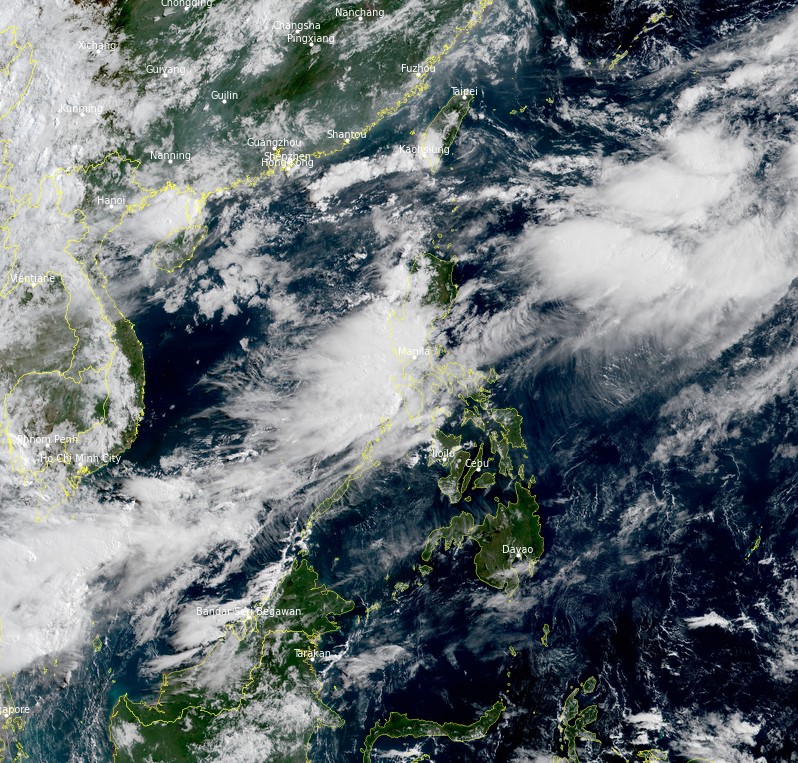
Image credit: JMA/Himawari-8, RAMMB/CIRA, TW. Acquired 00:50 UTC on July 29, 2021
PAGASA urged all residents and the local disaster risk reduction and management office concerned to take all the necessary appropriate actions.
Over the next 24 hours, the Southwest Monsoon will bring moderate to heavy with at times intense rains over Ilocos Region, Benguet, Zambales, Bataan, Tarlac, Pampanga, and Occidental Mindoro, PAGASA said.
Meanwhile, light to moderate with at times heavy rains will prevail over Metro Manila, CALABARZON, Abra, Nueva Ecija, Bulacan, Oriental Mindoro, and northern Palawan including Calamian Islands.
"Moreover, occasional gusty winds will be experienced over these areas especially in the coastal and upland localities. Under these conditions, scattered to widespread flooding and rain-induced landslides are possible during heavy or prolonged rainfall especially in areas that are highly or very highly susceptible to these hazards as identified in hazard maps."
I'm a dedicated researcher, journalist, and editor at The Watchers. With over 20 years of experience in the media industry, I specialize in hard science news, focusing on extreme weather, seismic and volcanic activity, space weather, and astronomy, including near-Earth objects and planetary defense strategies. You can reach me at teo /at/ watchers.news.
Commenting rules and guidelines
We value the thoughts and opinions of our readers and welcome healthy discussions on our website. In order to maintain a respectful and positive community, we ask that all commenters follow these rules.