
Severe thunderstorm brings massive hail, prompting rare warning in Iowa, U.S.

Image credit: Des Moines Police
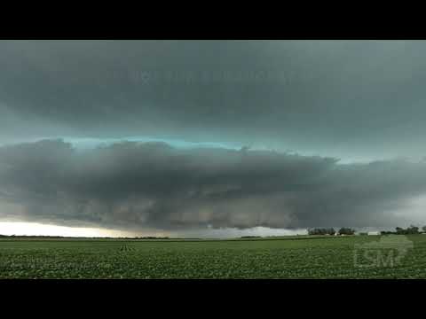
Severe thunderstorms brought strong winds and huge hail to Des Moines, Iowa, on Friday afternoon, July 9, 2021. The National Weather Service (NWS) issued what might be the city's first warning for hail of up to 10 cm (4 inches).
The Des Moines metro area was battered hard by severe weather on Friday afternoon. At 18:07 UTC (13:07 LT), the NWS issued a severe thunderstorm warning for parts of Boone and Green Counties for the hail of up to 6 cm (2.5 inches).
The warning spread to Dallas, Polk, and Story counties 11 minutes later, and hail reports began coming in shortly.
At 18:40 UTC (13:40 LT), the warning upgraded for the potential of hail the size of a softball, with more than 7.6 cm (3 inches) of hail reported in Woodward.
This may be the first time the NWS Des Moines office has warned for a storm with up to 10 cm (4 inches) hail, said Daryl Herzmann with Iowa State University. The extent of damage is yet to be confirmed.
NWS forecasts flooding and strong storms for parts of the Midwest this weekend.
"A well defined upper-level trough will support the development of an organized surface low across the Midwest, and this will aid in the development of multiple mesoscale convective systems that could repeatedly affect the same general areas, particularly from Missouri to central Kentucky where several inches of rainfall will be possible along with numerous strong to severe storms," it wrote Saturday, July 10.
"Heavy rainfall and flash flooding may occur over portions of the Midwest and Mississippi Valley into Sunday (July 11)."
View from the 2nd floor just before the storm… pic.twitter.com/wJabu9l7u1
— Des Moines Police (@DMPolice) July 9, 2021
HAIL NO: People in the Des Moines area reported hail up to three inches in diameter Friday afternoon as a storm rolled through central Iowa. https://t.co/WjsZ6IJLWW pic.twitter.com/wBti1eUcSq
— KWWL Storm Track 7 (@KWWLStormTrack7) July 9, 2021
Huge hail falling in Johnston & Grimes. @WHOWeather @EdWilsonWX13HD @BrettMcWx #iawx pic.twitter.com/ioKUHEAeRP
— Megan Salois (@WXMegs) July 9, 2021
That’s some big hail from Des Moines on SnapMaps pic.twitter.com/NbHYuQwIru
— Lincoln_Wx (@Lincoln_Wx) July 9, 2021
Oh hail. Here at the Cheese Bar in Des Moines, it’s like sitting inside a pinball machine pic.twitter.com/cZmRmLYk7z
— Jane Burns (@jrburns) July 9, 2021
Monster supercell coming through Des Moines right now! #iawx @NWSDesMoines @spann pic.twitter.com/evhXeO5qpw
— Evan (@evan27_wx) July 9, 2021

Published in the last 24 hours
- High Risk of excessive rainfall covers Florida’s Space Coast as St. Johns River near Cocoa reaches 5.67 m
- A broad low over southeastern Florida and the northwestern Bahamas has a 30 percent chance of subtropical or tropical development within 48 hours and a 50 percent chance within 7 days, the National Hurricane Center says
- Asteroid 2026 WJ to pass Earth at 1.7 lunar distances at 04:20 UTC on November 22, with 2026 WD following at 4.4 lunar distances on November 23
- Cyclone Akvan crossed the north Andhra Pradesh and south Odisha coasts close to Gopalpur on November 20 with 70-80 km/h winds gusting to 90, and has weakened into a deep depression
