
Sydney records coldest run of May nights since 1967, Australia
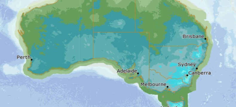
Featured image: Overnight minimum temperatures for May 20, 2021. Credit: BOM/MetEye
A record-breaking cold snap is affecting eastern Australia this week, with Sydney, NSW recording its coldest run of May nights since 1967.
The minimum temperatures in the city dropped to 8.6 °C (47 °F) on Thursday morning, May 20, 2021, marking the coldest run of May nights (5 in a row) since 1967, when the temperature fell below 9 °C (48 °F) for six nights in a row.
According to the Australian Bureau of Meteorology (BOM), the past 5 days also marked the coldest run of nights this early in the year since 1955.
The cold air mass that swept through northern parts of NSW on May 16 brought record low temperatures this early in May, including -7.5 °C (18.5 °F) in GlenInnes, -5.2 °C (22.6 °F) in Tenterfield, 2.5 °C (36.5 °F) in White Cliffs, and 5 °C (41 °F) in Ballina.
The temperatures are expected to drop again on Friday morning, May 21, and continue over the weekend, with parts of NSW ranges dropping below freezing.
Frosts are forecast across parts of the Southern Downs in Queensland, through the northern ranges of New South Wales, the ACT, northern Victoria, and Tasmania.
Meanwhile, two cold fronts are expected to arrive this weekend in Western Australia's South West, bringing showers, possible storms, and even the potential for snow, BOM meteorologists said.
The first front on Saturday, May 22 will bring widespread rain to the South West of the state, while the second cold front, arriving on Sunday, will be the coldest front experienced in WA this year.
Snow is possible on Sunday night on Bluff Knoll in the Stirling Ranges.
Two cold fronts are expected to arrive this weekend in the South West. The first front on Saturday will bring widespread rain to the SW, while the second cold front, arriving on Sunday, will be the coldest front in WA this year. Forecasts: https://t.co/s6h92mr6gz pic.twitter.com/LLeXxSWwTH
— Bureau of Meteorology, Western Australia (@BOM_WA) May 20, 2021
Temperatures will drop from 6 – 9 °C (11 – 16 °F) through inland parts of the southwest between Friday and Sunday. Perth will only get to a high of 19 °C (66 °F) on Sunday, 17 °C (62.6 °F) on Monday and cold conditions will continue throughout early next week. The wind chill will make it feel even colder, BOM said.
Monday is forecast to be the coldest day. Katanning is expected to record the coldest temperature of 11 °C (51.8 °F), with several other places in the Great Southern expected to only reach 12 °C (53.6 °F).
The coldest morning is forecast to be Tuesday, May 25. Areas in the Wheat Belt and Great Southern may only reach 2 – 3 °C (35.6 – 37.4 °F) overnight.
A vigorous southerly air stream from the Southern Ocean is driving this early taste of winter, particularly with the second, stronger cold front.
The last time we had snow was on September 21, 2020, at Bluff Knoll. Prior to that, a dusting of snow occurred on April 19, 2019, and a heavier fall on August 9, 2018, also at Bluff Knoll.
Typically when snow falls in WA it's between July and September, but has arrived as early as April.
I'm a dedicated researcher, journalist, and editor at The Watchers. With over 20 years of experience in the media industry, I specialize in hard science news, focusing on extreme weather, seismic and volcanic activity, space weather, and astronomy, including near-Earth objects and planetary defense strategies. You can reach me at teo /at/ watchers.news.
I live in this district- nothing really seemed out of the ordinary to me- however… there has been heavy continuous flyovers by chem-spraying tankers, and plenty of VLF pumped into the sky- the weather is being interfered with, as it was ALL summer long, they clouded the place over- we had NO summer temps. reflected, defelcted UV, burning the ozone layer from above, reflecting up, burning through the ozone again. Night temps were moderate, but never cool. Today, 21/5/21, has been the coolest, with showers, after jets went over yesterday, dropping various mixes in the sky at differing levels, causing a densening of the cloud. I could see the chemicals dropping and mixing as the prevailing winds mixed it together, today- no sunshine at all, just another grey day- all by design, of someone.