
Enhanced Risk issued for severe storms across Northern Plains, tornadoes, very large hail, and damaging winds forecast
The Storm Prediction Center has placed parts of the Northern Plains under an Enhanced Risk (Level 3/5) for severe thunderstorms on June 9, 2026, as a strengthening low-pressure system emerging from the northern Rockies is forecast to support numerous storms capable of producing very large hail, damaging winds, and tornadoes, including a few strong tornadoes, from eastern North Dakota and northeastern South Dakota into northwestern Minnesota.
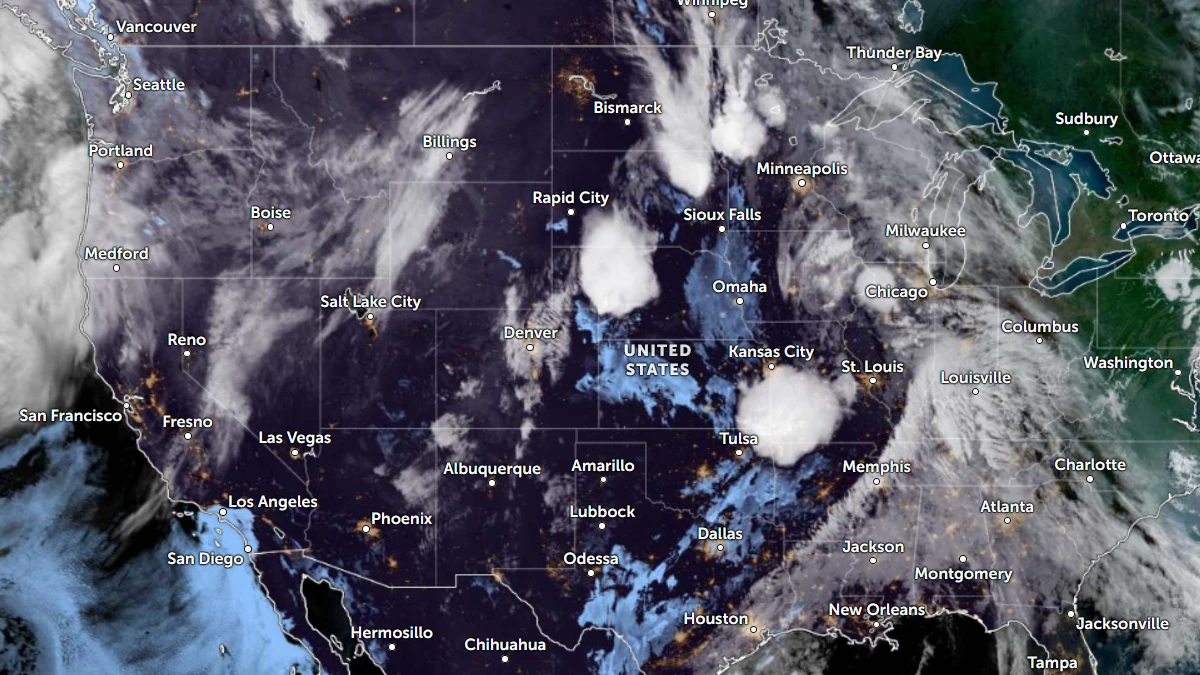
Satellite image of the USA at 11:20 UTC on June 8, 2026. Credit: NOAA/GOES-19, Zoom Earth, The Watchers
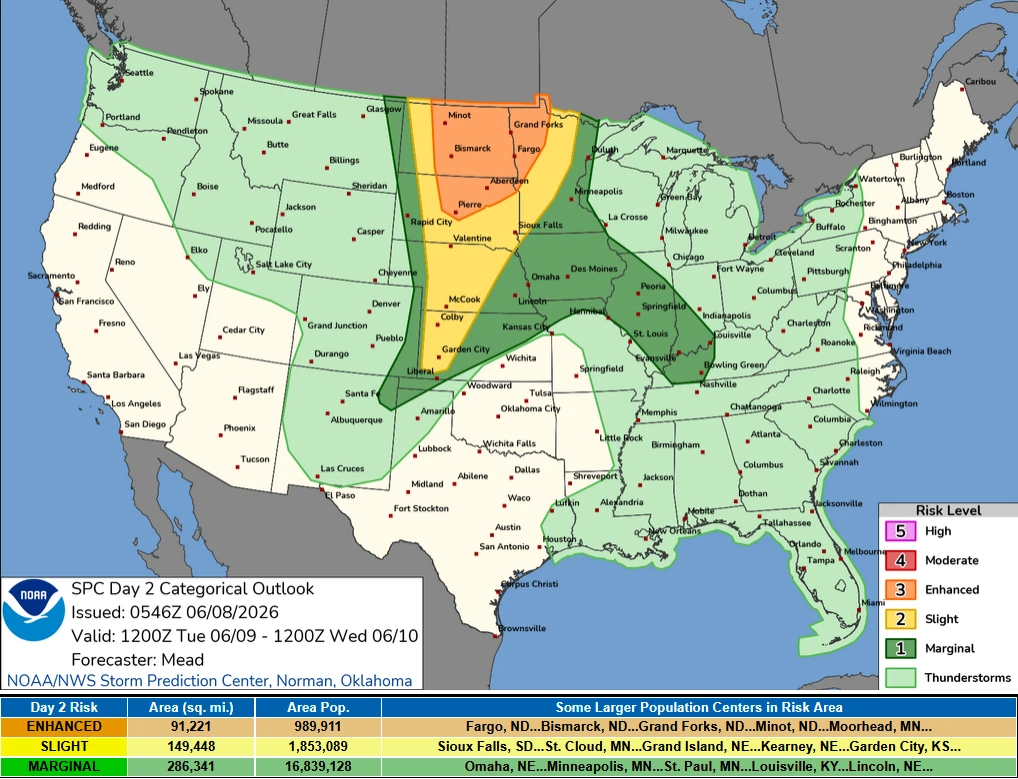
The Storm Prediction Center (SPC) has issued an Enhanced Risk (Level 3/5) of severe thunderstorms for parts of the Northern Plains on June 9.
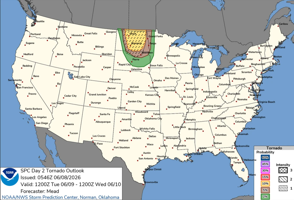
Severe storms capable of producing very large hail, damaging winds, and possibly a few strong tornadoes are expected from eastern North Dakota and northeastern South Dakota into northwestern Minnesota during the forecast period, valid from 12:00 UTC on June 9 through 12:00 UTC on June 10.
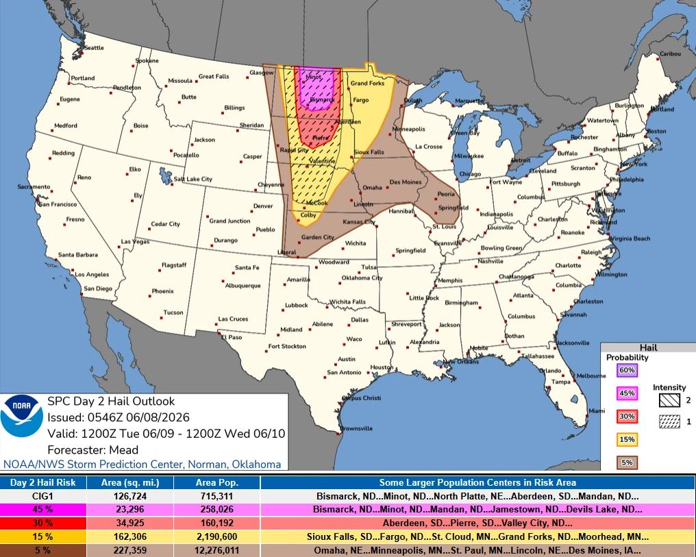
The Enhanced Risk area covers central and eastern North Dakota, north-central and northeastern South Dakota, and northwestern Minnesota. The main threats will be very large hail, damaging winds with significant gusts, and tornadoes.
A weather system moving out of the northern Rockies is forecast to strengthen as it enters the northern Plains on June 9. The short-wave trough will move northeast ahead of a stronger disturbance and associated mid- and upper-level jet streaks moving into the northern and central Plains during the night of June 9–10.
At the surface, low pressure is forecast to develop from southeastern Montana into northwestern North Dakota along a Pacific front or dryline-like boundary moving east across the northern High Plains.
A warm front extending across northern South Dakota into northwestern Minnesota is forecast to move north toward the international border on June 9.
As the warm front lifts northward, a warm and increasingly unstable air mass is expected to expand across the region. A strengthening low-level jet stream will transport moisture northward beneath steep mid-level lapse rates, creating an environment favorable for organized severe thunderstorms.
Meanwhile, widely scattered severe thunderstorms are also forecast farther south across parts of the central Plains. These storms may produce very large hail and damaging winds during the afternoon and evening of June 9.
Additional isolated severe storms capable of large hail and damaging winds are forecast from parts of the Midwest into the lower Ohio Valley.
References:
1 Day 2 Convective Outlook – SPC – June 8, 2026

I am an Assistant Editor and Severe Weather & Science Journalist at The Watchers, specializing in real-time severe weather coverage, geophysical event reporting, and research-driven scientific analysis. You can reach me at rishav(at)watchers(.)news.
Commenting rules and guidelines
We value the thoughts and opinions of our readers and welcome healthy discussions on our website. In order to maintain a respectful and positive community, we ask that all commenters follow these rules.