
Large and powerful low pressure system in the Central U.S.
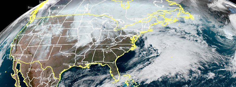
Image credit: NOAA/GOES-East, RAMMB/CIRA. Acquired at 17:50 UTC on January 14, 2021
A large and powerful low pressure system will develop and intensify across the Central U.S. on Thursday, January 14, 2021. The two main hazards will be heavy snow and high winds. Winter storm and blizzard warnings are in effect for portions of the Upper Midwest and high wind warnings extend from Montana and the Dakotas to the central Plains.
This low pressure system is expected to remain stationary over the region through Friday, January 15 before continuing on into the Great Lakes and Northeast on Saturday, NWS forecaster Kebede said.
Strong winds are expected to continue to be an issue on the backside of this system over the Northern/Central Plains through Friday morning.
High Wind Warnings are in effect for much of the Northern/Central Plains as a result.
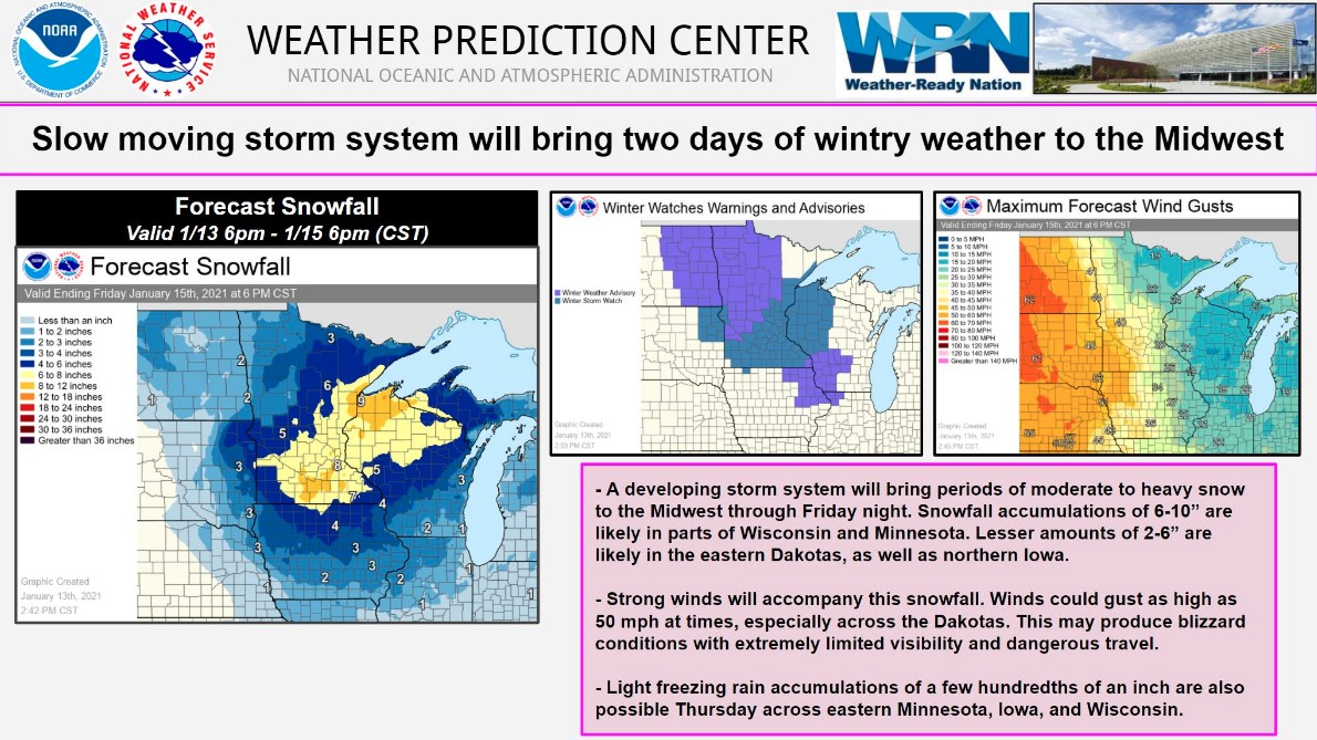
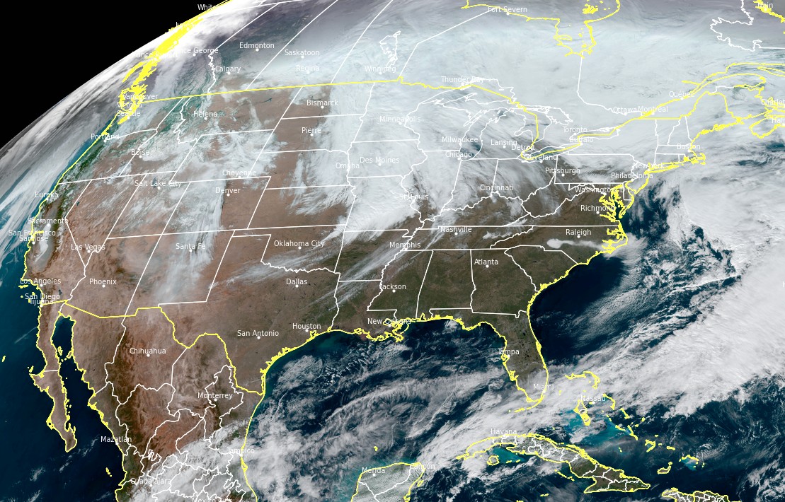
Image credit: NOAA/GOES-East, RAMMB/CIRA. Acquired at 17:50 UTC on January 14, 2021
Between 100 and 200 mm (4 – 8 inches) of snow are likely to fall over much of Iowa, Minnesota and parts of Wisconsin through Friday. Isolated amounts of over 200 mm (8 inches) can't be ruled out.
Some light freezing rain may also occur along the Upper Mississippi Valley. Winter Storm Watches and Advisories are in effect for this area.
This system will slide into the Northeast on Saturday and produce snowfall over the interior Northeast and rain for the coastal areas.
Upslope enhancement could mean that parts of the Northern/Central Appalachians could see measurable snow on Saturday.
I'm a dedicated researcher, journalist, and editor at The Watchers. With over 20 years of experience in the media industry, I specialize in hard science news, focusing on extreme weather, seismic and volcanic activity, space weather, and astronomy, including near-Earth objects and planetary defense strategies. You can reach me at teo /at/ watchers.news.
Commenting rules and guidelines
We value the thoughts and opinions of our readers and welcome healthy discussions on our website. In order to maintain a respectful and positive community, we ask that all commenters follow these rules.