
Texas bracing for Hurricane “Hanna” – landfall expected this afternoon or early this evening
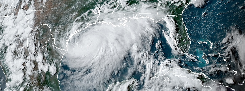
Featured image: Tropical Storm "Hanna" at 22:50 UTC on July 24, 2020. Credit: NOAA/GOES-East, RAMMB/CIRA
Tropical Storm "Hanna" remains in an atmospheric and oceanic environment conducive for strengthening, and is expected to reach hurricane status before it makes landfall this afternoon (LT) or early this evening, July 25, 2020, along the coast of southern Texas.
- A Storm Surge Warning is in effect for Port Mansfield to Sargent, Texas.
- A Hurricane Warning is in effect for Port Mansfield to Mesquite Bay, Texas.
- A Tropical Storm Warning is in effect for Barra el Mezquital, Mexico to Port Mansfield, Texas; and Mesquite Bay to High Island, Texas.
- There is a danger of life-threatening storm surge along the Texas coast from Port Mansfield to Sargent, where a Storm Surge Warning is in effect. Residents in these locations should follow advice given by local emergency officials.
- Hurricane conditions are expected along the Texas coast from Port Mansfield to Mesquite Bay, where a Hurricane Warning is in effect. Tropical storm conditions are expected to first reach the coast within the warning area this morning.
- Hanna is expected to produce heavy rains across portions of southern Texas and northeastern Mexico. These rains could result in life-threatening flash flooding and isolated minor to moderate river flooding.
Governor Greg Abbott has placed numerous resources across the state on standby, urging residents to take precautionary measures to protect life and property.
"I urge all those who are in the path of this storm to heed the warnings and guidance from local officials before the storm makes landfall. The State of Texas will coordinate with local officials to provide assistance and resources to communities in the area."
A voluntary evacuation is in effect for several communities in Kleberg County, which includes a portion of Padre Island.
Corpus Christi and Nueces County closed their beaches until 06:00 LT on Monday, July 27.
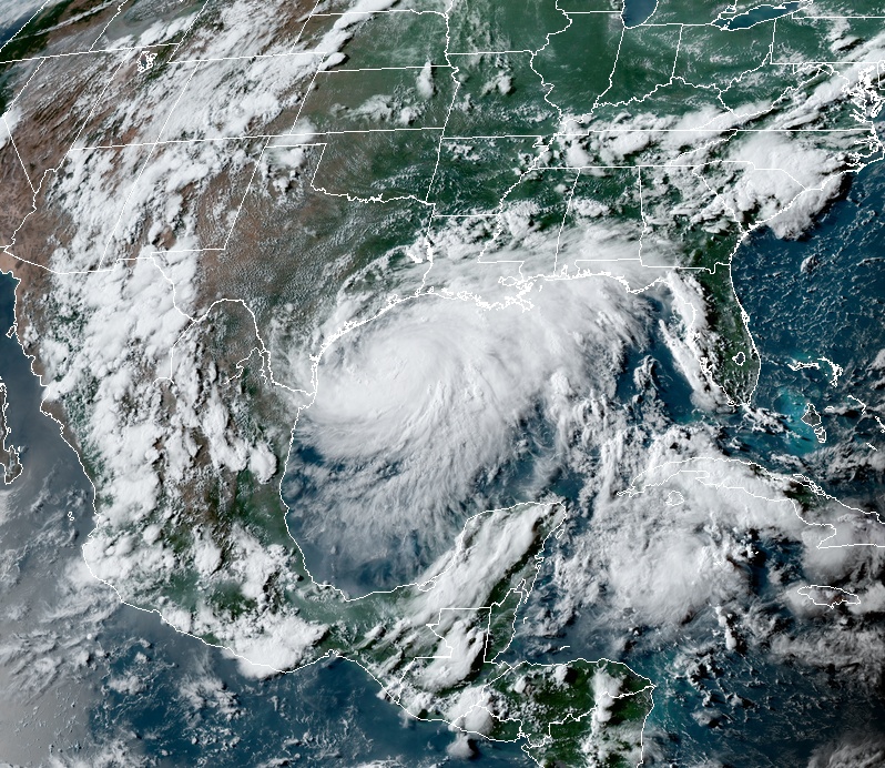
Tropical Storm "Hanna" at 22:50 UTC on July 24, 2020. Credit: NOAA/GOES-East, RAMMB/CIRA
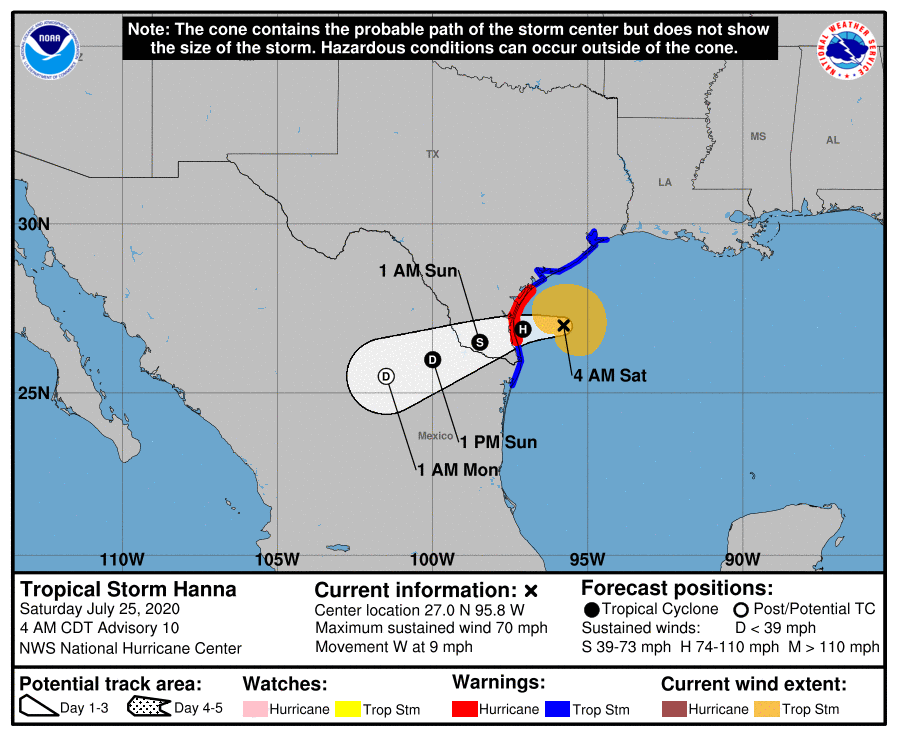
At 09:00 UTC on July 25 (04:00 CDT), the center of Tropical Storm "Hanna" was located about 180 km (115 miles) ESE of Corpus Christi and 165 km (100 miles) ENE of Port Mansfield, Texas.
The system has maximum sustained winds of 110 km/h (70 mph) and was moving W at 15 km/h (9 mph). Its minimum central pressure was 988 hPa.
On the forecast track, the center of Hanna should make landfall along the Texas coast this afternoon or early this evening.
Additional strengthening is forecast, and Hanna is expected to become a hurricane before it makes landfall today. Rapid weakening is expected after Hanna moves inland.
The combination of a dangerous storm surge and the tide will cause normally dry areas near the coast to be flooded by rising waters moving inland from the shoreline.
The water could reach the following heights above ground somewhere in the indicated areas if the peak surge occurs at the time of high tide:
- Port Mansfield to Baffin Bay, Texas: 60 – 120 cm (2 to 4 feet)
- Baffin Bay to Sargent, Texas, including Corpus Christi Bay, Copano Bay, Aransas Bay, San Antonio Bay, and Matagorda Bay: 90 – 150 cm (3 to 5 feet)
- Mouth of the Rio Grande to Port Mansfield, Texas: 30 – 90 cm (1 to 3 feet)
- North of Sargent to High Island, Texas, including Galveston Bay: 30 – 60 cm (1 to 2 feet)
The deepest water will occur along the immediate coast near and to the right of the landfall location. Surge-related flooding depends on the relative timing of the surge and the tidal cycle, and can vary greatly over short distances.
Hurricane conditions are expected in the warning area this afternoon. Tropical storm conditions are expected to begin in the warning area later this morning.
Hanna is expected to produce 150 – 300 mm (6 to 12 inches) of rain with isolated maximum totals of 460 mm (18 inches) through Sunday night in south Texas and into the Mexican states of Coahuila, Nuevo Leon, and northern Tamaulipas.
This rain may result in life-threatening flash flooding, rapid rises on small streams, and isolated minor to moderate river flooding in south Texas.
75 – 125 mm (3 to 5 inches) of rain is expected along the upper Texas and Louisiana coasts.
Swells generated by Hanna are expected to increase and affect much of the Texas and Louisiana coasts during the next couple of days. These swells are likely to cause life-threatening surf and rip current conditions.
A few tornadoes are possible today and overnight over parts of the lower to middle Texas coastal plain.
I'm a dedicated researcher, journalist, and editor at The Watchers. With over 20 years of experience in the media industry, I specialize in hard science news, focusing on extreme weather, seismic and volcanic activity, space weather, and astronomy, including near-Earth objects and planetary defense strategies. You can reach me at teo /at/ watchers.news.
Commenting rules and guidelines
We value the thoughts and opinions of our readers and welcome healthy discussions on our website. In order to maintain a respectful and positive community, we ask that all commenters follow these rules.