
Record cold temperatures across western and central United States
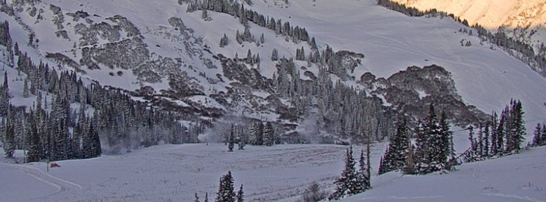
Image credit: Alta Ski Area
Widespread record cold temperatures will continue today across the western and central portions of the country. In contrast, the eastern U.S. remains anomalously warm. In between this huge contrast in temperature, a large-scale low pressure system is currently forming along the Mississippi and Ohio Valleys near a strong cold front. Widespread rainfall is expected to greet Trick-or-Treaters from the Deep South to much of the East Coast as the low pressure system intensifies rapidly and heads toward the Great Lakes today and into New England on Friday.
Salt Lake City recorded -10 °C (14 °F) on October 30, making it the coldest October temperature recorded in the city since records began in 1874. Meanwhile, several areas in Utah recorded temperatures below -40 °C (-40 °F), closing in on some of the coldest temperatures ever experienced in the lower 48 states in the month of October. Meanwhile, in Kansas City, black ice produced slippery road conditions, causing several crashes across the area on Thursday, October 31.
Prior to these events, a surge of arctic air has been forecasted to bring heavy snow and record cold temperatures into the western U.S., central and southern Plains.
The winter storm dubbed "Bessie" by The Weather Channel has begun engulfing Central Plains and Midwest and is expected to continue this week.
This early season storm has already broken records.
"On Tuesday, October 29, the storm dumped more than 152 mm (6 inches) of snow to Denver. For this month, Denver has now received 317 mm (12 inches) of snow, making it the snowiest October since 2009 and 12th snowiest on record," reports said.
Crazy cold in the western U.S. including coldest on record in October at Salt Lake City (records back to 1874), and a hard-to-fathom -46° at Peter Sinks, UT, elevation 8,164 feet. #recordcold pic.twitter.com/KATA3hZF3S
— Tom Tasselmyer (@ttasselWBAL) October 31, 2019
Record shattering cold temperatures across Utah today! #utwx pic.twitter.com/eikA67uOeJ
— NWS Salt Lake City (@NWSSaltLakeCity) October 31, 2019
5 PM: It is definitely cold out there tonight. Current temps across the West show how extreme this airmass is. #utwx pic.twitter.com/iv3Tjs3yA7
— NWS Salt Lake City (@NWSSaltLakeCity) October 30, 2019
On Wednesday, October 30, Chicago saw 30.5 mm (1.2 inches) of snow – the most snow this early in the season in 30 years.
Residents in Tulsa, Oklahoma also experienced snow, which was a very unusual occurrence for October. The city has only seen snow in October six times in the last 119 years.
A winter weather advisory is in place from Iowa to Michigan as the snowstorm is now slamming the Midwest. An additional 51 to 102 mm (2 to 4 inches) of snow is possible, while a new round of snow is heading Midwest.
In Kansas, officials have warned motorists of black ice which covered roads as temperatures dropped 8 to 10 °C (46 to 50 °F). The National Weather Service said I-49 south of Belton became extremely slick.
Black ice is a thin layer of ice that can form on road surfaces during cold weather. The depth of the ice makes it invisible on the pavement, hence, the name.
Black Ice has developed this morning from melted snow last night as the temperatures dropped into the mid 20s. Please use extra caution this morning. If the road looks wet, assume it could have ice. https://t.co/VE4at6S08J
— NWS Kansas City (@NWSKansasCity) October 31, 2019
"Black Ice" is forming all over the place. Here is a classic example of a car meetng ice. See the car on the bridge turned around? Use caution, take it slow, it may look wet, but may be icy. After 10 AM, roads will improve. @JeffPennerKSHB @41actionnews pic.twitter.com/pCL5N40gJx
— 41 Traffic Now (@41TrafficNow) October 31, 2019
SLICK road conditions near 435 N at 23rd … this car slid sideways into the far left lane. Please be careful this morning @41actionnews pic.twitter.com/NJH01SQYct
— Rae Daniel (@RAEtheReporter) October 31, 2019
A total of up to 152 mm (6 inches) of snow is expected from northern Illinois to Michigan.
Following Bessie, very cold air will be heading towards central U.S. from the Gulf Coast to the Great Lakes. Temperature is expected to be way below average for about 33% of the country.
Furthermore, the same storm system that dumped snow to the Rockies and the Midwest will move into the humid air along the east coast, possibly spawning storms and tornadoes that could hit Georgia to Pennsylvania. Heavy rains could also produce flooding for the I-95 corridor from Washington D.C. to Boston.
Mid-winter cold continues to impact the Western US. Some lows so far this morning:
Rawlins, WY: -20
Laramie, WY: -13
Casper, WY: -9
Cheyenne, WY: 2
Rapid City: -1
Denver: 4
Salt Lake City: 14
Seattle: 33
Portland: 31
Vegas: 36 pic.twitter.com/pNSrscBW5F— Eric Faulkner (@WX_Eric2018) October 30, 2019
Commenting rules and guidelines
We value the thoughts and opinions of our readers and welcome healthy discussions on our website. In order to maintain a respectful and positive community, we ask that all commenters follow these rules.