
Tropical Storm “Dorian” moves across St. Lucia, heading toward Puerto Rico, Hispaniola, Bahamas and Florida
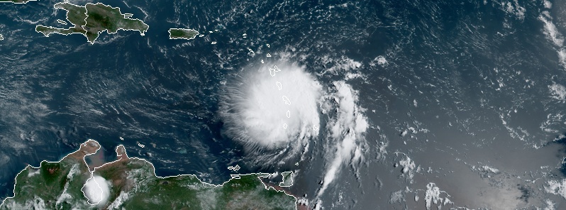
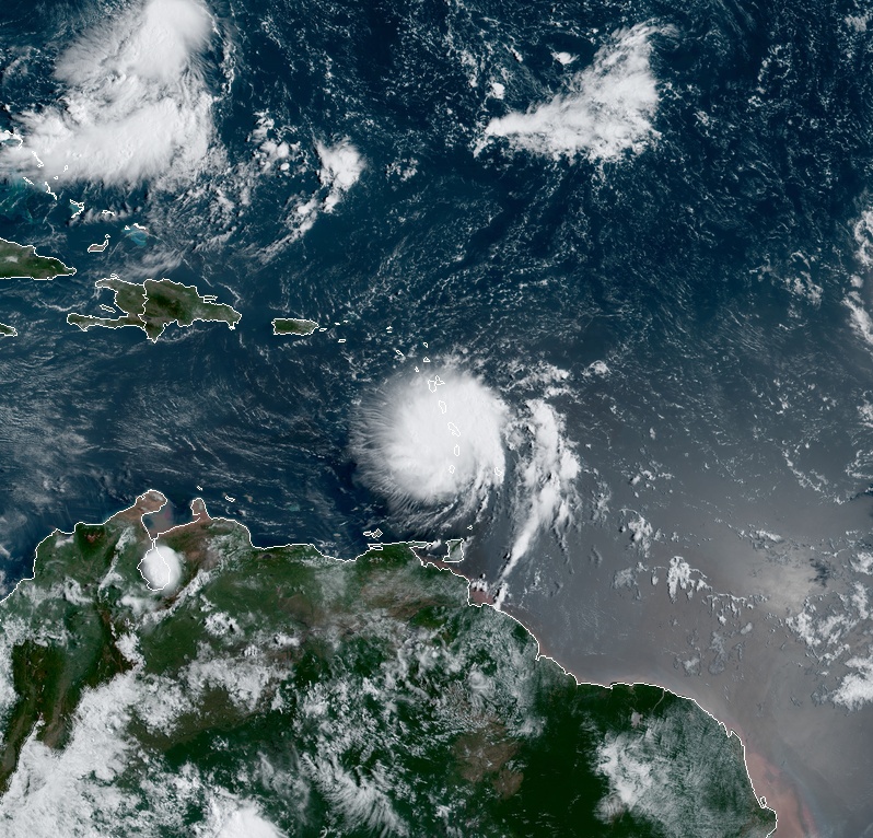
Featured image: Tropical Storm "Dorian" at 13:20 UTC on August 27, 2019. Credit: NOAA/GOES-East
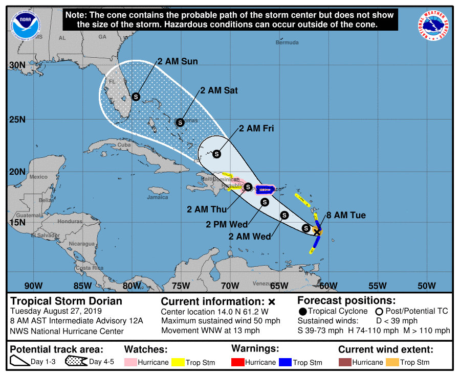
Tropical Storm "Dorian" moved across St. Lucia and into the eastern Caribbean Sea on August 27, 2019. The current forecast track takes Dorian across the eastern and northeastern Caribbean Sea during the next few days, near or south of Puerto Rico on Wednesday, August 28, near or over eastern Hispaniola Wednesday night, north of Hispaniola on Thursday, into the Bahamas on Friday and Saturday and Florida, U.S. on Sunday, August 31.
At 12:00 UTC (08:00 AST) on August 27, the center of Tropical Storm "Dorian" was located about 25 km (15 miles) WNW of St. Lucia. Its maximum sustained winds were 85 km/h (50 mph) and 1 005 hPa. The system is moving WNW at 20 km/h (13 mph), according to the NHC.
A Hurricane Watch is in effect for:
- Puerto Rico
- Dominican Republic from Isla Saona to Samana
A Tropical Storm Warning is in effect for:
- Martinique
- St. Vincent and the Grenadines
- Puerto Rico
A Tropical Storm Watch is in effect for:
- Dominica
- Grenada and its dependencies
- Saba and St. Eustatius
- Dominican Republic from Isla Saona to Punta Palenque
- Dominican Republic from Samana to Puerto Plata
Tropical Storm "Dorian" at 13:20 UTC on August 27, 2019. Credit: NOAA/GOES-East
Slow strengthening is forecast during the next 48 hours, and Dorian is forecast to be near hurricane strength when it moves close to Puerto Rico and eastern Hispaniola.
The system is expected to produce the following rain accumulations through Thursday:
Barbados: additional rainfall up to 25 mm (1 inch), storm total around 150 mm (6 inches)
Windward Islands from Martinique to Saint Vincent: 76 – 150 mm (3 to 6 inches), isolated 250 mm (10 inches)
Grenadines to Grenada: 25 – 75 mm (1 to 3 inches)
Leeward Islands from Guadeloupe to Dominica: 25 – 100 mm (1 to 4 inches)
Puerto Rico and Saint Croix: 50 – 100 mm (2 to 4 inches), isolated 150 mm (6 inches)
Dominican Republic: 50 – 100 mm (2 to 4 inches), isolated 150 mm (6 inches)
This rainfall may cause life-threatening flash floods, especially where totals exceed 100 mm (4 inches)
Tropical storm conditions are occurring in portions of the tropical storm warning area in the Lesser Antilles and these conditions are expected to continue during the next several hours.
Tropical storm conditions are expected and hurricane conditions are possible in Puerto Rico on Wednesday.
Hurricane conditions are possible in the hurricane watch area in the Dominican Republic by late Wednesday and tropical storm conditions are possible in the tropical storm watch area beginning late Wednesday.
Tropical storm conditions are possible within the tropical storm watch area in the Lesser Antilles today.
Swells generated by Dorian are affecting portions of the Lesser Antilles and they should continue during the next several hours.
Swells are expected to increase along the southern coasts of Puerto Rico and Hispaniola on Wednesday and they could cause life-threatening surf and rip current conditions.
I'm a dedicated researcher, journalist, and editor at The Watchers. With over 20 years of experience in the media industry, I specialize in hard science news, focusing on extreme weather, seismic and volcanic activity, space weather, and astronomy, including near-Earth objects and planetary defense strategies. You can reach me at teo /at/ watchers.news.
Commenting rules and guidelines
We value the thoughts and opinions of our readers and welcome healthy discussions on our website. In order to maintain a respectful and positive community, we ask that all commenters follow these rules.