
Extremely dangerous Tropical Cyclone “Kenneth” about to make landfall in Mozambique
Featured image: Tropical Cyclone "Kenneth" at 09:00 UTC on April 25, 2019. Credit: UW-CIMSS
Tropical Cyclone "Kenneth" has rapidly intensified over the past 24 hours and is now a Category 4 hurricane equivalent on the Saffir-Simpson Hurricane Wind Scale. Landfall is expected before the end of the UTC day, April 25 in northern Mozambique, near Ingoane, Cobre, Nagulue and Pangane, with destructive winds over 185 km/h (115 mph) – Category 3 hurricane equivalent.
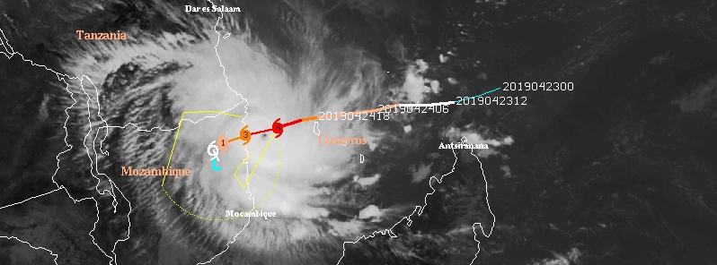
At 06:00 UTC on April 25, the center of Intense Tropical Cyclone "Kenneth" was located 145 km (90 miles) E of Ingoane, Mozambique and 158 km (98 miles) W of Moroni, Comoros.
It had a maximum average wind speed of 213 km/h (132 mph) and a central pressure of 934 hPa.
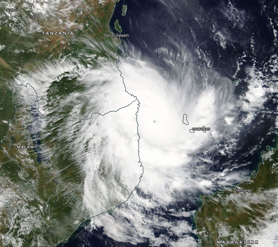
Tropical Cyclone "Kenneth" on April 25, 2019. Credit: NASA Terra/MODIS
"Over the last six hours, cloud tops surrounding Kenneth's pinhole eye have continued to cool, thus increasing further the intensity estimates," RSMC La Reunion said.
On the current track, a landfall on the north Mozambican coast is expected by the end of the afternoon or in the early evening (Mozambique's time), 100 to 150 km (62 – 93 miles) N of Pemba, the center said.
In the medium term, the track of the residual overland low is uncertain. It could track over the northern Mozambican territories before coming back over sea sometime in the beginning of next week.
This scenario remains very uncertain as of yet and has thus not been displayed in the official track forecast.
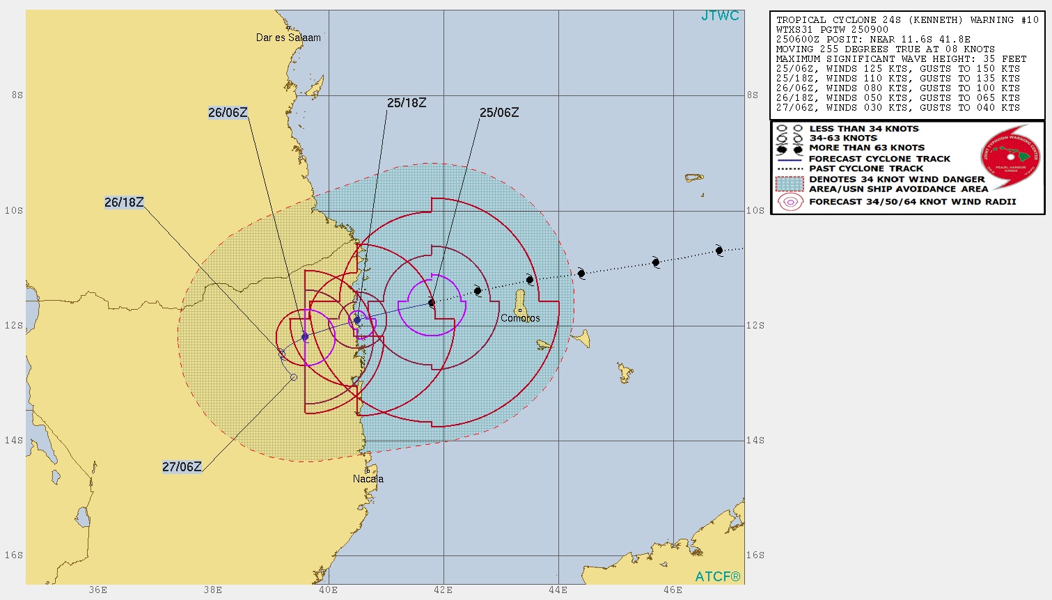
Given the recent trend, Kenneth has probably reached its peak intensity over the last hours.
Kenneth's intensity is expected to weaken slightly before landfall, while remaining over 185 km/h (115 mph). The radius of destructive winds is also expected to increase significantly, which should widen the area of maximum danger, both in terms of strong winds and of marine storm surge.
Kenneth is, therefore, an extremely dangerous system, which will severely impact the regions north of Pemba.
The system will also generate a life-threatening storm surge when landing on the Mozambican coasts, which can reach between 3 and 5 m (10 – 16 feet) in some areas south of the landfall, to which must be added the wave and cyclonic swell run-up and the phenomenon of heavy rainfall, which can cause flooding in Mozambique.
The country is still recovering from last month's Tropical Cyclone "Idai" which claimed more than 1 000 lives and is considered as one of the worst natural disasters in the southern hemisphere.
Kenneth will make landfall about 1 000 km (620 miles) NNE of Idai's point of impact.
I'm a dedicated researcher, journalist, and editor at The Watchers. With over 20 years of experience in the media industry, I specialize in hard science news, focusing on extreme weather, seismic and volcanic activity, space weather, and astronomy, including near-Earth objects and planetary defense strategies. You can reach me at teo /at/ watchers.news.
Commenting rules and guidelines
We value the thoughts and opinions of our readers and welcome healthy discussions on our website. In order to maintain a respectful and positive community, we ask that all commenters follow these rules.