
Historic flooding hits Manhattan, Kansas, state of emergency declared in 5 counties
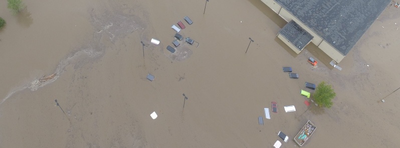
Image credit: Riley County PD
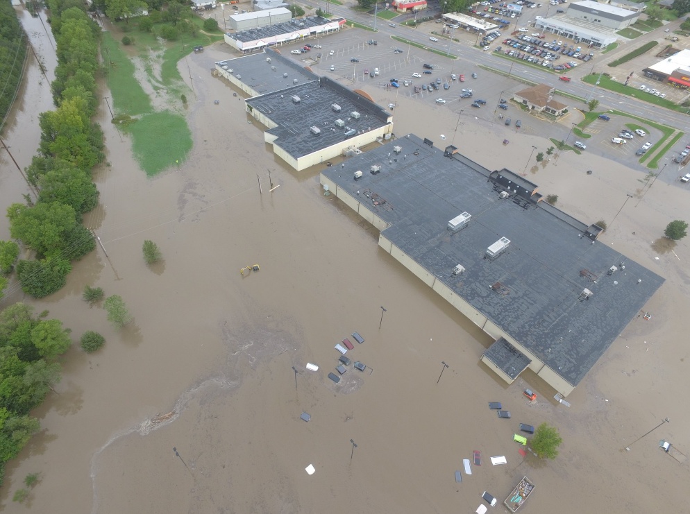
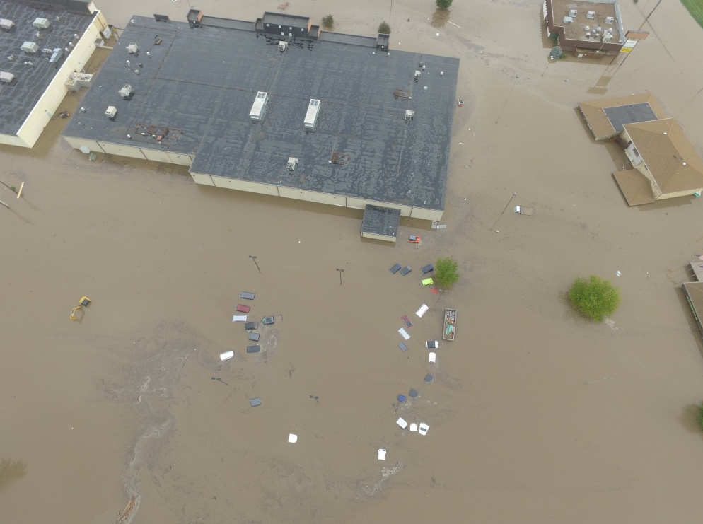
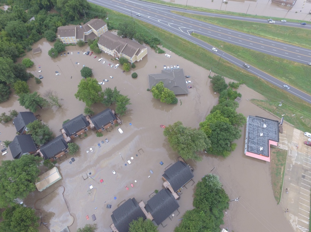
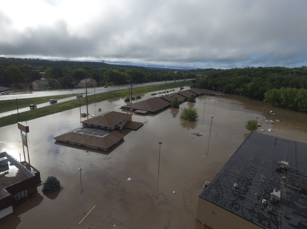
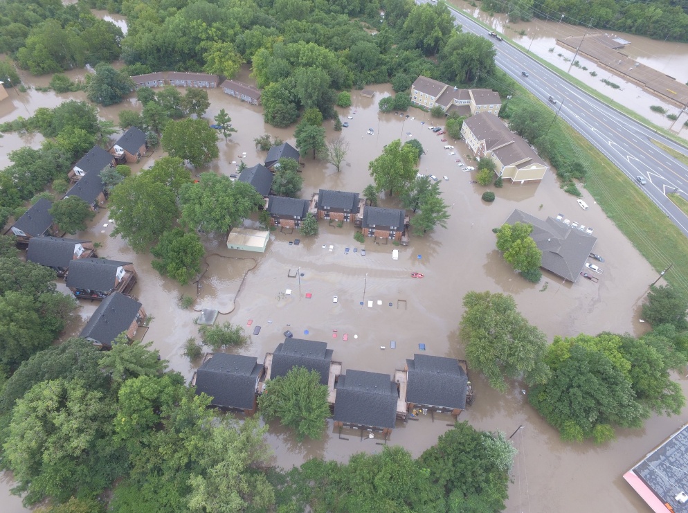
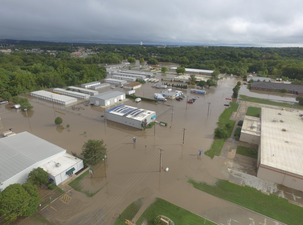
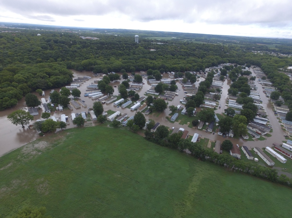
Parts of Kansas, including the worst-hit Manhattan, received nearly 228.6 mm (9 inches) of rainfall late Sunday, September 2 into Monday, September 3, 2018, causing major flash flooding and forcing more than 300 people to evacuate their homes. Additional shower and thunderstorm chances will allow the threat for flash flooding and river flooding to continue through Friday night, September 7.
Heavy rains caused Wildcat Creek to burst its banks and flood the Kansas college town of Manhattan, forcing more than 300 people to evacuate, including some who were ferried out. Some 3 000 customers in the town were left without power, officials said.
"It was one of the most significant events that we’ve experienced in my history here," Manhattan city manager Ron Fehr said at a news conference Monday. "Things got flooded this time that have never been flooded before, even some of the rural areas."
Pat Collins, director of Riley County Emergency Management, said September 4 that some residents had returned to their flood-damaged homes and apartments, while several dozen others were staying in shelters set up in Manhattan.
"While Wildcat Creek receded, emergency management personnel are watching the Kansas River, which was at 4.3 m (14 feet) Tuesday afternoon and was expected to crest Wednesday at about 5.5 m (18 feet), which is flood stage," Collins said.

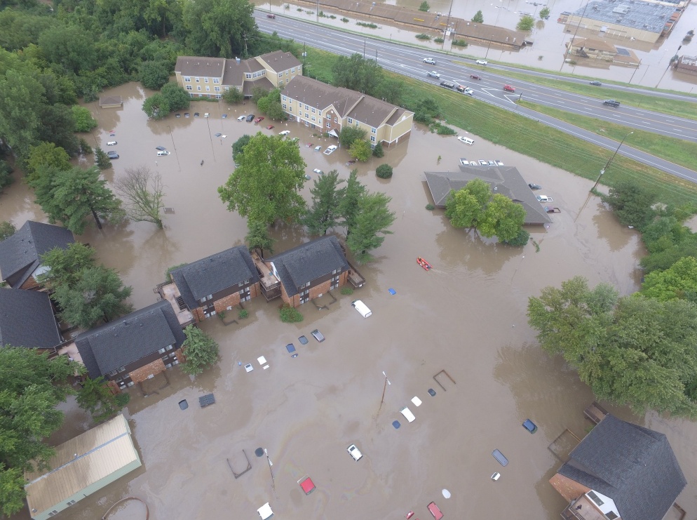
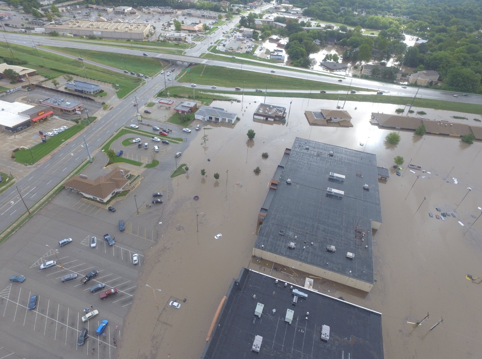
All images courtesy of Riley County PD
Kansas Governor Jeff Colyer issued a disaster emergency declaration for Jewell, Kingman, Marshall, Pratt, and Riley counties and said the declaration could be expanded as more damage assessments come in. The declaration authorizes the counties to use state resources and personnel to help with recovery operations.
Authorities said all roads and bridges that had been closed reopened Tuesday after floodwaters had receded.
NWS meteorologist Audra Hennecke said more rainfall is possible this week in the Manhattan area, as well as other parts of northern Kansas.
"We're in this pattern in which we're continuing to bring more moisture into the area," Hennecke said. "We're stuck in this pattern that really isn't moving anywhere."
I'm a dedicated researcher, journalist, and editor at The Watchers. With over 20 years of experience in the media industry, I specialize in hard science news, focusing on extreme weather, seismic and volcanic activity, space weather, and astronomy, including near-Earth objects and planetary defense strategies. You can reach me at teo /at/ watchers.news.
Commenting rules and guidelines
We value the thoughts and opinions of our readers and welcome healthy discussions on our website. In order to maintain a respectful and positive community, we ask that all commenters follow these rules.