
Intense lake-snow effect to continue downwind the Great Lakes
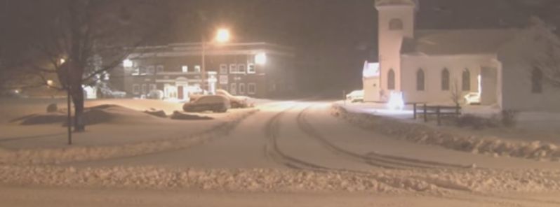
Featured image: Lake-effect snow in Redfield, New York State, December 8, 2016. Image credit: StormChasingVideo
The lake-effect snow, affecting regions downwind the Great Lakes since December 8, 2016, is expected to continue into the weekend. A deadly pile up caused three deaths and several injuries in Central Michigan, so far.
40 vehicles were involved in a crash, caused by heavy snowfall, that occurred near the Fowlerville town, on the Interstate 96. Intense snowy conditions lead to whiteout conditions, as the falling snow melted and froze, causing slippery roads, according to the local authorities.
Dave Samuhel, a Senior Meteorologist from the AccuWeather explained a burst of snow occurred around or just before the accidents while temperatures were in the range between -3.9 and -3.3 °C (25 and 26 °F). At the same time, low visibility conditions were reported, reaching under 402 m (1 320 feet) at Howell town.
Video credit: StormChasingVideo via YouTube
Video credit: StormChasingVideo via YouTube
Video credit: ohiostormchasers via YouTube
According to the National Weather Service (NWS), lake-effect snow will continue through December 10 (local time) downwind of the Great Lakes, as cold air from Canada streams across the relatively warm lakes. Some regions may receive more than 0.6 m (2 feet) of snow. At the same time, other regions will see between 2.5 and 15.2 cm (1 and 6 inches) of snow.
Poor travel conditions are expected, and people are urged to exercise caution. Alex Sosnowski, a Senior Meteorologist from AccuWeather expects the I-90 corridor in the region between Indiana and Ohio, and Pennsylvania and New York State will be the most affected. Drivers could also encounter severe weather conditions across portions of I-75, I-79, I-80, I-81, I-96, and I-196.
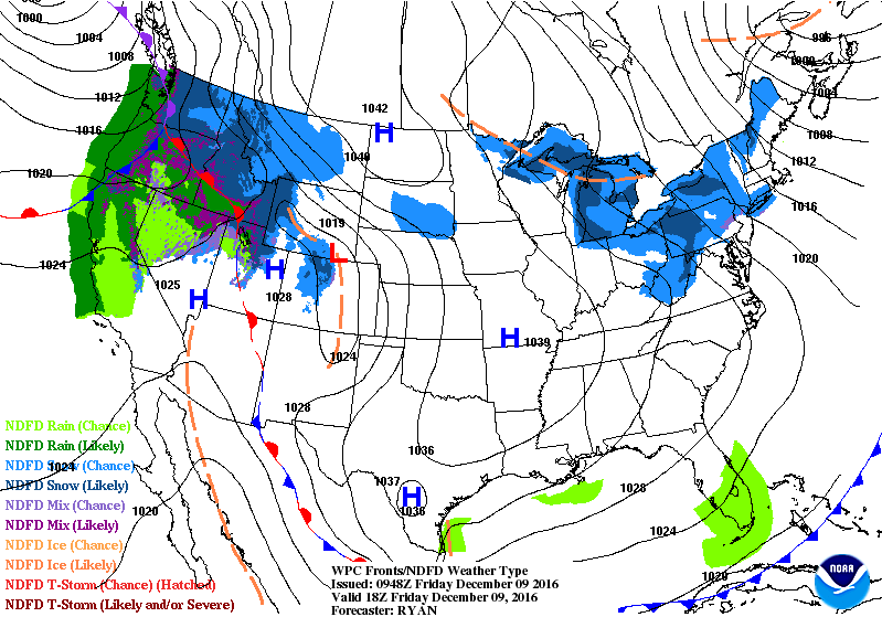
Pressure system forecast over US, December 9, 2016. Image credit: NOAA/NWS
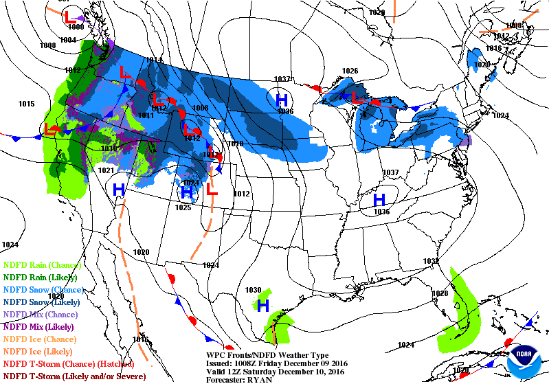
Pressure system forecast over US, December 10, 2016. Image credit: NOAA/NWS
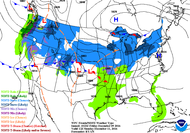
Pressure system forecast over US, December 11, 2016. Image credit: NOAA/NWS
The lake-effect snow occurs in cooler conditions as a cold air mass travels across long patches of warmer lake water. The lower air layer heats and picks up water vapor from the lake then rises up, freezes and gets deposited across the downwind shores. Areas especially prone to it include the eastern part of the Great Lakes, the Great Salt Lake, and parts of the northern Atlantic Ocean.
Commenting rules and guidelines
We value the thoughts and opinions of our readers and welcome healthy discussions on our website. In order to maintain a respectful and positive community, we ask that all commenters follow these rules.