
Earl becomes a hurricane hours before Belize landfall
Featured image: Hurricane "Earl" on August 3, 2016. Credit: UW-CIMSS
Tropical Storm "Earl" formed on August 2 near Jamaica and strengthened into a hurricane by 21:00 UTC on August 3. Earl will make landfall over Belize within a couple of hours, and start weakening as it moves toward Mexico. Earl is bringing strong winds and some very heavy rain. Isolated maximum amounts of 400 mm (16 inches) are possible in Belize and Mexico. These rains could result in life-threatening flash floods and mudslides.
A NOAA Hurricane Hunter aircraft reached Earl at 21:00 UTC today and measured maximum sustained winds of 120 km/h (75 mph), indicating that Earl is now a hurricane. Earl thus became the first hurricane in the western Caribbean Sea since Sandy in 2012.
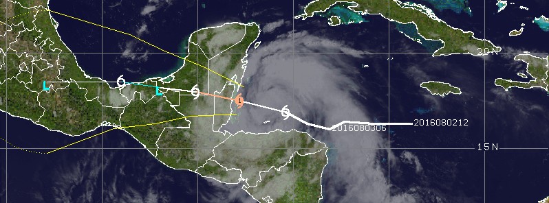
At the same time, the center of Hurricane "Earl" was located about 110 km (70 miles) NE of Isla Roatan, Honduras and 240 km (150 miles) E of Belize City, Belize. Earl is moving west at 22 km/h (14 mph). Its estimated minimum central pressure is 998 hPa.
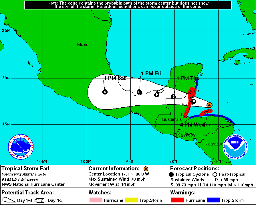
A Hurricane Warning is in effect for Puerto Costa Maya, Mexico, southward to the Belize/Guatemala border and Bay Islands, Honduras.
A Tropical Storm Warning is in effect for the north coast of Honduras from Cabo Gracias a Dios westward to the Honduras/Guatemala border, and north of Puerto Costa Maya to Punta Allen, Mexico.
Earl has become a large cyclone, and tropical-storm-force winds extend outward up to 220 km (140 miles) primarily to the northeast of the center. Weakening is expected after the center of Earl moves inland.
Hazards affecting land
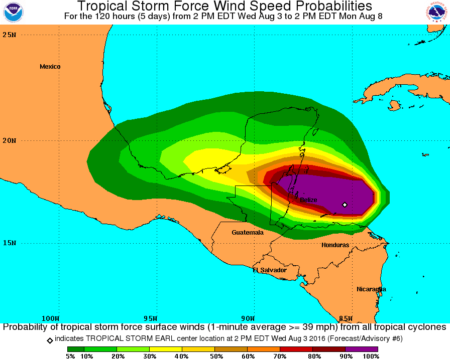
Wind
Tropical storm conditions are probably occurring along the north coast of Honduras, including the Bay Islands. These conditions will reach Belize and Mexico within the hurricane and tropical storm warning area in the next couple of hours. Hurricane conditions are expected in the Bay Islands of Honduras, and in portions of the hurricane warning area in Belize and Mexico.
Rainfall
Earl is expected to produce total rain accumulations of 200 to 300 mm (8 to 12 inches) over portions of Belize, Honduras, Guatemala, and the Yucatan peninsula of Mexico through Thursday night (CDT).
Very heavy rain will reach the Mexican states of Tabasco and Veracruz between Thursday night and Saturday morning.
Isolated maximum amounts of 400 mm (16 inches) are possible in Belize and Mexico. These rains could result in life-threatening flash floods and mudslides.
Storm surge
A storm surge will raise water levels by as much as 1.2 to 1.8 m (4 to 6 feet) above normal tide levels along the immediate coast of Belize and the eastern Yucatan peninsula near and to the north of where the center makes landfall, and in areas of onshore winds on the Bay Island of Honduras.
Near the coast, the surge will be accompanied by large and damaging waves.
Earl becoming a hurricane on August 3, 2016. Credit: UW-CIMSS
The Watchers team and our contributors bring the latest on extreme weather, earthquakes, volcanic eruptions, space weather, and all things science. We're all about making sense of the natural world and keeping you informed on what’s happening. Got a tip or a question? Hit us up using the form at newstips!
Commenting rules and guidelines
We value the thoughts and opinions of our readers and welcome healthy discussions on our website. In order to maintain a respectful and positive community, we ask that all commenters follow these rules.