
Powerful eruption of Tungurahua sends ash up to 11 km a.s.l., Ecuador
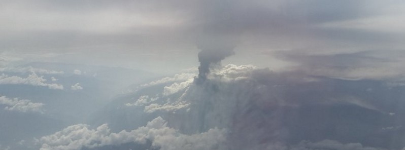
Featured image: Tungurahua eruption on March 8, 2016. Credit: Fander Falconí (@fanderfalconi)
A powerful eruption at Ecuador's Tungurahua volcano at 12:51 UTC on March 8, 2016, produced an eruption column that rose approximately 11 km (36 000 feet) above sea level. Pyroclastic flows descended 2.2 km (1.3 miles) towards the communities of Mandur and Achupashal.
Very strong explosions also occurred on March 6 and 7, and all of them produced pyroclastic flows into various directions towards the western and northern sector, Volcano Discovery reported.
El volcán Tungurahua desďe el aire. Foto de hoy 8 de marzo pic.twitter.com/4Qi2vegVfI
— Fander Falconí (@fanderfalconi) March 8, 2016
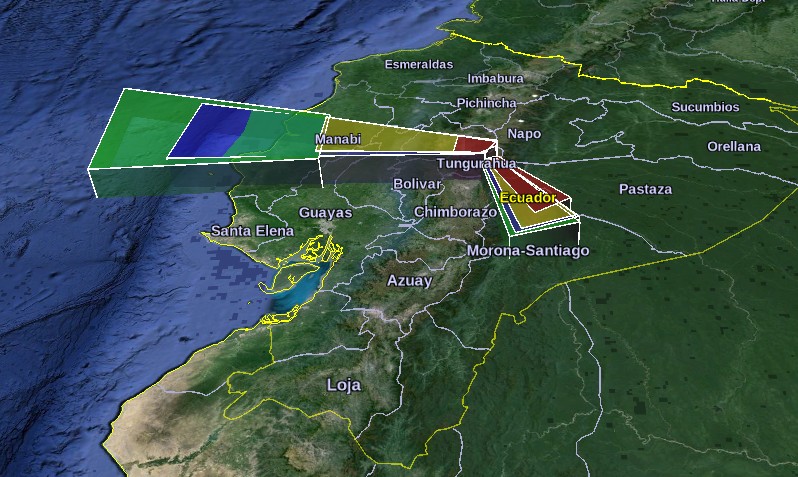
Volcanic ash direction after March 8, 2016 eruption. Image credit: Washington VAAC/Google
"Violent shock waves that rattled windows and doors and ground rumblings accompanied the explosions. Most of the time, a steam and ash column was rising 3 to 4 km above the crater. At night, explosions could be seen ejecting incandescent material to great height (many 100 meters) and distances over the volcano's cone, generating spectacular avalanches," according to VD.

Image credit: IGEPN
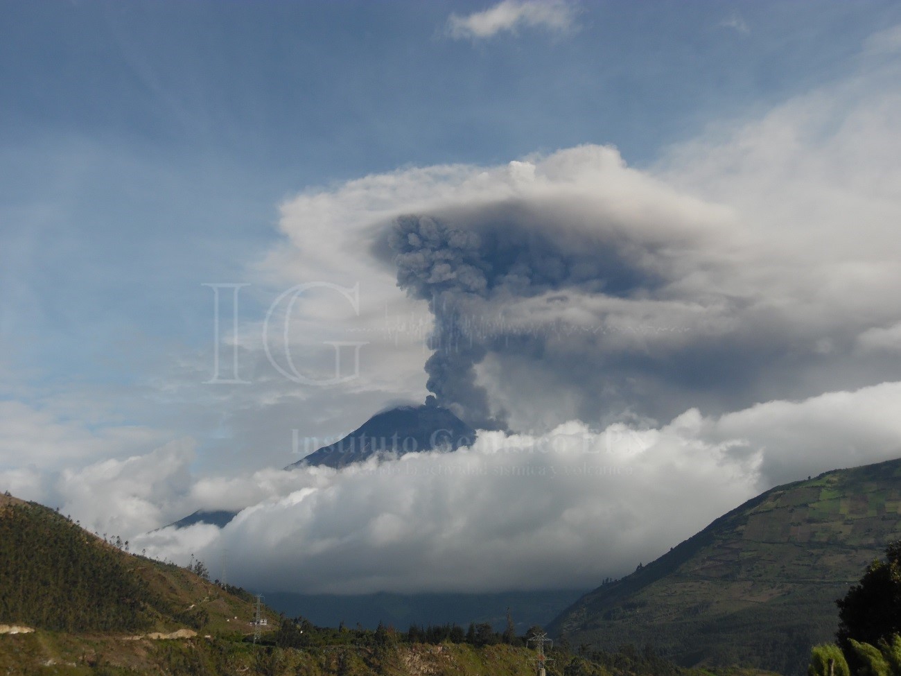
Tungurahua eruption on March 5, 2016. Image credit: IGEPN
OVT-IGEPN said 7700 g/m2 of ash had accumulated in Choghlontus region since February 26, 2016. This region is rich in corn fields which have been severely damaged by the ongoing eruption. Authorities encouraged the relocation of livestock.

Ash accumulation on crops. Image credit: IGEPN
Geologic summary
Tungurahua, a steep-sided andesitic-dacitic stratovolcano that towers more than 3 km above its northern base, is one of Ecuador's most active volcanoes. Three major edifices have been sequentially constructed since the mid-Pleistocene over a basement of metamorphic rocks. Tungurahua II was built within the past 14,000 years following the collapse of the initial edifice.
Tungurahua II itself collapsed about 3000 years ago and produced a large debris-avalanche deposit and a horseshoe-shaped caldera open to the west, inside which the modern glacier-capped stratovolcano (Tungurahua III) was constructed. Historical eruptions have all originated from the summit crater, accompanied by strong explosions and sometimes by pyroclastic flows and lava flows that reached populated areas at the volcano's base. Prior to a long-term eruption beginning in 1999 that caused the temporary evacuation of the city of Baños at the foot of the volcano, the last major eruption had occurred from 1916 to 1918, although minor activity continued until 1925. (GVP)
I'm a dedicated researcher, journalist, and editor at The Watchers. With over 20 years of experience in the media industry, I specialize in hard science news, focusing on extreme weather, seismic and volcanic activity, space weather, and astronomy, including near-Earth objects and planetary defense strategies. You can reach me at teo /at/ watchers.news.
Commenting rules and guidelines
We value the thoughts and opinions of our readers and welcome healthy discussions on our website. In order to maintain a respectful and positive community, we ask that all commenters follow these rules.