
Tropical Storm “Chan-hom” forms and intensifies on its way toward Guam
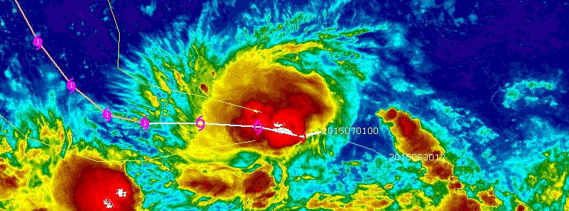
Featured image: IR image of Tropical Storm "Chan-hom" on July 1, 2015. Image credit: UW-CIMSS.
Tropical Storm "Chan-hom" formed east of Guam on June 30, 2015 and is expected to intensify on its was toward the island.
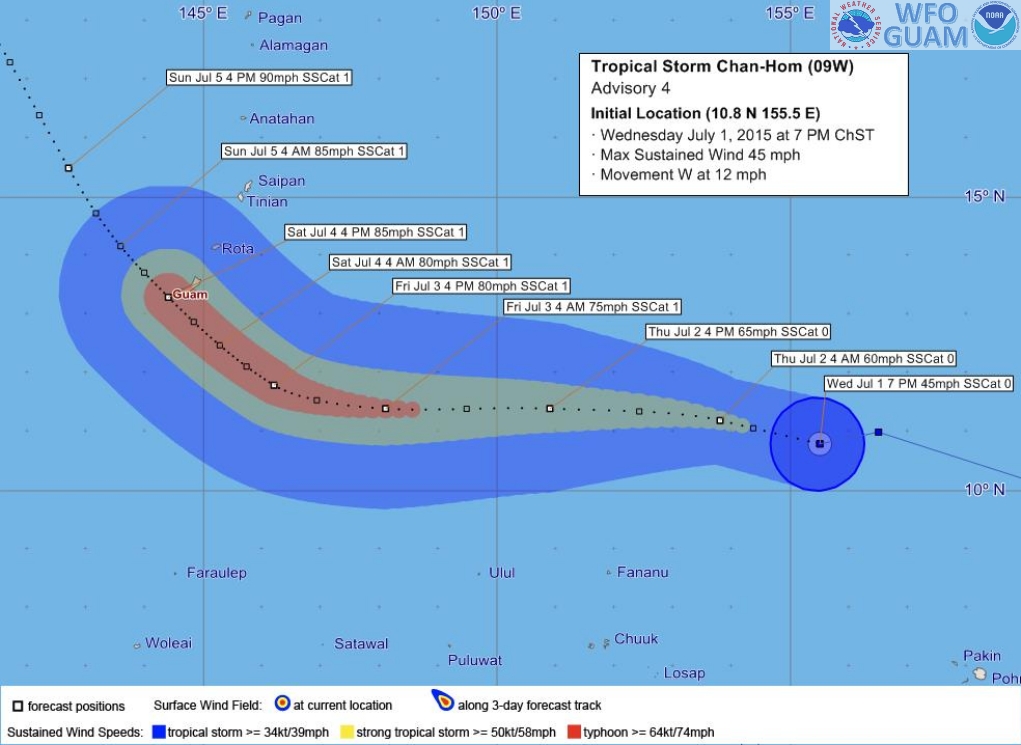
Current forecast track calls Chan-hom to reach Guam by July 4, 2015 as Category 1 equivalent typhoon, bringing heavy rain and wind gusts over 129 km/h (80.5 mph).
At 09:00 UTC on July 1, the system was located 523 km (325 miles) NW of Pohnpei, 539 km (335 miles) NE of Chuuk and 1 207 km (750 miles) ESE of Guam. Chan-hom is tracking W at 19.3 km/h (12 mph) with maximum sustained winds of 83.3 km/h (51.7 mph).
The system is expected to continue its westward direction through July 2 while increasing forward speed, NWS Guam said.
Tropical storm winds extend outward up to 96 km (60 miles) from the center. Chan-hom is expected to slowly intensify over the next several days.
A news release from Guam’s department of Homeland Security said residents should prepare for the arrival of a typhoon.
There are no watches or warnings in effect for Guam today and Chan-hom is still not a threat, however, it can certainly become one over the next few days.
NWS Warning Coordination Meteorologist Chip Guard said:
“Conditions could change during the night. National Weather Service anticipates the storm slowing down during the night and we should know more about the exact track tomorrow morning.”
Tropical Storm "Chan-hom" forecast track by JTWC on July 1, 2015.
Guam Homeland Security/Office of Civil Defense (GHS/OCD) advises residents and visitors to make necessary preparations at home and at work.
As a precaution, residents should take the following steps to prepare for the tropical storm:
- Prepare your emergency preparedness kits for your household.
- Take care of the yard and store objects that can fly with heavy wind.
- Gas your car and get fuel for your generators.
- Stock up on non-perishable foods (like canned goods) and drinking water.
- Get batteries for flashlights and battery-operated radios.
- Get your shutters ready.
- Prepare and secure your office area.
GHS/OCD in conjunction with NWS will continue to monitor all conditions in this area closely and provide updates in a timely manner. Residents and visitors are advised to stay tuned to local media for any changes to this system.
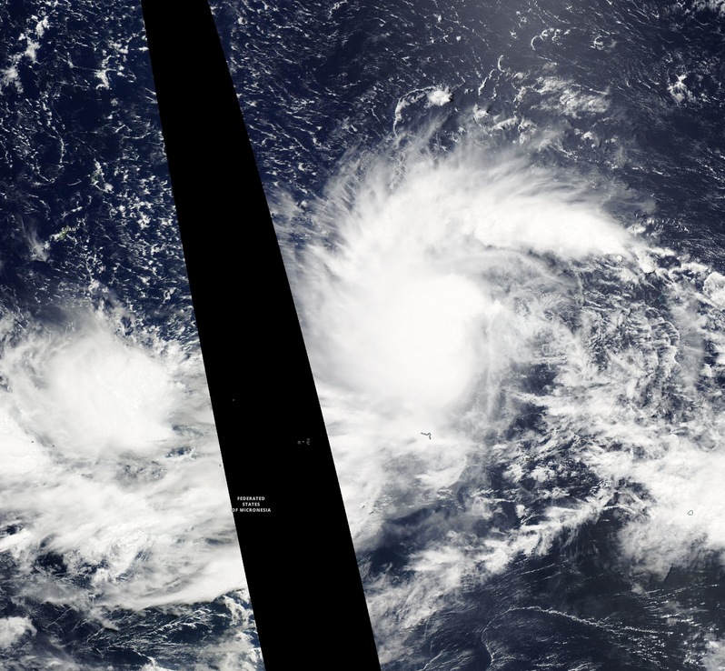
Tropical Storm "Chan-hom" on July 1, 2015. Image credit: NASA Aqua/MODIS.
I'm a dedicated researcher, journalist, and editor at The Watchers. With over 20 years of experience in the media industry, I specialize in hard science news, focusing on extreme weather, seismic and volcanic activity, space weather, and astronomy, including near-Earth objects and planetary defense strategies. You can reach me at teo /at/ watchers.news.
Commenting rules and guidelines
We value the thoughts and opinions of our readers and welcome healthy discussions on our website. In order to maintain a respectful and positive community, we ask that all commenters follow these rules.