
Tropical Storm “Mekkhala” (Amang) intensifies over the Philippine Sea
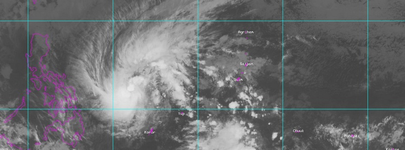
Featured image: Tropical Storm "Mekkhala" on January 15, 2015 at 09:32 UTC. Image credit MTSAT2/NOAA
The first tropical depression of the 2015 western Pacific season formed southwest of Guam on January 13 and intensified over the warm waters of the Philippine Sea into a tropical storm while headed toward the Philippines.
Areas of Eastern Visayas and specifically Leyte, Samar and Southern Luzon will likely see over 200 mm (7.87 inches) in some locations. Flashfloods and landslides are very likely.
PAGASA advised the public and the disaster risk reduction and management council concerned to take appropriate actions.
At 09:00 UTC today, Tropical Storm "Mekkhala" (locally known as Amang) was located approximately 511 km (217 miles) NNW of Koror, Palau. According to JTWC, the storm is moving westward at 18.5 km/h (11.5 mph).
At 06:00 UTC, its maximum significant wave height was reaching 3.9 meters (13 feet). At the same time, Mekkhala's maximum sustained winds were 64.8 km/h (40.2 mph), wind gusts were 83.3 km/h (51.7 mph).
Mekkhala is forecast to reach its maximum intensity over the next 36 hours. At 18:00 UTC on January 16, Mekhhala's maximum sustained winds are expected to reach 92.6 km/h (57.5 mph) with wind gusts of 120 km/h (74.8 mph).
Gradual weakening is expected from January 18.
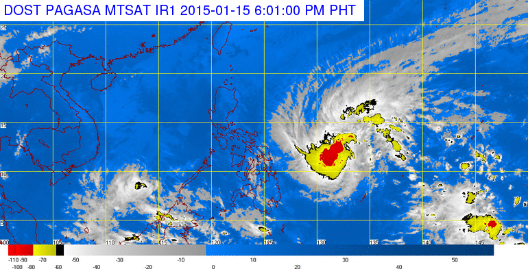
Image credit: PAGASA/MTSAT
At 02:00 UTC today (10:00 am local time on January 15), Mekkhala was located 905 km E of Guiuan, Eastern Samar, PAGASA said. Estimated rainfall amount is from 7.5 – 20 mm (0.29 – 0.78 inches) per hour (heavy – intense) within the 300 km (186 miles) diameter of the storm.
Residents over flood and landslide prone areas in Samar and Leyte provinces experiencing rains for the past few days are advised to be alert for possible occurrence of flashfloods and landslides, the agency said.
Fisherfolks and those with small seacrafts are advised not to venture out over the seaboards of Northern and Central Luzon and the Eastern seaboard of Southern Luzon and of Visayas.
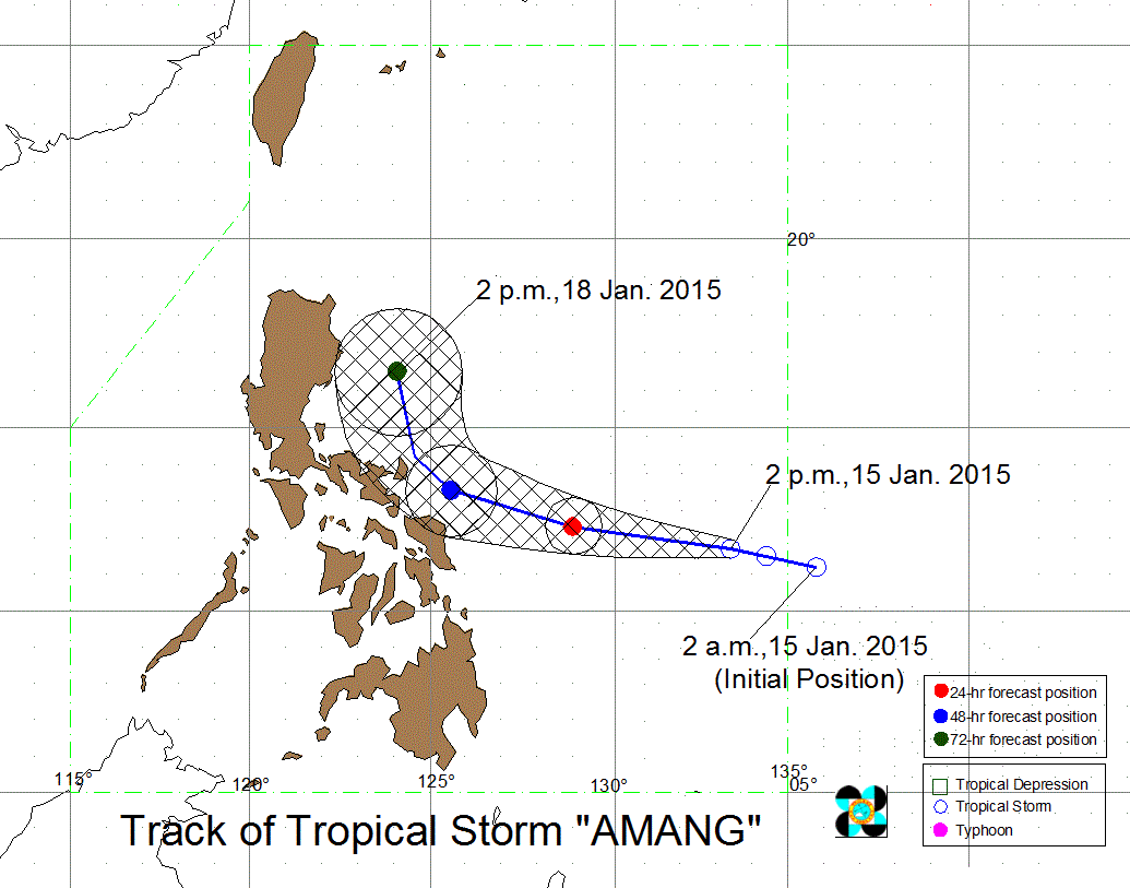
Tropical Storm "Mekkhala" (Amang) forecast track on January 15, 2015 by PAGASA.
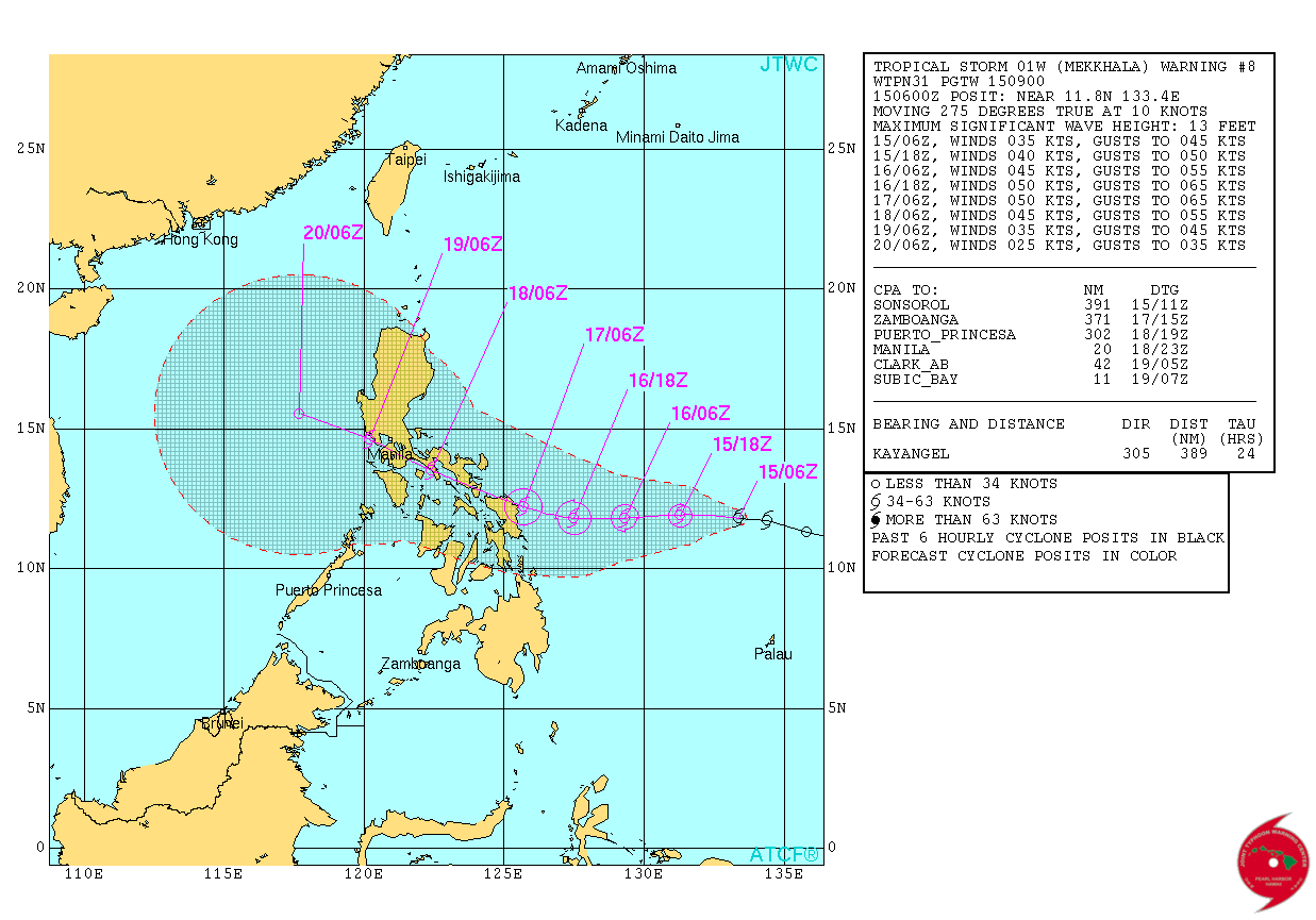
Tropical Storm "Mekkhala" forecast track by JTWC on January 15, 2015.
"Mekkhala is expected to weaken before it directly impacts the Philippines but the bigger issue will be the rainfall, as is often the case with storms like this," meteorologist Robert Speta of the WestPacWx said.
"Due to the storms persistent westerly motion, keeping it out of the grasp of the North East Monsoon to the north, the forecast is now leaning more towards a landfall on Saturday into Sunday," he said.
"As we seen with the last system in 2014, Tropical Storm "Seniang" left over 50 dead because people did not make proper preparations. That storm remained a TS but still brought heavy rains. Mekkhala may be something along those lines," Speta added.
River flooding, urban flooding and landslides will all be threats presented with this system.
Video courtesy of the WestPacWx
Satellite animations
- Storm-Centered Infrared (MTSAT; NOAA/SSD)
- Storm-Centered Infrared (Aviation Color Enhancement) (MTSAT; NOAA/SSD)
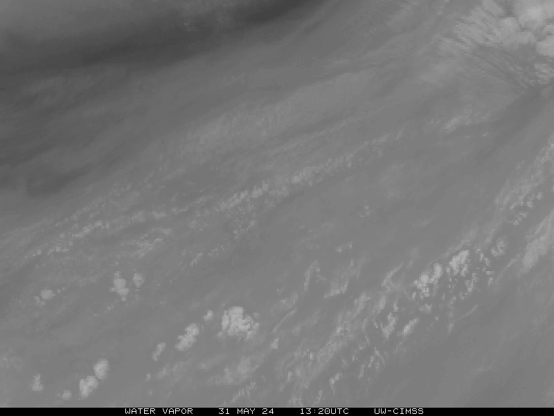
- Storm-Centered Water Vapor (MTSAT; NOAA/SSD)
- Storm-Centered Visible (MTSAT; NOAA/SSD)
- Storm-Centered Visible (Colorized) (MTSAT; NOAA/SSD)
- Storm-Centered Infrared (MTSAT2; CIMSS)
- Storm-Centered Enhanced Infrared (MTSAT2; CIMSS)
- Storm-Centered Water Vapor (MTSAT2; CIMSS)
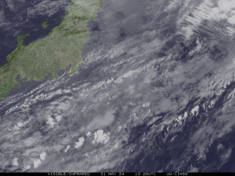
- Storm-Centered Visible (MTSAT2; CIMSS)
- Tropical West Pacific Infrared (MTSAT2; NOAA)
- Tropical West Pacific Enhanced Infrared (MTSAT2; NOAA)
- Tropical West Pacific Water Vapor (MTSAT2; NOAA)
- Tropical West Pacific Visible (MTSAT2; NOAA)
I'm a dedicated researcher, journalist, and editor at The Watchers. With over 20 years of experience in the media industry, I specialize in hard science news, focusing on extreme weather, seismic and volcanic activity, space weather, and astronomy, including near-Earth objects and planetary defense strategies. You can reach me at teo /at/ watchers.news.
Commenting rules and guidelines
We value the thoughts and opinions of our readers and welcome healthy discussions on our website. In order to maintain a respectful and positive community, we ask that all commenters follow these rules.