
Tropical Storm Man-yi aims Japan
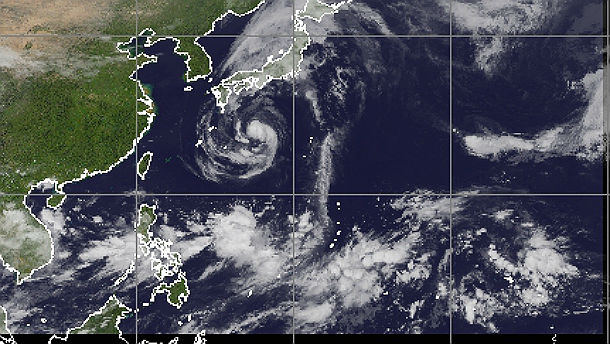
Featured image: West Pacific Infrared global mosaic satellite view at 19:30 UTC on September 14, 2013 (Credit: UW-CIMSS)
Tropical Storm Man-yi is spinning in west Pacific and it's forecast to slam Japan as Category 1 Typhoon in the next 24 hours. Widespread heavy rain is already battering south-east coast of Japan. A total of 100 to 200 mm (4 to 8 inches) of rain is forecast to inundate south-central and eastern parts of Honshu and eastern Shikoku, with possible localized amounts of 300 mm (a foot) in the mountains, which could trigger flash flooding and landslides.
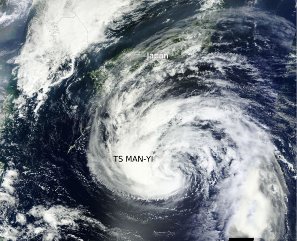
TS Man-yi captured by MODIS satellite on September 14, 2013 as approaching Japan (Credit: LANCE Rapid Response/MODIS/Worldview)
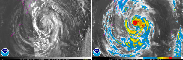
MTSAT's Infrared and Infrared AVN satellite image taken at 21:01 UTC on September 14, 2013 (Credit: NOAA/MTSAT)
According to latest report by Joint Typhoon Warning Center (JTWC), the center of TS Man-yi is located approximately 539 nm south-southwest of Yokosuka, Japan. The system is moving north-northwestward at speed of 14 knots. Maximum sustained winds are 50 knots with gusts up to 65 knots.
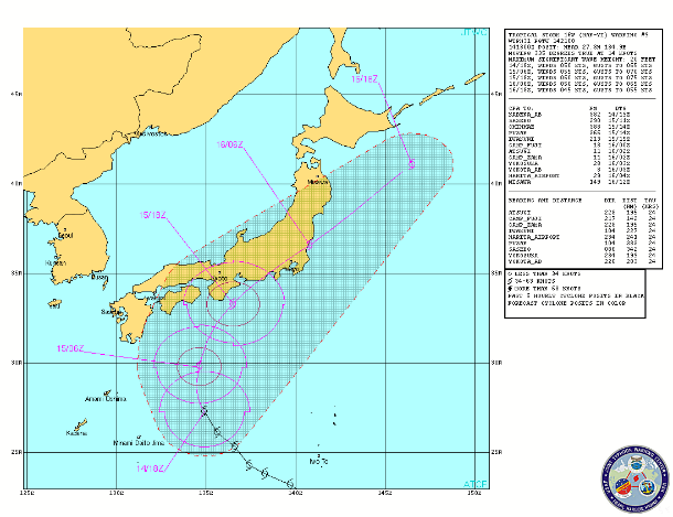
TS Man-Yi forecast track by JTWC (Credit: JTWC)
TS Man-yi is forecast to turn northward by the next 12 hours and it will turn northeastward after and accelerate as it begins to interact with an approaching mid-latitude shortwave trough. The system is expected to maintain 50 to 55 knot sustained winds as it tracks across the Kanto Plain and should also maintain expansive gale force winds as it tracks back over water.
.jpg) Satellite Animations
Satellite Animations
- Storm-Centered Infrared (MTSAT; NOAA/SSD)
- Storm-Centered Infrared (Aviation Color Enhancement) (MTSAT; NOAA/SSD)
- Storm-Centered Water Vapor (MTSAT; NOAA/SSD)
- Storm-Centered Visible (MTSAT; NOAA/SSD)
- Storm-Centered Visible (Colorized) (MTSAT; NOAA/SSD)
- Tropical West Pacific Infrared (MTSAT2; NOAA)
- Tropical West Pacific Enhanced Infrared (MTSAT2; NOAA)
- Tropical West Pacific Water Vapor (MTSAT2; NOAA)
- Tropical West Pacific Visible (MTSAT2; NOAA)
Commenting rules and guidelines
We value the thoughts and opinions of our readers and welcome healthy discussions on our website. In order to maintain a respectful and positive community, we ask that all commenters follow these rules.