
Strong and shallow M 5.9 earthquake struck Azores Islands, Portugal
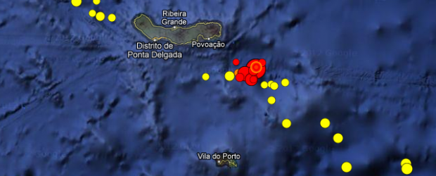
Image credit: Centro de Vulcanologia e Avaliação de Riscos Geológicos. Google 2013 – Image: NASA, TerraMetrics 2013.
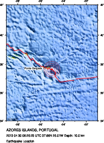
A strong and shallow earthquake magnitude M 5.9 struck Azores Islands, Portugal on April 30, 2013 at 06:25 UTC. Epicenter was located in between Sao Miguel and Santa Maria islands; 29 km (18 miles) ESE of Furnas, Portugal and 58 km (36 miles) E of Ponta Delgada, Portugal. Centro de Vulcanologia e Avaliação de Riscos Geológicos – CIVISA is also reporting a M 5.9 earthquake. Depth is still uncertain. EMSC is reporting epicenter at depth of 2 km, USGS (set by location program) still reports depth of 10 km.
There are 130 000 people within 100 km.
The area is experiencing increased seismic activity (as shown on the map below). Numerous aftershocks were reported after M 5.9 today. Azores are considered as seismically very active region. However, these kinds of earthquakes, so close to islands, are not happening very often. Check ER for list of latest updates.
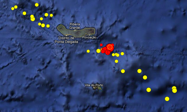
List of latest earthquakes – Azores Islands, Portugal. Credits: Centro de Vulcanologia e Avaliação de Riscos Geológicos. Google 2013 – Image: NASA, Terrametrics 2013.
| Magnitude | 5.9 |
|---|---|
Date-Time |
|
| Location | 37.655°N, 25.007°W |
| Depth | 10 km (6.2 miles) set by location program |
| Region | AZORES ISLANDS, PORTUGAL |
| Distances | 29 km (18 miles) ESE of Furnas, Portugal 58 km (36 miles) E of Ponta Delgada, Portugal 222 km (137 miles) ESE of Angra do Heroismo, Portugal 920 km (571 miles) NW of Camara de Lobos, Portugal |
| Location Uncertainty | horizontal +/- 7.5 km (4.7 miles); depth fixed by location program |
| Parameters | NST=110, Nph=110, Dmin=>999 km, Rmss=0.9 sec, Gp= 43°, M-type=teleseismic moment magnitude (Mw), Version=2 |
| Source |
|
| Event ID | us2013pqaf |
Major Tectonic Boundaries: Subduction Zones -purple, Ridges -red and Transform Faults -green
I'm a dedicated researcher, journalist, and editor at The Watchers. With over 20 years of experience in the media industry, I specialize in hard science news, focusing on extreme weather, seismic and volcanic activity, space weather, and astronomy, including near-Earth objects and planetary defense strategies. You can reach me at teo /at/ watchers.news.
Commenting rules and guidelines
We value the thoughts and opinions of our readers and welcome healthy discussions on our website. In order to maintain a respectful and positive community, we ask that all commenters follow these rules.