
Tropical Cyclone Felleng moves southward, away from Madagascar
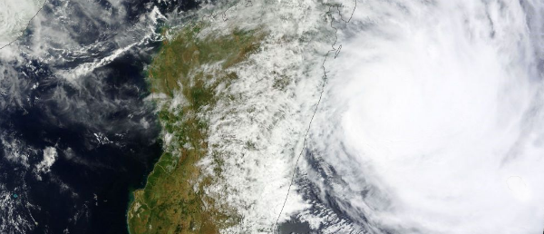
Image credit: LANCE/WorldView
According to latest report by Joint Typhoon Warning Center (JTWC), Tropical Cyclone Felleng (13S) was located 275 nm west of La Reunion and continued to track southward along the western periphery of a north-south oriented subtropical steering ridge, at speed of 6 knots. The system should continue to track southward through the next 36 hours, then will begin to turn south-southeastward as it rounds the southern periphery of the subtropical ridge.
 TC Felleng forecast track (Credit: JTWC)
Felleng is expected to weaken rapidly after the next 24 hours as it encounters increasing, strong vertical wind shear associated with an approaching shortwave trough and also tracks over cooler waters which range from 25ºC to as low as 20ºC. The system is also forecast to begin extra- tropical transition in the next two days. Felleng should complete extra-tropical transition after 96 hours as it becomes embedded in the midlatitude westerlies and begins to accelerate southeastward.
 TC Felleng in South Indian Ocean (Credit: JTWC/SATOPS/EUMETSAT)
Radar
- Réunion (Météo France)
Satellite Animations
- Storm-Centered Infrared (Meteosat 7; CIMSS)
- Storm-Centered Enhanced Infrared (Meteosat 7; CIMSS)
- Storm-Centered Water Vapor (Meteosat 7; CIMSS)
- Storm-Centered Visible (Meteosat 7; CIMSS)
- Meteosat 7 Infrared (Meteosat 7; CIMSS)
- Meteosat 7 Infrared (Color Background) (Meteosat 7; CIMSS)
- Meteosat 7 Infrared (NHC Color Enhancement) (Meteosat 7; CIMSS)
- Meteosat 7 Water Vapor (Meteosat 7; CIMSS)
- Meteosat 7 Water Vapor (Color Background) (Meteosat 7; CIMSS)
Commenting rules and guidelines
We value the thoughts and opinions of our readers and welcome healthy discussions on our website. In order to maintain a respectful and positive community, we ask that all commenters follow these rules.