
Tropical Storm Wukong (QUINTA) traversing Camotes Islands and approaching Philippines
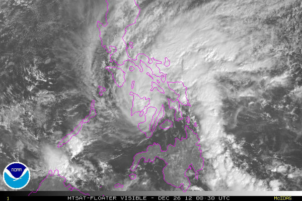
Image credit: Tropical Storm Wukong (QUINTA) seen by MT Floater Visible on December 26, 2012 at 00:30 UTC (NOAA/MTSAT)
Tropical Storm Wukong (QUINTA) has slightly weakened after making landfall over Leyte and is now traversing Camotes Island. According to latest report by Philippine Atmospheric, Geophysical and Astronomical Services Administration (PAGASA), the center of Tropical Storm Wukong (QUINTA) was estimated based on all available data in the vicinity of Pacijan Island, Cebu (10.7°N, 124.3°E). PAGASA reports maximum sustained winds of 65 km/h near the center and gustiness of up to 80 km/h. Fishing boats and other small seacrafts are advised not to venture out into the seaboards of Luzon and Visayas and northern seaboard of Mindanao.
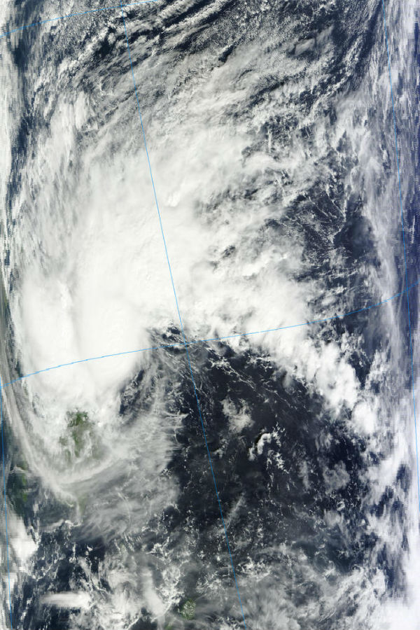 Wukong seen by MODIS/Terra satellite at 01:50 UTC on December 25, 2012 (Credit: LANCE/MODIS)
According to latest report by Joint Typhoon Warning Center (JTWC), Tropical Storm Wukong (QUINTA) was located approximately 290 nm southeast of Manila, Philippines, and was moving west-northwestward at 15 knots. Animated infrared satellite imagery depicts improved deep convective banding wrapping tightly into a well-defined low-level circulation center (LLCC).
The system is already impacting the Visayas, Philippines with moderate to sometimes heavy rains. Up to 80mm of rain has already been reported so far and up to 150mm is still possible over the next 24 to 48 hours. Moderate rains are impacting parts of Samar, Leyte, Dinagat Island, Bohol and Mindanao. Heavy rains will continue affecting Central Philippines for the next 48 hours and could produce widespread floods and landslides.
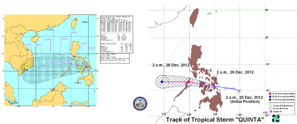 Wukong latest forecast tracks by JTWC (left) and PAGASA (right)
Wukong (QUINTA) is tracking west-northwestward along the southern periphery of the deep subtropical ridge entrenched over the western North Pacific Ocean. It is forecast to continue tracking west-northwestward through the next 36 hours as it tracks toward the western extent of the subtropical ridge. The system is expected to be at 70 km Southwest of Coron, Palawan by tomorrow morning. By Friday morning, it will be at 460 km Northwest of Puerto Princesa City, Palawan.
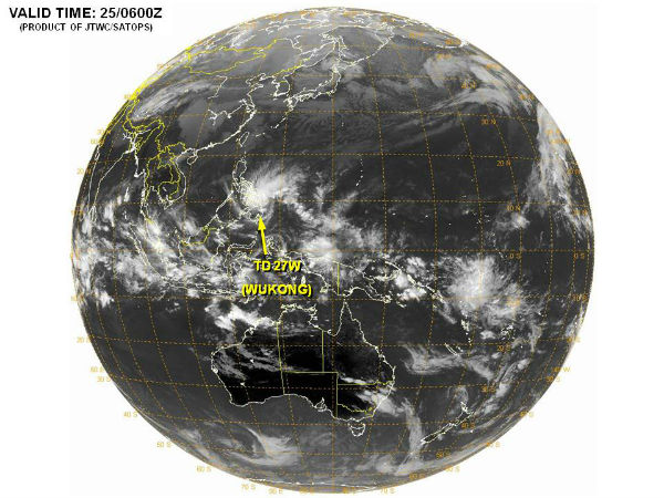 Western/South Pacific Ocean globe view (Credit: JTWC/SATOPS)
Wukong (QUINTA) is expected to intensify slightly as it tracks over the South China Sea due to improving poleward outflow. However, this phase is expected to be short-lived due to increasing vertical wind shear associated with a northeast surge event. It should dissipate over the next 48 hours.
Latest radar images and rainfall data (CLIMATEX)
Satellite Animations
- Storm-Centered Infrared (MTSAT; NOAA/SSD)
- Storm-Centered Infrared (Aviation Color Enhancement) (MTSAT; NOAA/SSD)
- Storm-Centered Water Vapor (MTSAT; NOAA/SSD)
- Storm-Centered Visible (MTSAT; NOAA/SSD)
- Storm-Centered Visible (Colorized) (MTSAT; NOAA/SSD)
- West Pacific/South China Sea Infrared (MTSAT2; NOAA)
- West Pacific/South China Sea Enhanced Infrared (MTSAT2; NOAA)
- West Pacific/South China Sea Water Vapor (MTSAT2; NOAA)
Sources: Joint Typhoon Warning Center, Japan Meteorological Agency, WesternPacificWeather, PAGASA
Commenting rules and guidelines
We value the thoughts and opinions of our readers and welcome healthy discussions on our website. In order to maintain a respectful and positive community, we ask that all commenters follow these rules.