
Tropical Storm Rosa formed in eastern Pacific
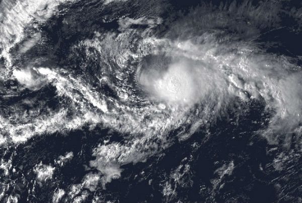
Image credit: TW
According to latest public advisory by US National Hurricane Center (NHC) at 21:00 UTC on November 1 the center of Tropical Storm Rosa was located near latitude 14.2N and longitude 117.9W, about 1285 km (795 miles) SW of Cabo San Lucas Mexico. The system is moving westward at speed of 6 km/h (3 miles) and this general motion is expected to continue through Thursday.

Maximum sustained winds are near 85 km/h (50 mph) with higher gusts. Tropical storm force winds extend outward up to 165 km (105 miles) from the center. Minimum central pressure is 1003 mB.

There are no coastal watches or warnings in effect because Rosa is moving away from mainland. Some slow weakening is likely to begin on Thursday. Westerly vertical wind shear is expected to significantly increase tomorrow which should induce weakening.

New low pressure area
Another broad area of low pressure is located about 450 miles southwest of Manzanillo, Mexico and it continues to produce disorganized showers and thunderstorms. Upper-level winds do not appear to be conductive for significant development. This system has a low 10% chance of becoming a tropical cyclone during the next 48 hours as it drifts west-northwestward, according to NHC.

Satellite Animations
- Storm-Centered Infrared (GOES 13; NOAA/SSD)
- Storm-Centered Infrared (Aviation Color Enhancement) (GOES 13; NOAA/SSD)
- Storm-Centered Water Vapor (GOES 13; NOAA/SSD)
- Storm-Centered Visible (GOES 13; NOAA/SSD)
- Storm-Centered Visible (Colorized) (GOES 13; NOAA/SSD)
- Tropical East Pacific Hurricane Sector Infrared (GOES 15; NOAA)
- Tropical East Pacific Hurricane Sector Water Vapor (GOES 15; NOAA)
- Tropical East Pacific Hurricane Sector Visible (GOES 15; NOAA)
Commenting rules and guidelines
We value the thoughts and opinions of our readers and welcome healthy discussions on our website. In order to maintain a respectful and positive community, we ask that all commenters follow these rules.