
Magnitude 6.4 earthquake hit near New Ireland, PNG
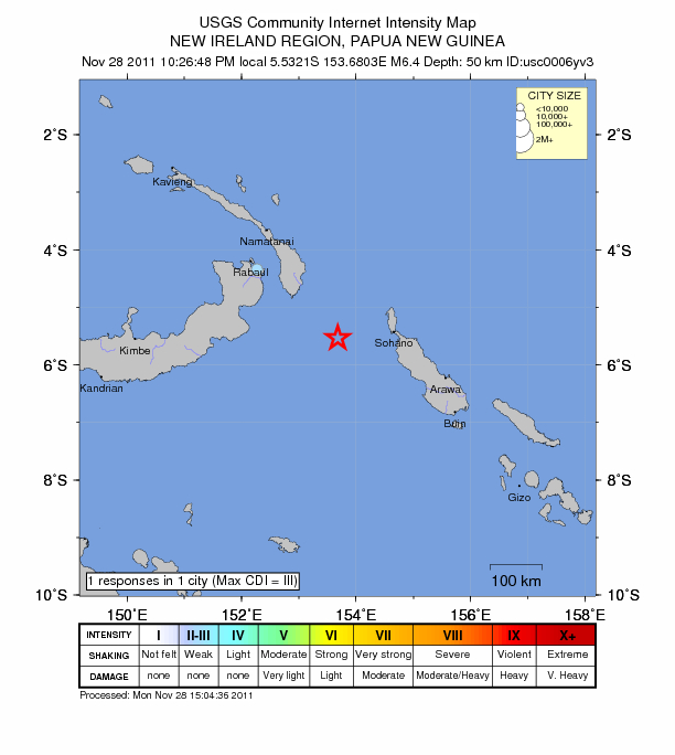
Image credit: TW
Very strong earthquake magnitude 6.4 struck today at 12:26:48 UTC near the Papua New Guinea islands coast (5.532°S, 153.680°E) according to USGS. The earthquake epicenter is on top of a steep subduction zone at depth of 50.4 km (31.3 miles) located 137 km (85 miles) SSE of Taron, New Ireland and 220 km (136 miles) WNW of Arawa, Bougainville, PNG. The depth will seriously weaken the impact of this earthquake, but will also trigger weak to light shaking in a very wide area.
 EMSC recorded 6.1 magnitude with depth of 52 km (32.2 miles). For the local population such impact is called “nothing unuasual”. People in this area of the world are most afraid from tsunamis. Luckily, there were no tsunami alerts issued.

Earthquake Information for Papua New Guinea
Satellite map of the greater epicenter area
Commenting rules and guidelines
We value the thoughts and opinions of our readers and welcome healthy discussions on our website. In order to maintain a respectful and positive community, we ask that all commenters follow these rules.