
‘Weather Bomb’ – Explosive cyclogenesis in the Atlantic
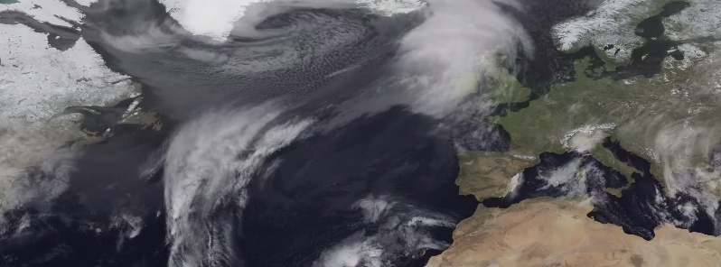
Image credit: TW
A low pressure system underwent what is known as "explosive cyclogenesis" – or less formally became a "weather bomb" – when it intensified rapidly with a steep decline in pressure, between Greenland and Iceland late on Monday and early on Tuesday.
The system has brought strong wind to Iceland and to the United Kingdom and Ireland, with particularly high waves on the open sea. The waves were described as "phenomenal" in the shipping forecast for the Rockall area.
The low pressure system, known in some countries as Alexandra, has also brought strong wind to northern areas of mainland Europe.
This animation shows the system developing and progressing from 11:00 UTC on Monday, December 8, until 09:00 UTC on Wednesday, December 10. The animation was generated using infrared data from Meteosat, over NASA's Blue Marble.
Source: EUMETSAT
The Watchers team and our contributors bring the latest on extreme weather, earthquakes, volcanic eruptions, space weather, and all things science. We're all about making sense of the natural world and keeping you informed on what’s happening. Got a tip or a question? Hit us up using the form at newstips!
Wow that’s powerful…………….
So what is the chance that this is an effect of purposeful geo-engineering, as has been reported by weather analysis of the ongoing drought, and now, planned deluge of California in recent government “scenarios?”
AHOLY FREAKING CRAP.