
Tropical Storm “Hagupit” continues to weaken as it exits the Philippines
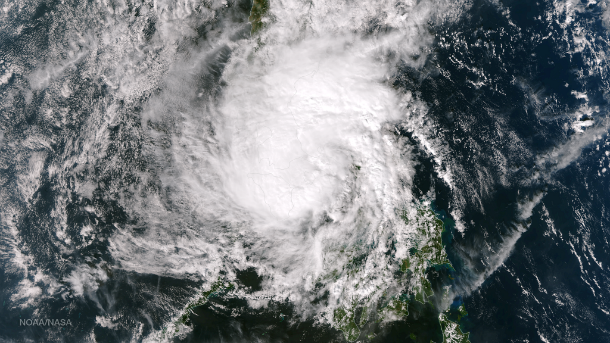
Featured image: Aqua/MODIS satellite image taken at 5:35 UTC on December 09, 2014. (Credit: LANCE Rapid Response/MODIS)
Former Super Typhoon – now a Tropical Storm "Hagupit", also known as “Ruby” in the Philippines, continues to weaken as it makes its way out from the Philippines, into the open waters of the South China Sea.
Hagupit lashed the Philippines leaving at least 27 deaths, according to the Philippine Red Cross. Most of fatalities are reported in Borongan, Samar. Thousands of homes have also been severely damaged, with Visayas among hardest hit. According to the National Disaster Risk Reduction and Management Council (NDRRMC), more than 1.6 million people have been evacuated to the safer grounds.
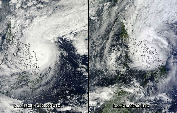
Aqua/MODIS satellite image from December 6 (left) and Terra/MODIS satellite image from December 7 (right) as Typhoon Hagupit approached the Philippines. (Credit: NASA's Goddard MODIS Rapid Response Team)
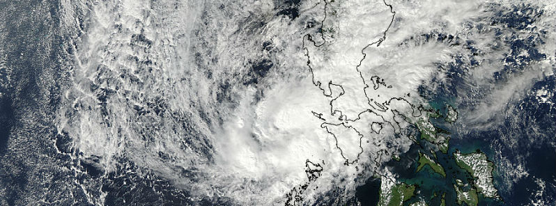
Satellite image taken by the Suomi NPP satellite's VIIRS instrument at 05:10 UTC on December 8, 2014. (Credit: NASA/NOAA/SuomiNPP)
The NDRRMC reported that Hagupit affected over 450,000 families or more than two million people, majority of whom were evacuated from their homes.
Twenty provinces in six regions experienced power outages while 16 areas in Quezon province, Laguna and Marinduque have been flooded. Albay, Camarines Sur, Catanduanes and San Pablo City in Laguna had been declared under a state of calamity.
Hagupit brought heavy rainfall, with more than 400 mm (16 inches) in Borongan and 350 mm (14 inches) in Catbalogan, both in Samar region where Hagupit made landfall. Areas along the direct path of Hagupit experienced widespread flooding and mudslides.
After hitting Samar in the eastern Philippines, the slow moving typhoon had weakened to a tropical storm, crossing northern Sibuyan Sea, between the islands of the central and northern Philippines.
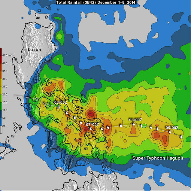
Rainfall analysis from December 1-8, 2014 shows rainfall totals of over 450 mm (17.5 inches) in a few areas in the eastern Philippines near Hagupit's landfall. (Credit: NASA/JAXA, SSAI, Hal Pierce)
The system is currently moving westward and is expected to continue to slowly weaken as it crosses the South China Sea through the next few days.
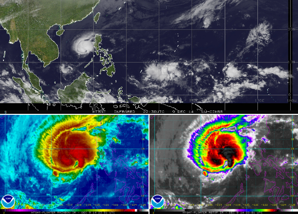
MTSAT composite – IR, Rainbow IR and RBTOP IR satellite imagery taken at 22:30-23:00 UTC on December 9, 2014. (Credit: NOAA/MTSAT/UW-CIMSS)
Cold front from northeast continues to affect the system and it is expected to make landfall as a very weak system around the southern coast Vietnam on December 12, 2014. Some of these same areas already experienced torrential rainfall a week ago from Tropical Cyclone "Sinlaku" which will raise the risk of flooding and mudslides.
.png)
Meanwhile, a new low pressure area (Invest 96W) is forming south of Guam. For now, it looks like no significant threat.
Satellite animations
- Storm-Centered Infrared (MTSAT; NOAA/SSD)
- Storm-Centered Infrared (Aviation Color Enhancement) (MTSAT; NOAA/SSD)
- Storm-Centered Water Vapor (MTSAT; NOAA/SSD)
- Storm-Centered Visible (MTSAT; NOAA/SSD)
- Storm-Centered Visible (Colorized) (MTSAT; NOAA/SSD)
- Storm-Centered Infrared (MTSAT2; CIMSS)
- Storm-Centered Enhanced Infrared (MTSAT2; CIMSS)
- Storm-Centered Water Vapor (MTSAT2; CIMSS)
- Storm-Centered Visible (MTSAT2; CIMSS)
- South China Sea/West Pacific Infrared (MTSAT2; NOAA)
- South China Sea/West Pacific Enhanced Infrared (MTSAT2; NOAA)
- South China Sea/West Pacific Water Vapor (MTSAT2; NOAA)
Commenting rules and guidelines
We value the thoughts and opinions of our readers and welcome healthy discussions on our website. In order to maintain a respectful and positive community, we ask that all commenters follow these rules.