
Tropical storm Talas threatens Japan
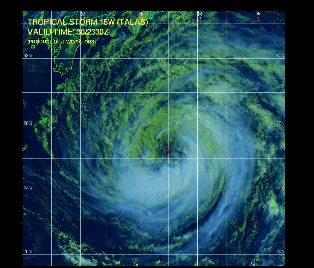
Image credit: TW
Tropical Storm Talas will gather typhoon strength south of Japan before midweek and could ultimately make a landfall as a typhoon in southeastern Japan, west of Tokyo.
Talas, as a tropical storm or typhoon landfall, would bring flooding rain, damaging winds and potentially inundating storm tides to the southeastern side of Honshu, Japan’s main island. On Tuesday, the center of Tropical Storm Talas was still more than 600 miles south of Tokyo; the broad storm was 200 miles to the northwest of Iwo Jima, one of Japan’s Volcano Islands, and was drifting towards the north-northwest at 8 mph.
 On Wednesday and Thursday, atmospheric conditions will be favorable for intensification that should result in typhoon status for Talas. Movement will be mostly to the north with a rise in speed at midweek.
Torrential rain and high rain of Talas should reach southeastern Japan on Friday.

Satellite Animations
- Storm-Centered Infrared (MTSAT; NOAA/SSD)
- Storm-Centered Infrared (Aviation Color Enhancement) (MTSAT; NOAA/SSD)
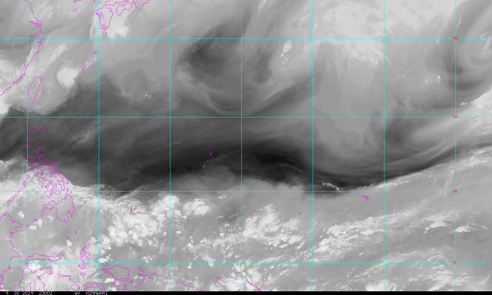
- Storm-Centered Water Vapor (MTSAT; NOAA/SSD)
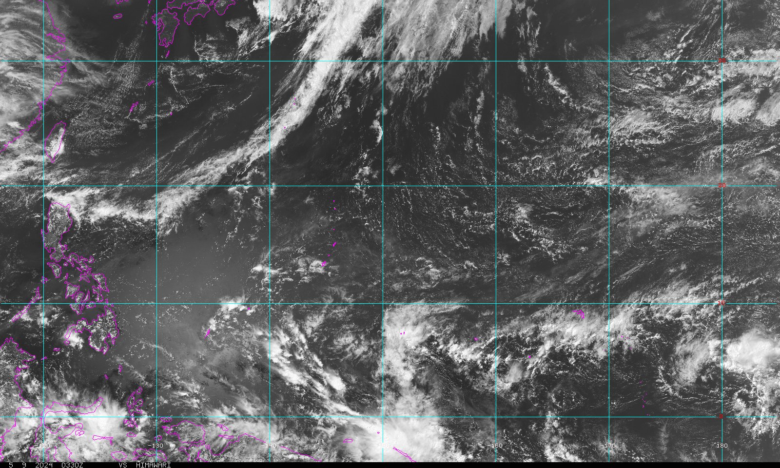
- Storm-Centered Visible (MTSAT; NOAA/SSD)
- Storm-Centered Visible (Colorized) (MTSAT; NOAA/SSD)
- Tropical West Pacific Infrared (MTSAT; NOAA)
- Tropical West Pacific Enhanced Infrared (MTSAT; NOAA)
- Tropical West Pacific Water Vapor (MTSAT; NOAA)
- Tropical West Pacific Visible (MTSAT; NOAA)
- West Pacific Infrared (MTSAT2; NRL)
- West Pacific Infrared (Color-Enhanced) (MTSAT2; NRL)
- West Pacific Water Vapor (MTSAT2; NRL)
- West Pacific Visible (MTSAT2; NRL)
Commenting rules and guidelines
We value the thoughts and opinions of our readers and welcome healthy discussions on our website. In order to maintain a respectful and positive community, we ask that all commenters follow these rules.