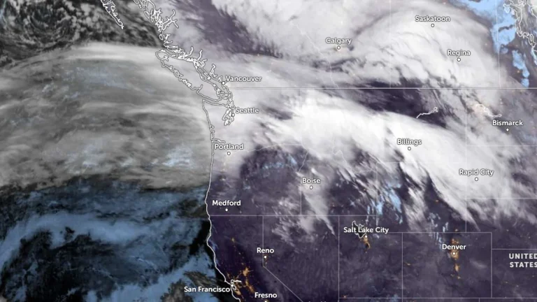
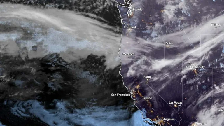
• Atmospheric river forecast to stall over Washington, raising flood risk through March 20

    A stalled atmospheric river over the Pacific Northwest is forecast to deliver 127–254 mm (5–10 inches) of precipitation to parts of Washington between March 17 and 20, 2026. High freezing levels above 2 100 m (7 000 feet) will result in rainfall across most elevations, accelerating snowmelt and increasing the likelihood of riverine flooding.

  • Snowstorm causes spinouts and closure of I-90 at Snoqualmie Pass, Washington

    Heavy snowfall caused multiple vehicle spinouts and crashes on I-90 at Snoqualmie Pass in Washington, forcing authorities to close the highway in both directions on March 13 and keep it closed overnight into March 14, 2026. Snoqualmie Pass received about 56 cm (22 inches) of new snow overnight, while the Summit at Snoqualmie reported about 107 cm (42 inches) over 48 hours during the storm.

  • Long-duration atmospheric river impacts Washington and Oregon with heavy rain, snow and flood risk, U.S.

    An atmospheric river made landfall in the Pacific Northwest during the morning of March 11, 2026, bringing heavy rain and snow across portions of Washington and Oregon. Forecasts show that the event will continue affecting the region through early March 14, producing significant precipitation totals, flooding concerns, and major winter weather impacts in mountainous terrain.

  • Atmospheric rivers forecast to bring heavy rain and snow to the Pacific Northwest through mid-March

    Two atmospheric rivers are forecast to hit the Pacific Northwest beginning late March 10, 2026, bringing heavy rainfall to coastal areas and significant snowfall to higher elevations in Washington and Oregon. Precipitation totals of 180–380 mm (7–15 inches) are forecast in mountainous regions, with the potential for river rises and localized flooding through the week.

  • Back-to-back atmospheric rivers forecast to impact the U.S. West Coast through December 20

    Two atmospheric rivers are forecast to bring prolonged heavy rain and mountain snow to the Pacific Northwest and northern California through December 20, 2025. The Weather Prediction Center (WPC) forecasts 100–150 mm (4–6 inches) of precipitation across western Washington and 100–200 mm (4–8 inches) across western Oregon, with locally higher totals in the Cascades and coastal ranges.

  • High wind warnings and watches issued for parts of Montana, Wyoming, Idaho, Washington, and Oregon

    The National Weather Service (NWS) issued multiple high wind warnings and watches across the Pacific Northwest and northern Rockies on Monday, December 15, 2025, as a strong surface low-pressure system moved into the region. The alerts cover parts of Montana, Wyoming, Idaho, Washington, and Oregon, and remain in effect through Wednesday afternoon, December 17, with sustained winds of 40–70 km/h (25–45 mph) and gusts exceeding 110 km/h (70 mph) forecast in exposed and mountainous areas.