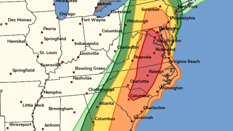
• Rare Moderate Risk (4/5) issued for Mid-Atlantic as severe thunderstorms raise threat of damaging winds and tornadoes

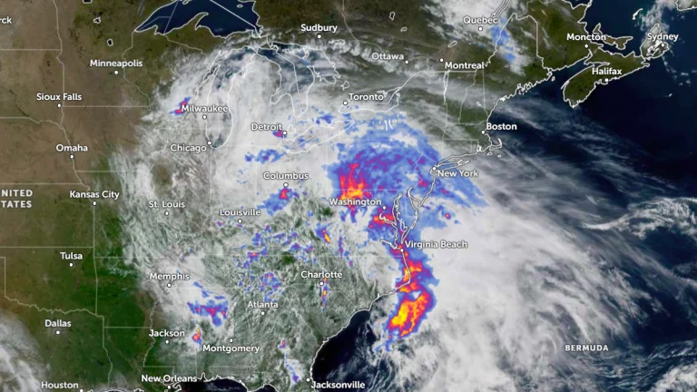
    A Moderate Risk (Level 4 of 5) for severe thunderstorms has been issued across parts of the Mid-Atlantic United States for Monday, March 16, 2026, as a powerful multi-hazard storm threatens over 100 million people across the U.S. Fast-moving storms capable of producing damaging winds and a few strong tornadoes are forecast to develop from the Carolinas into Virginia and Maryland during the afternoon and evening hours. A Moderate Risk is an unusually high severe weather category for the Mid-Atlantic and is not issued often for this region. The National Weather Service office serving the Washington, D.C. area described the setup as a “quite rare Day 2 Moderate Risk area” ahead of the event.

  • Potomac River advisory lifted in Washington, D.C. as repairs begin on collapsed interceptor

    The District Department of Health lifted a recreational advisory for the Potomac River in Washington, D.C., on March 2, 2026, after three weeks of monitoring showed bacterial levels had returned to typical ranges following the January 19 collapse of the Potomac Interceptor sewer line. Repair operations advanced the following day as crews prepared the damaged pipe for structural reinforcement while environmental restoration continues in the affected section of the C&O Canal National Historical Park.

  • Slow-moving storm triggers flood watches from North Carolina to Pennsylvania

    Flood watches have been issued from North Carolina to Pennsylvania, including Washington, D.C., as a severe weather system brings heavy rains to the Northeast starting Tuesday, May 13, 2025. Heavy rainfall is expected to extend from the Southeast to the Great Lakes, with much of the Mid-Atlantic affected through Wednesday, May 14.