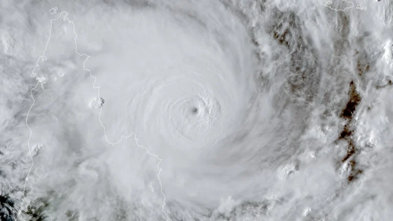
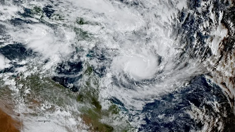
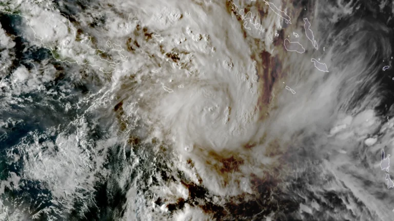
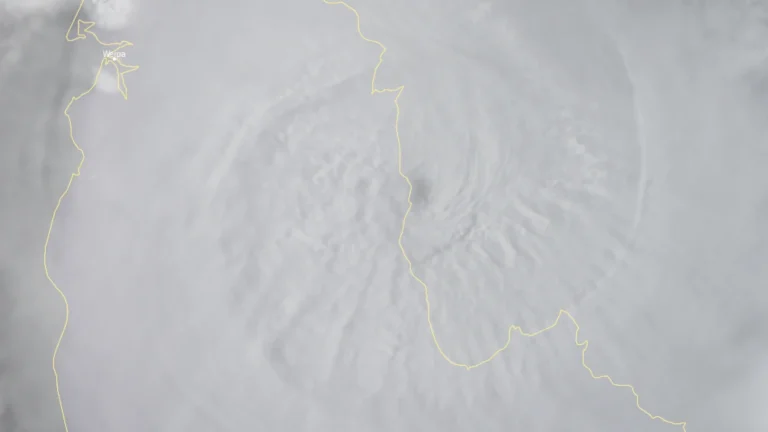
• Tropical Cyclone Narelle weakens after Queensland landfall, forecast to re-intensify over Gulf of Carpentaria

    Tropical Cyclone Narelle made landfall over the Queensland coast at 07:00 AEST on March 20 (21:00 UTC on March 19), as a high-end Category 4 system after briefly reaching Category 5 intensity a day earlier. The cyclone crossed the coast approximately 75 km (47 miles) south of Lockhart River, weakened to Category 2 by the afternoon, and began moving offshore toward the Gulf of Carpentaria. Destructive winds, heavy rainfall, and coastal flooding were reported across affected areas.

  • Category 5 Severe Tropical Cyclone Narelle forecast to cross Far North Queensland on March 20

    Severe Tropical Cyclone Narelle intensified into a Category 5 system on March 19, 2026, and is forecast to cross the Cape York Peninsula between Lockhart River and Cape Melville, Queensland, on the morning of March 20. Very destructive wind gusts of more than 250 km/h (155 mph), heavy rainfall of 100 to 350 mm (4 to 14 inches), and dangerous coastal conditions including abnormally high tides and large waves are forecast near and south of the landfall area, although slight weakening to a high-end Category 4 before crossing remains possible.

  • Severe Tropical Cyclone Narelle forecast to briefly reach Category 5 before Queensland landfall, Australia

    Severe Tropical Cyclone Narelle is forecast to intensify to Category 5 peak intensity over the Coral Sea before approaching the Far North Queensland coast between Lockhart River and Cooktown on March 20, 2026. Destructive winds of over 250 km/h (155 mph), along with rainfall totals over 350 mm (14 inches), are expected to triggere flash flooding, significant storm surges, and coastal flooding.

  • Tropical Cyclone Narelle forms in Coral Sea, forecast to intensify before Queensland impact, Australia

    ropical Cyclone Narelle developed in the northern Coral Sea on Tuesday, March 17, 2026, with sustained winds of 85 km/h (53 mph) and gusts to 120 km/h (75 mph). The system is moving west-southwest toward Far North Queensland and is forecast to intensify to severe tropical cyclone strength before approaching the coast later this week, with damaging winds, heavy rainfall, and coastal flooding being forecast.

  • Major flooding underway in northern Queensland after extreme rainfall, Australia

    A major flood event is underway in northern Queensland, Australia, on Sunday, February 2, 2025, after parts of the region received between 500 and 1 000 mm (19.7 – 39.4 inches) of rain in the 48 hours leading up to 09:00 LT today. At least one person has drowned in floodwaters after an SES boat capsized. The region is forecast to receive additional heavy rainfall, with some areas expected to see up to 500 mm (19.7 inches) of additional rain over the next 24 hours.