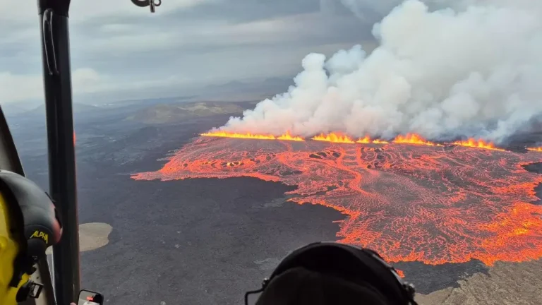
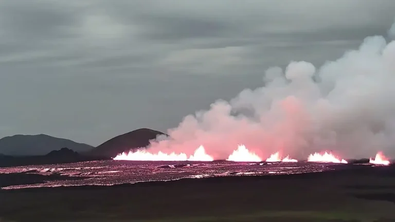
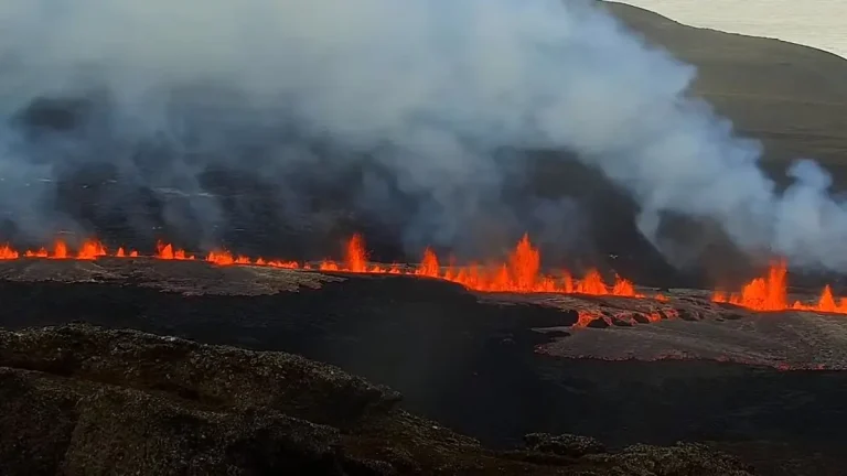
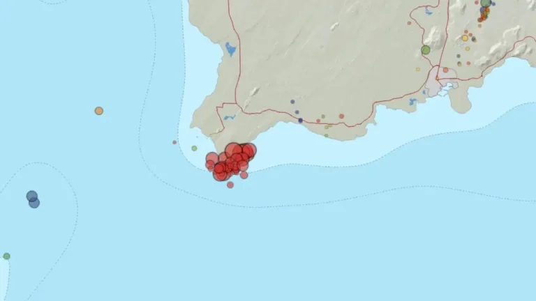
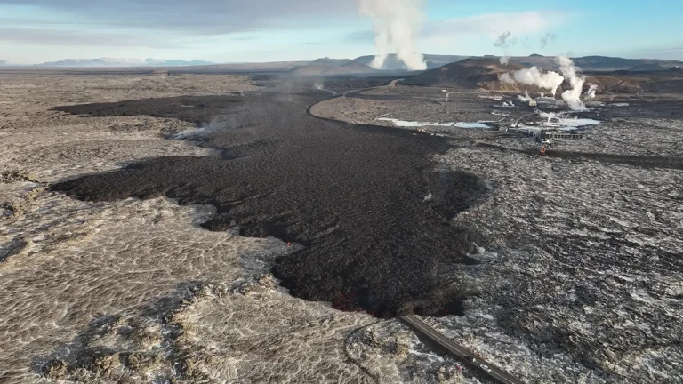
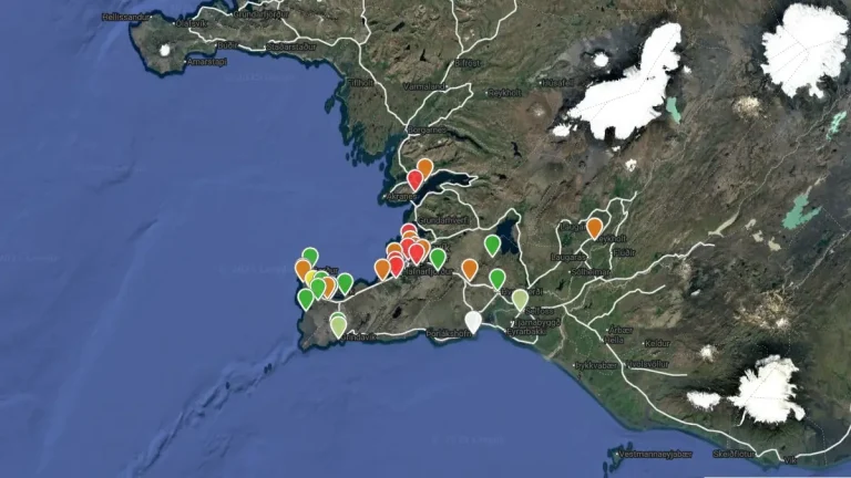
Magma volume under Svartsengi approaches eruption threshold, Iceland

Magma volume under Svartsengi approaches eruption threshold, Iceland

Updated modeling shows Svartsengi’s magma volume reached 7.6 million m³ (268.3 million ft³) on February 26, 2024, and is now near or at the eruption threshold. With seismic activity increasing, particularly east of Sýlingarfell, the Norwegian Meteorological Agency has raised risk assessments, marking the Sundhnjúka crater series at high risk and adjusting other zones accordingly.

Iceland builds massive dykes to shield against volcanic lava flows

Iceland builds massive dykes to shield against volcanic lava flows

Icelanders build massive dykes to protect against lava flows from reactivated volcanoes near Reykjavik. The six volcanic systems, active for the first time in nearly 800 years, pose a significant threat to the Reykjanes peninsula, prompting around-the-clock construction efforts to safeguard homes and a crucial power plant.

University of Iceland professor warns of lava flow proximity to Reykjavík

University of Iceland professor warns of lava flow proximity to Reykjavík

Þorvaldur Þórðarson, a volcanology professor at the University of Iceland, suggests that recent earthquakes in the Reykjanes Peninsula could indicate magma accumulation under Húsfellsbruna, raising concerns about potential lava flows near Reykjavík.

Magma accumulation accelerates land rise near Svartsengi, Iceland

Magma accumulation accelerates land rise near Svartsengi, Iceland

In recent days, Svartsengi, Iceland, has experienced accelerated land rise, reaching up to 8 mm (0.3 inches) daily, attributed to magma accumulation under the area. While seismic activity remains mild, the risk assessment for Grindavík has been downgraded to orange, with a continued high risk for crack collapse.

Grindavik faces significant risk of ground collapse due to fissures, Iceland

Grindavik faces significant risk of ground collapse due to fissures, Iceland

Recent volcanic activity in the Svartsengi area has led to continuous land uplift, although the exact rate is still being determined through GNSS measurements. Around 200 earthquakes, the largest measuring M1.4, have been recorded near the magma conduit since yesterday. Despite a reduction in earthquake frequency, significant risks, including ground collapse, remain for the nearby Grindavík area.