• At least 30 dead and 39 missing after extreme rainfall causes severe flooding and landslides in Minas Gerais, Brazil

    Severe flooding and landslides struck the southeastern Brazilian state of Minas Gerais between February 23 and 24, 2026, following extreme rainfall that exceeded three times the monthly average. At least 30 people died, 39 remain missing, and more than 3 000 were displaced as torrential downpours caused the Paraibuna River to overflow in Juiz de Fora and inundate parts of Ubá.

  • Late-February 2026 Nor’easter sets all-time snowfall records and leaves 650 000 without power across Northeast U.S.

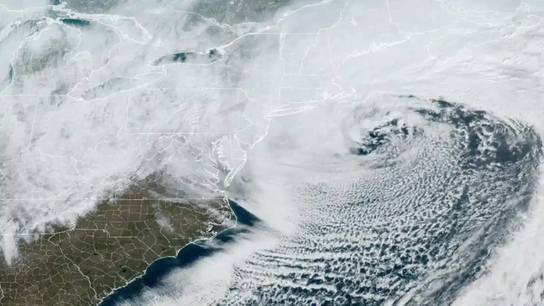
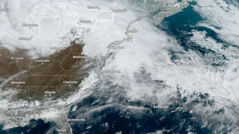
    A rapidly intensifying Nor’easter brought record-breaking snowfall, hurricane-force winds, and major disruptions across the northeastern United States on February 23, 2026. Providence, Rhode Island, recorded 96.3 cm (37.9 inches) of snow, the highest single-storm total on record, while power outages peaked above 650 000 customers and more than 11 000 flights were canceled nationwide. Officials confirmed at least four storm-related fatalities in Maryland and Pennsylvania.

  • Major Nor’easter produces hurricane-force gusts, up to 66 cm (24 inches) of snow and widespread outages across Northeast U.S.

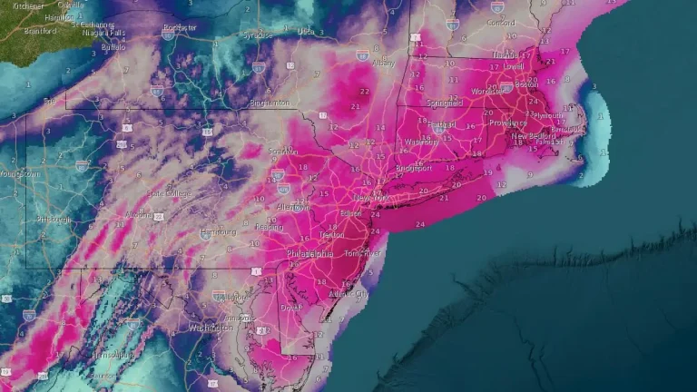
    Heavy snow and strong winds continued across the northeastern United States on February 23, 2026, as a major Nor’easter that began February 22 produced blizzard conditions, widespread travel disruption, scattered power outages, and minor to moderate coastal flooding from the Chesapeake Bay to New England. Over 660 000 customers from Virginia to New York and Massachusetts are without power.

  • Severe winter storm paralyzes the New York metropolitan area, grounding flights and closing schools

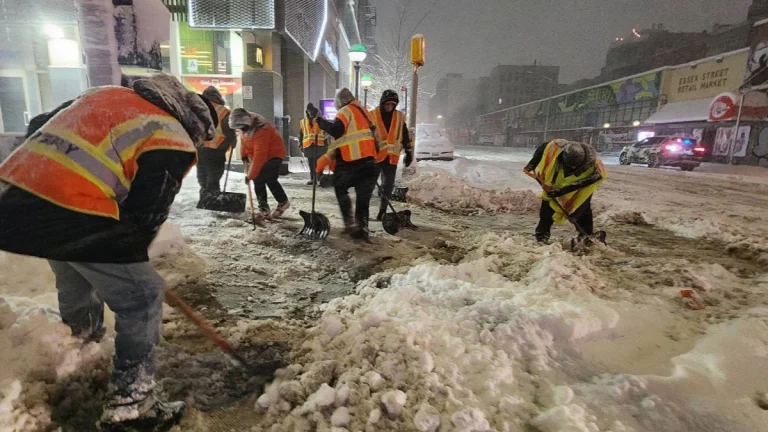
    A major blizzard struck New York on February 22, 2026, prompting a citywide travel ban and declaration of a State of Emergency. Snowfall totals reached 35.6 cm (14.0 inches) on Staten Island and 23.6 cm (9.3 inches) in Central Park. All schools have been closed on February 23, as Mayor Zohran Mamdani declared the first traditional snow day since 2019. No remote instruction will take place, and all after-school activities are cancelled.

  • Coastal storm and long-duration atmospheric river to bring heavy precipitation to Pacific Northwest and California

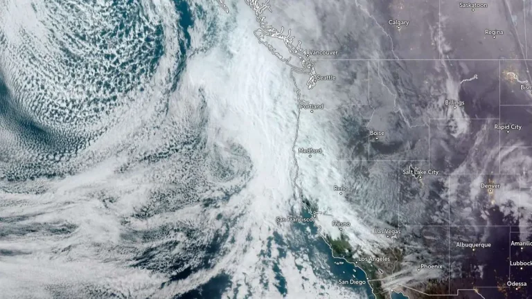
    A slow-moving low-pressure system is forecast to bring long-duration atmospheric river conditions to the U.S. West Coast between Saturday, February 21, and Wednesday, February 25, 2026, delivering heavy precipitation from Washington to California. The strongest impacts are expected across southern Oregon and northern California Coast Ranges and the Klamath Mountains, where 5-10 inches (125-250 mm) of rain is forecast.

  • Confidence increases for significant winter storm to impact Northeast and Mid-Atlantic

    Forecast confidence is increasing for an impactful winter storm to hit the Northeast and the Mid-Atlantic over the weekend into Monday, February 23, 2026. Lake-enhanced and lake-effect snow are forecast as the storm moves into the Great Lakes Region starting Saturday, February 21. Snowfall rates of over 25 mm (1 inch) an hour coupled with gusty winds will create dangerous travel conditions with low visibility and slick roads.

  • Enhanced Risk of severe storms with supercells capable of strong tornadoes across southern Illinois and Indiana

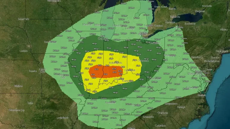
    Severe thunderstorms capable of producing tornadoes, large hail, and damaging wind gusts are forecast across parts of the Midwest and lower Ohio Valley on February 19, 2026, with an Enhanced Risk in place for southern Illinois and southern Indiana. The Storm Prediction Center warns that a few tornadoes may be strong, particularly near and south of the I-70 corridor during the afternoon and early evening.

  • Ranger Road Fire doubles in size in one day, reaching over 114 650 ha (283 000 acres) in Kansas-Oklahoma

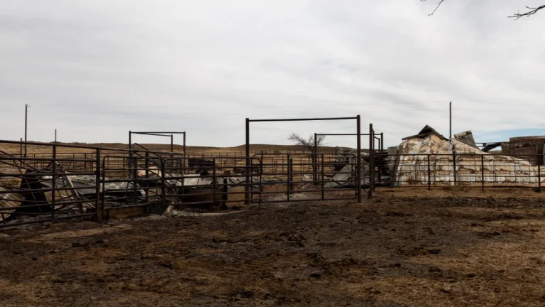
    The Ranger Road Fire nearly doubled in size from 58 700 ha (145 000 acres) to over 114 650 ha (283 000 acres) within roughly 24 hours after ignition at 11:40 LT on February 17, 2026, when it crossed the Kansas–Oklahoma border. As of February 18, containment stood at 15% following rapid expansion driven by dry fuels and high winds. Authorities closed sections of Kansas highways 283, 160, and 183.