• Severe Tropical Cyclone Narelle to pass close to the North West Cape, bringing destructive winds to Western Australia

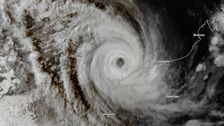
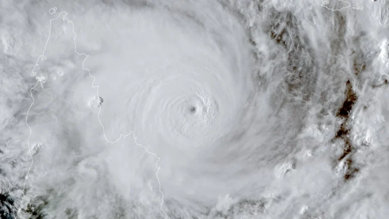
    Severe Tropical Cyclone Narelle strengthened to Category 4 off the coast of Western Australia on March 26, 2026, and was forecast to pass close to the North West Cape before tracking south along the Gascoyne coast on March 27. The Bureau of Meteorology warned the system could bring very destructive wind gusts up to 275 km/h (171 mph), dangerous storm surge, and heavy rainfall capable of producing flash flooding across parts of the Pilbara and Gascoyne.

  • Rare severe weather outbreak brings tornado risk to Gulf states

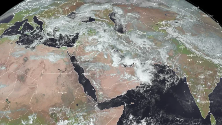
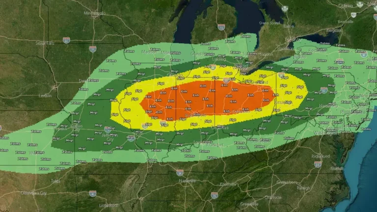
    A rare severe convective setup is forecast to develop across the Gulf region, including the United Arab Emirates, Qatar, and eastern Saudi Arabia, on March 26–27, 2026, as a deep low-pressure system and strong upper-level trough interact with high instability and wind shear. The environment may support organized thunderstorms capable of producing tornadoes, alongside heavy rainfall, hail, and damaging winds.

  • Major multi-day rainfall event forecast across Middle East from March 25-31

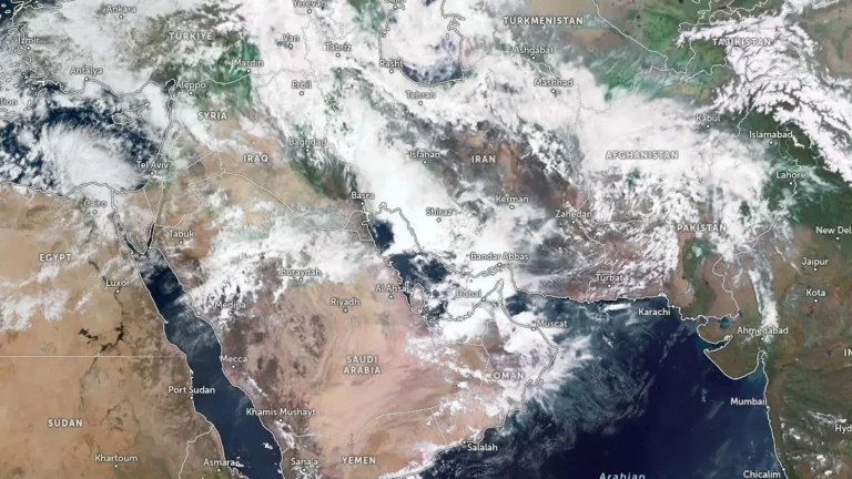
    A large-scale storm system is forecast to bring heavy to extremely heavy rainfall across parts of the Middle East, including Iraq, Iran, and the Gulf states, between March 25 and 31, 2026, raising flood risk in urban and desert regions. Authorities in the United Arab Emirates have issued warnings for unstable conditions with rain, strong winds, and reduced visibility, while flooding has already caused fatalities in Oman. Parts of the region might see a year’s worth of rain or more through the course of the event.

  • Widespread snow, freezing rain, and strong winds forecast as cross-country storm impacts Canada

    A cross-country storm is forecast to affect multiple regions of Canada from March 23 through midweek, bringing snow to western and central areas before spreading mixed precipitation and stronger impacts into parts of Ontario, Quebec, and Atlantic Canada. The highest-confidence snowfall totals, reaching 20 to 40 cm (8 to 16 inches) in parts of Newfoundland and elsewhere in Atlantic Canada, are expected to create hazardous travel conditions, reduced visibility, and local transport disruptions.

  • Kona low triggers life-threatening flooding on Oʻahu’s North Shore, Hawaii

    Life-threatening flash flooding struck Oʻahu’s North Shore, Hawaii, on March 20, 2026, after a slow-moving Kona low produced more than 330 mm (13 inches) of rain in parts of northern Oʻahu in about 12 hours from the evening of March 19 into the morning of March 20. Flooding in the Haleiwa and Waialua areas cut off road access, prompted evacuation orders, and triggered emergency response operations.

  • Tropical Cyclone Narelle weakens after Queensland landfall, forecast to re-intensify over Gulf of Carpentaria

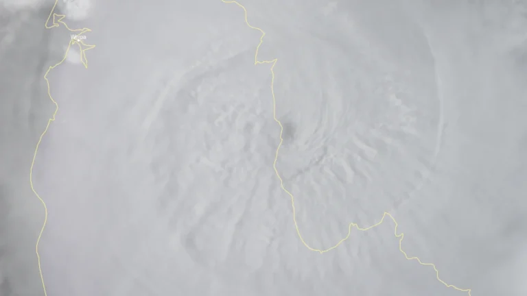
    Tropical Cyclone Narelle made landfall over the Queensland coast at 07:00 AEST on March 20 (21:00 UTC on March 19), as a high-end Category 4 system after briefly reaching Category 5 intensity a day earlier. The cyclone crossed the coast approximately 75 km (47 miles) south of Lockhart River, weakened to Category 2 by the afternoon, and began moving offshore toward the Gulf of Carpentaria. Destructive winds, heavy rainfall, and coastal flooding were reported across affected areas.

  • Category 5 Severe Tropical Cyclone Narelle forecast to cross Far North Queensland on March 20

    Severe Tropical Cyclone Narelle intensified into a Category 5 system on March 19, 2026, and is forecast to cross the Cape York Peninsula between Lockhart River and Cape Melville, Queensland, on the morning of March 20. Very destructive wind gusts of more than 250 km/h (155 mph), heavy rainfall of 100 to 350 mm (4 to 14 inches), and dangerous coastal conditions including abnormally high tides and large waves are forecast near and south of the landfall area, although slight weakening to a high-end Category 4 before crossing remains possible.