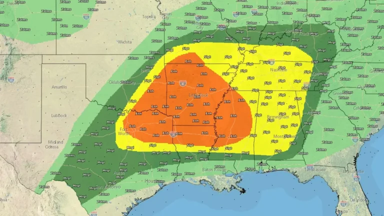
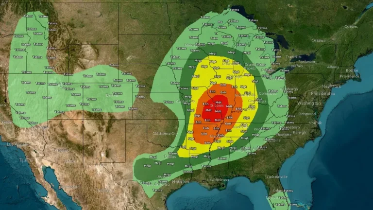
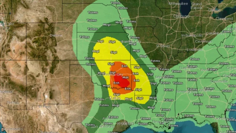
I am an Assistant Editor and Severe Weather & Science Journalist at The Watchers, specializing in real-time severe weather coverage, geophysical event reporting, and research-driven scientific analysis. You can reach me at rishav(at)watchers(.)news.

  • Wind chills to −57°C (−70°F) as Extreme Cold and Blizzard Warnings continue across Alaska

    Extreme Cold Warnings and Blizzard Warnings remain in effect across northern and western Alaska on February 11, 2026, with the National Weather Service forecasting wind chills as low as −57°C (−70°F) along the Arctic Coast and Brooks Range and wind gusts up to 105 km/h (65 mph) on St. Lawrence Island. Air temperatures near −46°C (−50°F) combined with increasing winds are expected to intensify frostbite risk across the North Slope, while snowfall of 7–15 cm (3–6 inches) and visibility reductions to 400 m (0.25 miles) or less are forecast in parts of western Alaska through early February 12.

  • Major storm hits Hawaii with damaging winds and extreme rainfall, causing widespread power outages

    A powerful storm system impacted Hawaii between February 8 and 10, 2026, producing heavy rainfall, flash flooding, landslides, and damaging winds. Wind gusts frequently exceeded 95 km/h (60 mph), with localized gusts approaching 115 km/h (70 mph), leading to road closures, including along Maui’s Hāna Highway, downed trees, and intermittent power outages affecting tens of thousands of customers on Oʻahu, Maui, and Hawaiʻi Island.

  • One dead and child missing as Storm Leonardo floods southern Spain and Portugal

    Flooding caused by Storm Leonardo left one person dead in Portugal and a child missing in southern Spain between Tuesday and early Thursday, February 3–5, 2026, as exceptional rainfall inundated towns across the Iberian Peninsula. Emergency services carried out evacuations and search operations as river levels rose rapidly.

  • Tropical Storm Penha (Basyang) expected to make multiple landfalls over Mindanao and Visayas, Philippines

    Tropical Storm Basyang is forecast to make multiple landfalls across the southern and central Philippines, beginning with Surigao del Sur late February 5 or early February 6, 2026. The system is forecast to cross Mindanao and may pass close to or make landfall over Siquijor and southern Negros Oriental before moving toward Palawan.